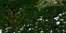
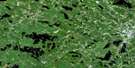
Bridgetown Satellite Image Map
Download Free Aerial Photo 021A14 at 1:50,000 scale
Bridgetown Satellite Imagery
To view this satellite map, mouse over the air photo on the right.
You can also download this satellite image map for free:
021A14 Bridgetown high-resolution satellite image map.
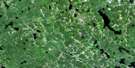
Maps for the Bridgetown aerial map sheet 021A14 at 1:50,000 scale are also available in these versions:
Bridgetown Surrounding Area Aerial Photo Maps
 |
 |
 |
 |
 |
 |
 |
 |
 |
 |
 |
 |
 |
 |
 |
 |
© Department of Natural Resources Canada. All rights reserved.
Bridgetown Gazetteer
The following places can be found on satellite image map 021A14 Bridgetown:
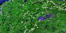
Bridgetown Satellite Image: Bays
Baie de FundyBay of Fundy
Chute Cove
Cottage Cove
Hampton Cove
Phinney Cove
Phinneys Cove
Port Lorne
Saw Mill Creek
St. Croix Cove
Ste. Croix Bay
Thornes Cove
Young Cove
Youngs Cove
Bridgetown Satellite Image: Beaches
Keatings Sand BeachSmall Keatings Sand Beach
Bridgetown Satellite Image: Capes
Haystack PointSeal Point
Steadmans Point
Bridgetown Satellite Image: Channels
The NarrowsBridgetown Satellite Image: Falls
Scotchmans LipTaylors Falls
Wamboldt Falls
Bridgetown Satellite Image: Geographical areas
AnnapolisBridgetown Satellite Image: Islands
Grass IslandMutton Island
Smiths Island
The Island
Bridgetown Satellite Image: Lakes
Baltzer LakeBirch Hill Lake
Cedar Lake
Chute Lake
Clements Lake
Corbett Lake
Cranberry Lake
Croskill Lake
Dalhousie Lake
Duck Pond
East Branch Lake
Eaton Lake
Eel Weir Lake
Elbow Lake
Elliott Lake
Fellows Lake
First Grimm Lake
First Lake
Foster Lake
Gesner Lake
Lily Lake
Long Lake
Longley Lake
McEwan Lake
McKenzie Lake
Merrys Mill Pond
Milburn Lake
Milbury Lake
Mud Lake
Paradise Lake
Paradise Lake Flowage
Phinneys Pond
Ramsey Lake
Ruggles Lake
Rumsey Lake
Sandy Lake
Scrag Lake
Second Grimm Lake
Second Lake
Shannon Lake
Snow Lake
Snowshoe Lake
Tellier Lake
Third Grimm Lake
Third Lake
Trout Lake
Wade Lake
Walker Lake
Wamboldt Lake
Young Lake
Youngs Lake
Bridgetown Satellite Image: Mountains
Birch HillHiram Layte Hill
North Mountain
North Mountain Range
South Mountain
Weasel Hill
Whynotts Hill
Bridgetown Satellite Image: Major municipal/district area - major agglomerations
AnnapolisBridgetown Satellite Image: Conservation areas
Bloody Creek National Historic Site of CanadaLieu historique national du Canada Bloody Creek
Valleyview Provincial Park
Bridgetown Satellite Image: Rapids
Alpena RapidsBeals Eddy
Big Rapids
Flat Rapids
Bridgetown Satellite Image: Rivers
Annapolis RiverBarteaux Brook
Bath Brook
Beals Brook
Beeler Brook
Bent Brook
Black River
Bloody Creek
Bloody Creek
Bloody Creek Brook
Brown Brook
Burbidge Brook
Button Brook
Chesley Brook
Chute Brook
Daniels Brook
Delanceys Brook
East Branch Brook
East Troop Brook
Eaton Brook
Eben Young Brook
Eel Weir Brook
Evans Brook
Evans Brook
Fash Brook
Foster Brook
Fraser Brook
Gaskill Brook
Gehues Brook
Gesner Brook
Glebe Brook
Granville Line Brook
Grimm Lake Brook
Hampton Brook
Hannam Brook
Hardwood Brook
Hazelwood Brook
Healeys Brook
Hiram Young Brook
Hogan Brook
Hollow Brook
Hooper Brook
Joe Brook
Jones Brook
Joudrey Brook
Keith Brook
Kelly Brook
Kempt Brook
Lake Brook
Leonard Brook
Lily Lake Brook
Little John Brook
Luxton Brook
McEwan Brook
Messenger Brook
Miller Brook
Millers Brook
Mills Brook
Mochelle Brook
Morton Brook
Moschelle Brook
Mosher Brook
Munros Brook
Nass Weir Brook
Neily Brook
Nictaux River
Number Five Brook
Oak Hollow Brook
Oakes Brook
Oaks Brook
Oates Brook
Paradise Brook
Paradise Brook
Parker Brook
Peck Brook
Petes Brook
Phinneys Brook
Poole Brook
Port George Brook
Ray Brook
Robinson Brook
Round Hill River
Roxbury Brook
Sabeans Brook
Saunders Brook
Saunders West Brook
Schoolhouse Brook
Shearer Brook
Sheep Shearer Brook
Sheep Shearer Brook
Sheridan Brook
Slobbery Meadow Brook
Slokum Brook
Smith Brook
Snow Brook
Snowshoe Brook
Solomon Chute Brook
Spurr Brook
Starratt Brook
Steadmans Brook
Torbrook River
Troop Brook
Troop Brook
Tupper Brook
Waterloo River
Watton Brook
Wheelock Meadows Brook
Whitman Brook
Wiswal Brook
Bridgetown Satellite Image: River features
Big StillwaterCemetery Pool
Delanceys Pool
Flat Rapids Pool
Margeson Pool
Stump Pool
Bridgetown Satellite Image: Shoals
Dunns RockBridgetown Satellite Image: Towns
BridgetownMiddleton
Bridgetown Satellite Image: Unincorporated areas
AlbanyAlpena
Arlington West
Beaconsfield
Belleisle
Bloomington
Brickton
Bridgetown Wye
Brooklyn
Carleton Corner
Central Clarence
Centrelea
Church Road
Clarence
Clarence East
Clarence West
Douglas Road
East Arlington
East Inglisville
Elliott
Gates Mountain
Granville Centre
Hampton
Inglewood
Inglisville
Lower Middleton
Middleton Junction
Mochelle
Moschelle
Mount Hanley
Mount Hanly
Mount Rose
New Albany
Nictaux
Nictaux East
Nictaux Falls
Nictaux South
Nictaux West
North Williamston
Outram
Paradise
Phinney Cove
Phinneys Cove
Port Lorne
Round Hill
Roxbury
South Williamston
Spa Springs
Squirreltown
St. Croix Cove
Ste. Croix Cove
Torbrook West
Tupperville
Upper Clarence
Upper Granville
Victoria Vale
West Brooklyn
West Inglisville
West Lawrencetown
West Paradise
Wilmot
Wilmot Station
Young Cove
Youngs Cove
Bridgetown Satellite Image: Valleys
Annapolis ValleyBridgetown Satellite Image: Low vegetation
Barteaux MeadowsBeals Meadows
Belleisle Marsh
Callaghan Meadows
Cowling Meadows
Crispe Bog
Crispe Meadows
McEwan Meadows
Miller Meadows
Parker Meadows
Pré Rond Marsh
Smith Meadows
The Wet Meadows
Thornes Meadows
Wheelock Meadows
Bridgetown Satellite Image: Villages
Lawrencetown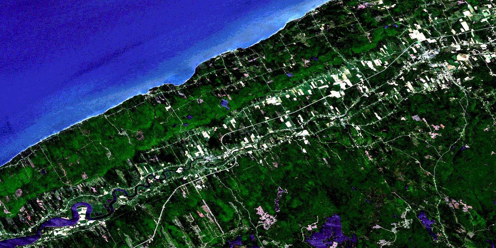
© Department of Natural Resources Canada. All rights reserved.
021A Related Maps:
021A Annapolis Royal021A01 Lahave Islands
021A02 Liverpool
021A03 Lake Rossignol
021A04 Wentworth Lake
021A05 Weymouth
021A06 Kejimkujik Lake
021A07 Bridgewater
021A08 Lunenburg
021A09 Chester
021A10 New Germany
021A11 Milford
021A12 Digby
021A13 Granville Ferry
021A14 Bridgetown
021A15 Gaspereau Lake
021A16 Windsor
