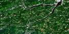
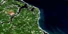
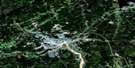
Salisbury Satellite Image Map
Download Free Aerial Photo 021I03 at 1:50,000 scale
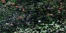
Salisbury Satellite Imagery
To view this satellite map, mouse over the air photo on the right.
You can also download this satellite image map for free:
021I03 Salisbury high-resolution satellite image map.
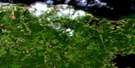
Maps for the Salisbury aerial map sheet 021I03 at 1:50,000 scale are also available in these versions:
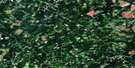
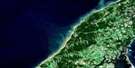
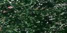
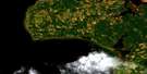
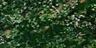
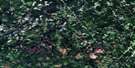
Salisbury Surrounding Area Aerial Photo Maps
 |
 |
 |
 |
 |
 |
 |
 |
 |
 |
 |
 |
 |
 |
 |
 |
© Department of Natural Resources Canada. All rights reserved.
Salisbury Gazetteer
The following places can be found on satellite image map 021I03 Salisbury:
Salisbury Satellite Image: Geographical areas
AlbertBrunswick
Coverdale
Havelock
Kings
Moncton
Queens
Salisbury
Westmorland
Salisbury Satellite Image: Lakes
Goose LakeLake Stream Lake
Lower Lake
Snowshoe Lake
Salisbury Satellite Image: Mountains
Keenan HillLeeman Hill
Steeves Mountain
Salisbury Satellite Image: Rivers
Abe Corey BrookAlward Brook
Bannister Brook
Ben Keith Brook
Blakeney Brook
Blakney Brook
Boundary Creek
Brandy Brook
Buctouche River
Canaan River
Cocagne River
Coldstream Brook
Coverdale River
Coy Brook
Dead Brook
Deep Hollow Brook
Duncan Brook
Dunstan Brook
East Branch Canaan River
East Canaan River
Five Mile Brook
Five Mile Brook
Fivemile Brook
Forks Stream
Four Mile Brook
Four Mile Brook
French Brook
Hasty Brook
Intervale Creek
Jordan Meadow Brook
Keohan Brook
Killam Brook
Killam Meadow Brook
Lake Stream
Lewis Mountain Brook
Lipsett Brook
Little River
Lower North Branch Canaan River
Lower North Canaan River
McDonalds Brook
McLeod Brook
McNaughton Brook
Middle North Branch Canaan River
Middle North Canaan River
Montgomery Brook
Murphy Meadow Brook
Nevers Brook
North Branch Cocagne River
North Cocagne River
North River
Paddy Brook
Petitcodiac River
Pollet River
Pollett River
Poplar Brook
Popple Brook
Price Brook
Ridge Brook
South Branch Buctouche River
South Branch Canaan River
South Buctouche River
South Canaan River
Springhill Brook
Springhill Brook
Thorne Brook
Thorne Brook
Thornes Brook
Thornes Brook
Three Mile Brook
Three Mile Brook
Trites Brook
Upper North Branch Canaan River
Upper North Canaan River
Walker Brook
West Alward Brook
West Branch Alward Brook
Will Taylor Brook
Wilmot Brook
Wilmot Brook
Wilson Brook
Salisbury Satellite Image: Unincorporated areas
AlwardBoundary Creek
Butternut Ridge
Canaan
Canaan
Canaan Road
Canaan Station
Cherryvale
Dobsons Corner
East Canaan
Five Points
Fredericton Road
Gallagher
Gallagher Ridge
Harewood
Havelock
Hicksville
Killams Mills
Lewis Mountain
Monteagle
New Canaan
North Branch
Salem
Scott Road
Second North River
Segawa
Springhill
Steeves Mountain
Steeves Settlement
Thrope
Upper Ridge
Wheaton Mills
Wheaton Settlement
Salisbury Satellite Image: Low vegetation
Jordan MeadowKillam Meadow
Murphy Meadow
Salisbury Satellite Image: Villages
Salisbury
© Department of Natural Resources Canada. All rights reserved.
021I Related Maps:
021I Moncton021I01 Port Elgin
021I02 Moncton
021I03 Salisbury
021I04 Chipman
021I05 Salmon River Road
021I06 Harcourt
021I07 Buctouche
021I08 Cape Egmont
021I09 O'Leary
021I10 Richibucto
021I11 Rogersville
021I12 Blackville
021I13 Newcastle
021I14 Kouchibouguac
021I15 Pointe-Sapin
021I16 Tignish
