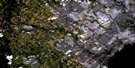
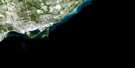
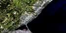
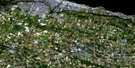
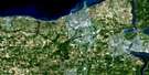
Toronto Satellite Image Map
Download Free Aerial Photo 030M11 at 1:50,000 scale
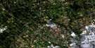
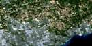
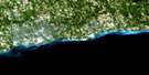
Toronto Satellite Imagery
To view this satellite map, mouse over the air photo on the right.
You can also download this satellite image map for free:
030M11 Toronto high-resolution satellite image map.
Maps for the Toronto aerial map sheet 030M11 at 1:50,000 scale are also available in these versions:
Toronto Surrounding Area Aerial Photo Maps
 |
 |
 |
 |
 |
 |
||
 |
|||
 |
 |
© Department of Natural Resources Canada. All rights reserved.
Toronto Gazetteer
The following places can be found on satellite image map 030M11 Toronto:
Toronto Satellite Image: Bays
Ashbridges BayBlockhouse Bay
Brigantine Cove
Humber Bay
Inner Harbour
Outer Harbour
Snug Harbour
Turning Basin
Toronto Satellite Image: Beaches
Balmy BeachCherry Beach
Cherry Street Beach
Eastern Beaches
Kew Beach
Mimico Beach
Sunnyside Beach
Woodbine Beach
Toronto Satellite Image: Capes
Gibraltar PointHanlan Point
Hanlans Point
Hanlan's Point
Outer Harbour East Headland
Toronto Satellite Image: Channels
Coatsworth CutDeep Pike Cut
Eastern Gap
Keating Channel
Main Harbour Channel
Outer Harbour Channel
Ship Channel
St. Andrews Cut
Sunfish Cut
Western Gap
Toronto Satellite Image: City
TorontoToronto Junction
Toronto Satellite Image: Geographical areas
East YorkEtobicoke
North York
Scarborough
York
Toronto Satellite Image: Islands
Algonquin IslandCentre Island
East Island
Forestry Island
Îles de Toronto
Junior Yacht Club Island
Muggs Island
Mugg's Island
Olympic Island
Ontario Place
R.C.Y.C. Island
Royal Canadian Yacht Club Islands
Snake Island
South Island
Sunfish Island
Toronto Island
Toronto Islands
Wards Island
Ward's Island
West Island
Toronto Satellite Image: Lakes
Bond LakeGrenadier Pond
Lac Ontario
Lake Ontario
Lighthouse Pond
Long Pond
West Pond
Toronto Satellite Image: Marine navigation features
Toronto HarbourToronto Satellite Image: Mountains
Scarborough BluffsToronto Satellite Image: Major municipal/district area - major agglomerations
Metropolitan TorontoOntario
Toronto Satellite Image: Other municipal/district area - miscellaneous
PickeringToronto Satellite Image: Rivers
Bellamy Ravine CreekBlack Creek
Cawthra Creek
Don River
Don River
Don River
Don River East Branch
Don River West Branch
Highland Creek
Humber River
Little Don River
Lornewood Creek
Maple Leaf Creek
Mimico Creek
Rivière Don
Rivière Humber
Southwest Highland Creek
Taylor Creek
Tyler Creek
Wilket Creek
Toronto Satellite Image: Towns
West Toronto JunctionToronto Satellite Image: Unincorporated areas
AlderwoodArmour Heights
Baby Point
Beaches
Bedford Park
Bennington Heights
Birch Cliff
Birchmount Park
Brimley
Browns Line
Cabbagetown
Cedarvale
Clairlea
Cliffcrest
Cliffside
Crescent Town
Danforth Station
Davisville
Deer Park
Del Ray
Don Mills
Don Vale
Downsview
East Toronto
East York
Etobicoke
Etobicoke
Fairbank
Flemingdon Park
Forest Hill
Glen Leven
Guildwood
Guildwood Village
Hanlans Point
High Park
Humber Bay
Humberside
Iondale Heights
Ionview
Keelesdale
Kennedy Park
Lawrence Heights
Lawrence Manor
Lawrence Park
Leaside
Meadow Wood
Mimico
Mimico Beach
Moore Park
Mount Dennis
Mulholland
North Park
North Toronto
North York
Oakridge
Oakwood
Old Mill
Orchard Heights
Parkdale
Parkview Hill
Ranee
Rattray Park Estates
Regent Park
Regents Park
Riverdale
Rosedale
Runnymede
Scarboro
Scarborough
Scarborough
Scarborough Bluffs
Scarborough Junction
Scarborough Station
Scarborough Village
Silverthorne
Silverthorne West
St. James Town
Sunnyside
Swansea
The Annex
The Beaches
The Golden Mile
The Junction
Thorncliffe
Todmorden
Toronto
Victoria Village
Wexford
Wexford Heights
Wilmar Heights
Wilson Heights
Winston Park
Woodbine Gardens
Woodbine Heights
Wychwood Park
York
York Mills
Yorkville
Toronto Satellite Image: Valleys
Hogg's HollowToronto Satellite Image: Low vegetation
Eglinton FlatsToronto Satellite Image: Villages
West Toronto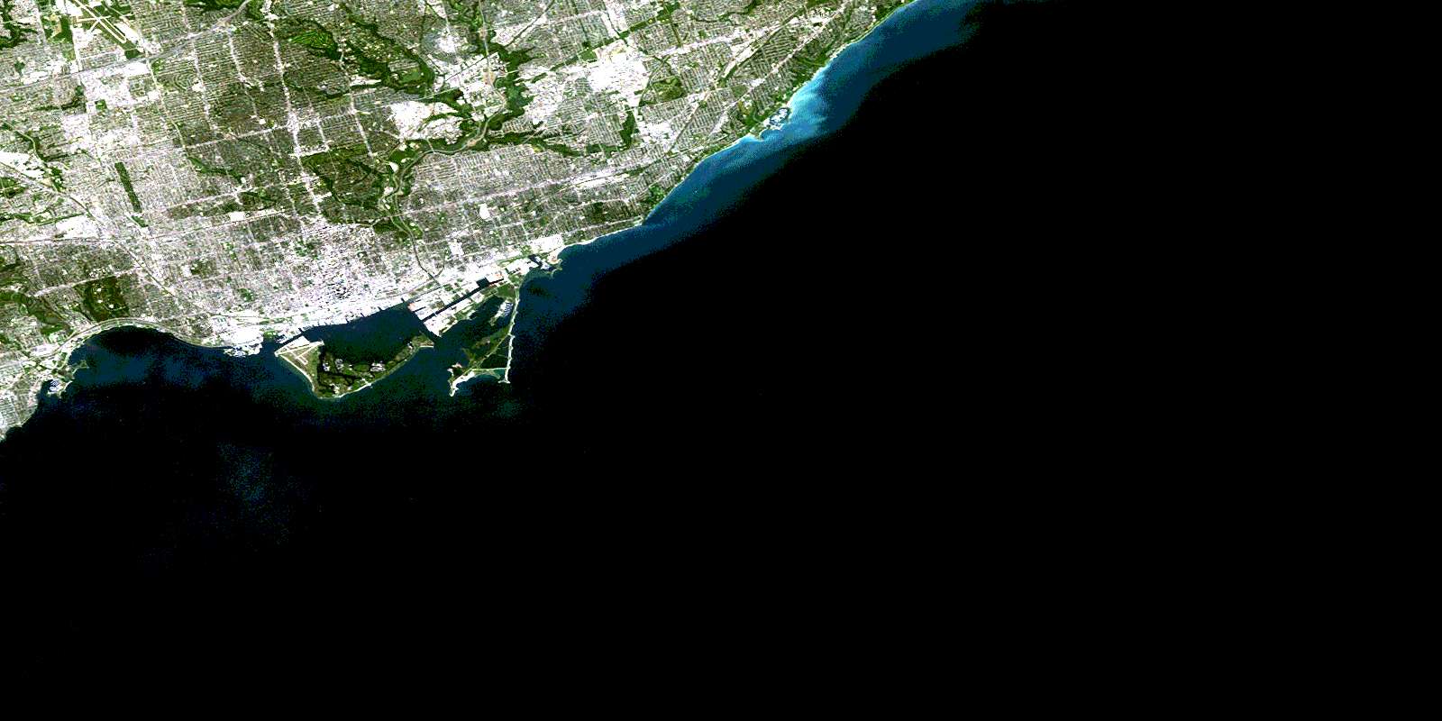
© Department of Natural Resources Canada. All rights reserved.
