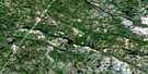
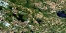
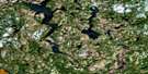
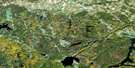
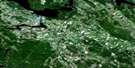
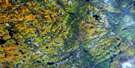
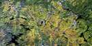
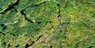
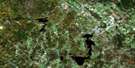
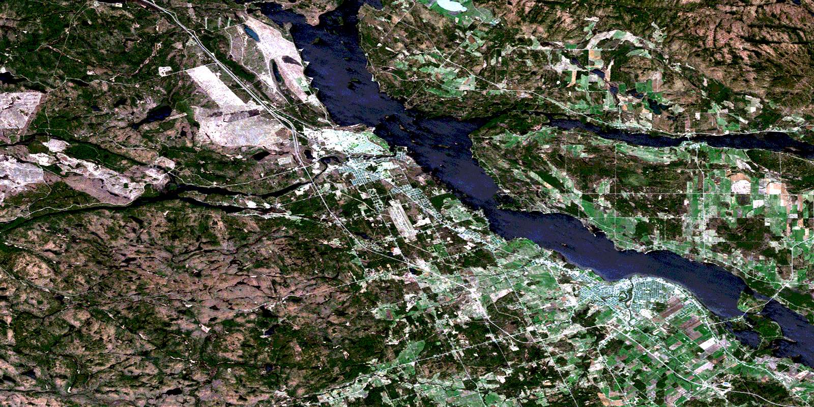
Pembroke Satellite Image Map
Download Free Aerial Photo 031F14 at 1:50,000 scale
Pembroke Satellite Imagery
To view this satellite map, mouse over the air photo on the right.
You can also download this satellite image map for free:
031F14 Pembroke high-resolution satellite image map.
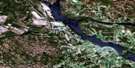
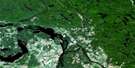
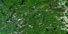
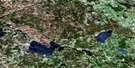
Maps for the Pembroke aerial map sheet 031F14 at 1:50,000 scale are also available in these versions:
Pembroke Surrounding Area Aerial Photo Maps
 |
 |
 |
 |
 |
 |
 |
 |
 |
 |
 |
 |
 |
 |
 |
 |
© Department of Natural Resources Canada. All rights reserved.
Pembroke Gazetteer
The following places can be found on satellite image map 031F14 Pembroke:
Pembroke Satellite Image: Bays
Baie de ChichesterBaie des Roy
Baie Harrington
Baie Meehan
Baie O'Brien
Baie Winters
Black Bay
Black Bay
Burnt Bridge Bay
Chalk Bay
Hazley Bay
Lamure Bay
MacGregor Bay
Pembroke Satellite Image: Capes
Antler PointBlack Point
Clement Point
Gust Point
Indian Point
King Point
Petawawa Point
Pointe de Chichester
Pointe Indian
Pointe Kelley
Pointe Kelly
Pointe Kennedy
Pointe Landen
Pointe Leblanc
Pointe Mackey
Pointe Murphy
Sullivan Point
The Head of the Island
Wegner Point
Pembroke Satellite Image: Channels
Chenal de la CulbuteChenal Leblanc
Chenal Lost
Lost Channel
Lower Narrows
Passe Lower
Upper Narrows
Pembroke Satellite Image: City
PembrokePembroke Satellite Image: Geographical areas
AliceBuchanan
Chichester
Fraser
Île-aux-Allumettes
Île-des-Allumettes
McKay
Nipissing
Pembroke
Petawawa
Richards
Saint-Alphonsus
Saint-Joseph
Saint-Paul-the-Hermit
Sheen
Waltham
Westmeath
Wylie
Pembroke Satellite Image: Islands
Basil IslandBeacon Island
Beckett Island
Carl Island
Chapman Island
Christie Island
Corinne Island
Cornelius Island
Cotnam Island
Crab Islands
Cushing Island
Daisy Island
Davis Island
Demers Island
Dow Island
Dunlop Island
Ellis Island
Evelyn Island
Fish Island
Forks Island
Fraser Island
Gibraltar Island
Green Island
Gutzman Island
Hazel Island
Houston Island
Île aux Allumettes
Île Berry
Île D'Arcy
Île Gagnon
Île Hawley
Île Henry
Île John-Park
Île Leblanc
Île Lorelei
Île Morrison
Irving Island
Jamieson Island
John Joe Island
King Edward Island
Lillian Island
Louise Island
Mackie Island
Metcalf Island
Metcalfe Island
Oak Island
O'Meara Island
Pearl Island
Pink Island
Poker Island
Princess Island
Ramsey Island
Randolph Island
Riddell Island
Ruby Islet
Sack's Island
Shoal Island
Short Turn Island
Spug Island
Steamer Island
Wabewawa Island
Willson Island
Windsor Island
Pembroke Satellite Image: Lakes
Allumette LakeAntler Lake
Barr Lake
Beaver Pond
Big Lake
Big Trout Lake
Bostwick Lake
Brennan Lake
Carson Lake
Centre Lake
Charlebois Lake
Clement Lake
Colby Lake
Corr Lake
Corry Lake
Duke Lake
East Bear Lake
Flat Iron Lake
Goltz Lake
Halfmile Lake
Johnny Lake
Jorgens Lake
Lac aux Allumettes
Lac Cobb
Lac Dennie
Lac Donay
Lac Downey
Lac du Bois Dur
Lac du Calumet
Lac Étroit
Lac Halfway
Lac Hurdman
Lac Isabel
Lac Manners
Lac Manny
Lac McDonald
Lac Poupore
Lac Ranger
Lac Turner
Lac Venne
Lemke Lake
Long Lake
Lower Allumette Lake
Mackenzie Lake
Mason Lake
Maunsell Lake
Maves Lake
Meitz Lake
Mill Lake
Mudturtle Lake
Percy Lake
Prange Lake
Range Lake
Rutherford Lake
Sand Lake
Sturgeon Lake
Summers Lake
Supple Lake
Thomas Lake
Tucker Lake
Unit Lake
Wolf Lake
Pembroke Satellite Image: Marine navigation features
Paquette LandingPembroke Satellite Image: Military areas
Base des Forces canadiennes PetawawaCanadian Forces Base Petawawa
Champ de tir et champ de manoeuvre Petawawa
Petawawa Range and Training Area
Pembroke Satellite Image: Miscellaneous
Holy SpiritOur Lady of the Lake
Pembroke Satellite Image: Mountains
Beacon HillClement Hill
Coteau à Butler
Gust Hill
Jorgens Hill
MacGregor Hill
Mont Dubé
Pranges Hills
Radtke Hill
Signal Hill
Spring Hill
The Three Hills
Touseants Hill
Pembroke Satellite Image: Major municipal/district area - major agglomerations
PontiacRenfrew
Pembroke Satellite Image: Other municipal/district area - miscellaneous
Alice and FraserHagarty and Richards
Killaloe, Hagarty and Richards
Laurentian Valley
Pembroke
Rolph, Buchanan, Wylie and McKay
Ross
Stafford
Stafford and Pembroke
Westmeath
Whitewater Region
Pembroke Satellite Image: Conservation areas
Algonquin Provincial ParkBarron River Provincial Park
Petawawa Terrace Provincial Park
Pembroke Satellite Image: Plains
Drury PlainDuke Plain
Gust Plain
Jorgens Plain
Plaines de Chapeau
The Plains
Pembroke Satellite Image: Provinces
OntarioPembroke Satellite Image: Rapids
Big Eddy RapidsHalfmile Rapids
Race Horse Rapids
Rapides de la Culbute
Rapides de l'Islet
Rapides des Allumettes
Rapides du Chapeau
White Horse Rapids
Pembroke Satellite Image: Rivers
Antler CreekBarron River
Black Bay Creek
Blackduck Creek
Centre Creek
Chalk River
Charlebois Creek
Clement Creek
Crooked Lake Creek
Culbute Channel
Duke Creek
Hales Creek
Halfmile Creek
Hennessys Creek
Indian River
Jorgens Creek
Landry Creek
Locksley Creek
Maunsell Creek
Maves Creek
McKay Creek
Mill Creek
Moffats Canal
Muskrat River
O'Mearas Creek
Ottawa River
Petawawa River
Range Creek
Rivière des Outaouais
Rivière des Outaouais
Ruisseau Calumet
Ruisseau de la Culbute
Ruisseau Houde
Ruisseau Kennedy
Ruisseau Lapierre
Ruisseau Loyola-Ryan
Ruisseau Nicabong
Ruisseau Nichabau
Ruisseau O'Brien
Ruisseau Phelan
Ruisseau Poupore
Ruisseau Sallafranque
Rutherford Creek
Spug Creek
Summers Creek
Tucker Creek
Unit Creek
Young Creek
Pembroke Satellite Image: Road features
Côte de l'ÉgliseCôte du Marais
Pembroke Satellite Image: Towns
ChapeauLaurentian Hills
Petawawa
Pembroke Satellite Image: Unincorporated areas
AliceAllumette
Baelstadt
Behnke Wood
Black Bay
Brindle Crossing
Brumsfield
Cedar Beach
Chapeau
Chapeau
Chartrands
Coin-chez-Leblanc
Cotnam Island
Davis Mills
Demers
Demers-Centre
Desjardinsville
Duke Crossing
Fairview
Forest Lea
Fort William
Government Road
Greenwood
Hamiltonsfield
Hampelsfield
Hiam
Hoffman
Indian
Indian Landing
Jorgens
Kathmae
Kathmae Siding
Kramer
Kramer Subdivision
La Tête-de-l'Île
Landry Crossing
Laurentian View
Le Flat
Le Landing
Marion's Corner
McGuire
Midway Crossing
Montgomery Crossing
Nicabong
Nichabau
Old Road Crossing
Pembroke Junction
Petawawa
Petawawa Point
Pine Meadows
Pine Ridge
Pleasant View
Race Horse Camp
Riverview
Saint-Joseph
Shady Nook
Sheenboro
Sheenboro
Stafford
Stewart Crossing
Stewart Farm
Stonebrook
Wabash
Pembroke Satellite Image: Valleys
River BottomVallée de l'Outaouais
Pembroke Satellite Image: Villages
ChichesterL'Isle-aux-Allumettes
L'Isle-aux-Allumettes
L'Isle-aux-Allumettes-Partie-Est
Sheenboro
Sheen-Esher-Aberdeen-et-Malakoff
Waltham
Waltham-et-Bryson
© Department of Natural Resources Canada. All rights reserved.
