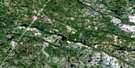
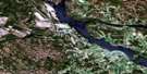
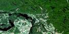
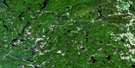
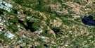
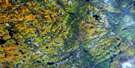
Golden Lake Satellite Image Map
Download Free Aerial Photo 031F11 at 1:50,000 scale
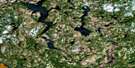
Golden Lake Satellite Imagery
To view this satellite map, mouse over the air photo on the right.
You can also download this satellite image map for free:
031F11 Golden Lake high-resolution satellite image map.
Maps for the Golden Lake aerial map sheet 031F11 at 1:50,000 scale are also available in these versions:
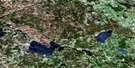
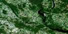
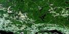
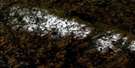
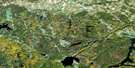
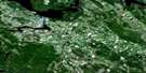
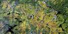
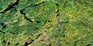
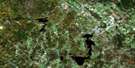
Golden Lake Surrounding Area Aerial Photo Maps
 |
 |
 |
 |
 |
 |
 |
 |
 |
 |
 |
 |
 |
 |
 |
 |
© Department of Natural Resources Canada. All rights reserved.
Golden Lake Gazetteer
The following places can be found on satellite image map 031F11 Golden Lake:
Golden Lake Satellite Image: Bays
Grassy BayHarris Bay
Hoffmans Bay
Kranzs Bay
Millers Bay
Mundts Bay
O'Connors Bay
Ruby Bay
Sand Bay
Sicards Bay
Skellys Bay
Smiths Bay
Square Bay
Turpins Bay
Wilsons Bay
Golden Lake Satellite Image: Capes
Black PointChurch Point
Hoffmans Point
Lafleurs Point
Long Point
MacDonalds Point
Thomas Point
Golden Lake Satellite Image: Caves
Bonnechere CavesGolden Lake Satellite Image: Channels
Boyles NarrowsGriffins Narrows
Harris Narrows
Golden Lake Satellite Image: Geographical areas
AlgonaAlice
Bromley
Brudenell
Fraser
Grattan
Hagarty
North Algona
Renfrew
Richards
South Algona
Stafford
Westmeath
Wilberforce
Golden Lake Satellite Image: Indian Reserves
Golden Lake Indian Reserve 39Pikwakanagan
Réserve indienne Golden Lake 39
Réserve indienne Pikwakanagan
Golden Lake Satellite Image: Islands
Beattys IslandBig Island
Centre Island
Umber Island
Golden Lake Satellite Image: Lakes
Big Swawell LakeBiggs Lake
Brewster Lake
Browns Lake
Buck Lake
Bullfrog Pond
Clear Lake
Crooked Lake
Dans Lake
Devils Lake
Dunns Lake
Eadys Lake
Edward Lake
Foley Lake
Golden Lake
Goose Lake
Grabers Lake
Green Lake
Jack Lakes
Jacks Lakes
Jeffrey Lake
Johns Lake
Jonsons Lake
Kelly Lake
Kidds Lake
Killaloe Pond
Lake Doré
Landrys Lake
Little Johns Lake
Little Redpine Lake
Little Round Lake
Little Swawell Lake
Long Lake
Long Lake
Lower Long Lake
Mackeys Lake
Meath Lake
Michigan Lakes
Middle Long Lake
Millers Lake
Mink Lake
Mud Lake
Mud Lake
Mud Lake
Mud Pond
Partridge Lake
Perrigo Lake
Petznick Lake
Pike Lake
Quacle Lake
Quades Lake
Rattrays Lake
Red Rock Lake
Red Rock Mountain Lake
Redpine Lake
Remus Lake
Rock Lake
Rock Lake
Rock Pond
Round Lake
Sams Lake
Scharfe Lake
Schwanns Lake
Shaws Pond
Silver (Zadow) Lake
Silver Lake
Silver Pond
St. Patricks Lake
Teapot Lake
Tous Sainte Lake
Touseants Lake
Upper Long Lake
Wilber Lake
Zadow Lake
Golden Lake Satellite Image: Mountains
Badhams MountainBig Hardwood Mountain
Big Mountain
Big Oak Mountain
Bluff Rock
Bluff Rock Mountain
Brewster Lake Mountain
Buck Hill
Camboose Mountain
Campbells Camp Mountain
Cherry Hill Mountain
Chicot Mountain
Cowies Hill
Devils Lake Range
Doe Hill
Eadys Mountain
Foley Lake Ridge
French Hill
Gardez Pieds Mountains
Gariepy Mountains
Goose Egg Mountain
Goulets Hill
Gully Hill
Hardwood Mountain
Higginsons Hill
Jackpine Mountain
Jacks Mountains
Jonsons Lake Mountain
Kilbys Mountain
Kilbys Mountains
Lake Doré Hills
Little Oak Mountain
Long Lake Range
Lower Long Lake Range
Madawaska Highlands
McDougalls Mountain
Meath Hill
Mount Edna
Oak Hill
O'Connors Hill
Old Shed Hill
Pauls Hill
Pine Ridge
Pine Ridge
Pinetree Mountain
Pinnacle Mountain
Pranges Hills
Red Rock Mountain
Redpine Mountain
Reinkes Hill
Rock Lake Mountain
Sand Hill
Sauers Mountain
Shed Hill
Shed Hill Range
Shellhorn Mountain
Smiths Shanty Hill
Sugarbush Mountain
Summers Mountain
Thomas Mountain
Thompson Pond Ridge
Topping Off Hill
Trace Hill
Wilno Hills
Golden Lake Satellite Image: Major municipal/district area - major agglomerations
RenfrewGolden Lake Satellite Image: Other municipal/district area - miscellaneous
AdmastonAdmaston/Bromley
Alice and Fraser
Bonnechere Valley
Bromley
Brudenell and Lyndoch
Brudenell, Lyndoch and Raglan
Grattan
Hagarty and Richards
Killaloe, Hagarty and Richards
Laurentian Valley
North Algona
North Algona Wilberforce
Pembroke
Raglan
Ross
Sebastopol
South Algona
Stafford
Stafford and Pembroke
Westmeath
Whitewater Region
Wilberforce
Golden Lake Satellite Image: Conservation areas
Foy Property Provincial ParkMud Lake/Creek Conservation Reserve
Silver Creek Peatland Conservation Reserve
Golden Lake Satellite Image: Rapids
Crooked RapidsJessups Rapids
Golden Lake Satellite Image: Rivers
Beaudrys CreekBiedermans Creek
Black Creek
Bonnechere River
Brennan Creek
Brennans Creek
Browns Creek
Brudenell Creek
Cochrane Creek
Cold Creek
Coles Creek
Crooked Lake Creek
Devines Creek
Eadys Creek
Fish Creek
Gardez Pieds Creek
Gariepy Creek
Hennessys Creek
Hurds Creek
Indian River
Jack Creek
Jacks Creek
Kelly Lake Creek
Little Cranberry Creek
Locksley Creek
Manions Creek
McKeys Creek
Mink Creek
Mud Creek
Muskrat River
Perrigo Creek
Pollocks Creek
Sauers Creek
Scharfe Creek
Silver Creek
Snake River
Spring Creek
Zummachs Creek
Golden Lake Satellite Image: Unincorporated areas
Allans CornersAugsburg
Budd Mills
Bulger
Bulgers Corners
Connaught
Deacon
Donegal
Doré Bay
Eganville
Fourth Chute
French Settlement
German Settlement
Germanicus
Golden Lake
Green Lake
Griersford
Howard
Huckabones Corners
Kellys Corner
Killaloe
Killaloe
Knightington
Lake Doré
Letts Corners
Locksley
Lower Stafford
Micksburg
Mink Lake
Misksburg
Mud Lake
Old Killaloe
Rankin
Ruby
Silver Lake
Slabtown
Stafford
Tramore
Woito
Zadow
Golden Lake Satellite Image: Valleys
Gardez Pieds RavineGariepy Ravine
Golden Lake Satellite Image: Low vegetation
Big MarshFeeleys Marsh
Gores Meadow
Long Meadow
McDougalls Marsh
Sunken Meadow
Golden Lake Satellite Image: Villages
Killaloe Station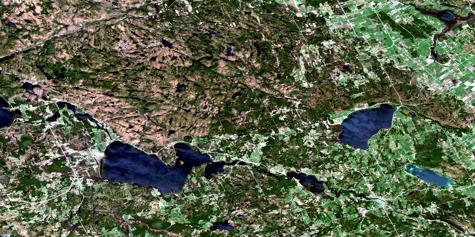
© Department of Natural Resources Canada. All rights reserved.
