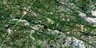
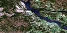
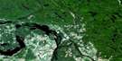
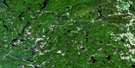
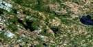
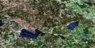
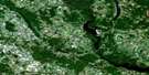
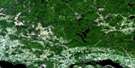
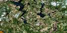
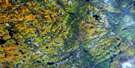
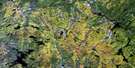
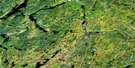
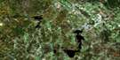
Barry's Bay Satellite Image Map
Download Free Aerial Photo 031F05 at 1:50,000 scale
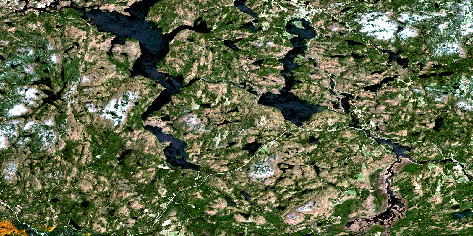
Barry's Bay Satellite Imagery
To view this satellite map, mouse over the air photo on the right.
You can also download this satellite image map for free:
031F05 Barry's Bay high-resolution satellite image map.
Maps for the Barry's Bay aerial map sheet 031F05 at 1:50,000 scale are also available in these versions:
Barry's Bay Surrounding Area Aerial Photo Maps
 |
 |
 |
 |
 |
 |
 |
 |
 |
 |
 |
 |
 |
 |
 |
 |
© Department of Natural Resources Canada. All rights reserved.
Barry's Bay Gazetteer
The following places can be found on satellite image map 031F05 Barry's Bay:
Barry's Bay Satellite Image: Bays
Barrys BayBedard Bay
Bell Bay
Bells Bay
Bills Bay
Blackfish Bay
Chapleau Bay
Clayfarm Bay
Cowan Bay
Halfmile Bay
Halfmoon Bay
Harris Bay
Hay Bay
Hydes Bay
Little Cub Bay
Littlebark Bay
McPhees Bay
McQuaig Bay
Mud Bay
One Mile Bay
Retza Bay
Sand Bay
Sand Bay
Thrashers Bay
Wasmund Bay
Barry's Bay Satellite Image: Capes
Big PointBleskies Point
Blueberry Point
Boffins Point
Coulas Point
Crogans Point
Depot Point
Green Point
Indian Point
Parcher Point
Squaw Point
Barry's Bay Satellite Image: Channels
The NarrowsThe Narrows
Barry's Bay Satellite Image: Falls
High FallsNeuman Falls
Barry's Bay Satellite Image: Geographical areas
BangorBrudenell
Carlow
Hagarty
Jones
Lyell
McClure
Monteagle
Murchison
Radcliffe
Raglan
Renfrew
Sabine
Wicklow
Barry's Bay Satellite Image: Islands
Beavertail IslandBig Island
Chapleau Island
Davis Island
Gull Island
Mask Island
Mayflower Island
Parcher Island
Ski Island
Barry's Bay Satellite Image: Lakes
Alexander LakeAnnies Lake
Babycoot Lake
Back Lake
Baileys Lake
Baldcoot Lake
Balsam Lake
Bancar Lake
Bark Lake
Bass Lake
Bath Lake
Bedard Ponds
Bell Rapids Lake
Bennett Lake
Biernacki Lake
Big Point Pond
Bills Pond
Birch Pond
Bird Lake
Blairs Lake
Boehmes Pond
Brisbois Pond
Brouse Pond
Buch Lake
Buck Lake
Budarick Lake
Buderick Lake
Campbell Lake
Canoe Lake
Cardwell Lake
Coffey Lake
Coghlan Lake
Combermere Lake
Crooked Lake
Cross Lake
Cybulski Lake
Daley Lake
Dam Lake
Davis Pond
Deer Lake
Diamond Lake
Divazie Lake
Dixie Lake
Drohan Lake
Dropledge Lake
Echo Lake
Evans Lake
Fish Lake
Fish Pond
Fosters Lake
Franks Lake
Frantz Pond
Franz Pond
Frogharbour Lake
Garden Lake
George Lake
Ghost Lake
Green Lake
Greenan Lake
Gruschwitz Pond
Gun Lake
Haley Lake
Halfway Lake
Harriets Lake
Hawk Lake
Helmer Lake
Hemans Lake
Hicks Lake
Hoare Lake
Hoover Lake
Hudson Pond
Indian Lake
Inright Lake
James Lake
James Pond
Johnson Lake
Kamaniskeg Lake
Kitts Lake
Kretzel Lake
Kuiack Lake
Kuick Lake
Kulas Lake
Labrador Lake
Lansing Pond
Lennon Lake
Lepenski Lake
Lepine Lake
Lève Lake
Levesque Pond
Little Gun Lake
Little Lake
Little Lyell Lake
Little Papineau Lake
Little Watson Lake
Little Wolf Lake
Little Yantha Lake
Littlecoot Lake
Lorbetski Lake
Lost Lake
Lost Pond
Luckovitch Lake
Lulum Lake
Lyell Lake
Lyell Long Lake
Maika Lake
Makeek Lake
Malone Lake
Marguardt Lake
Marquardt Lake
McCastle Pond
McCormick Lake
McKenzie Lake
McLaughlin Lake
McMaster Lake
Meadow Pond
Mekeek Lake
Menzies Pond
Middle Pond
Mill Pond
Mink Lake
Mitchell Lake
Moore Lake
Moore's Lake
Mountain Lake
Mud Pond
Mud Pond
Murack Lake
Muskrat Lake
Neds Pond
Negeek Lake
Noonan Lake
Norlock Lake
O'Grady Lake
Omega Lake
Papineau Lake
Parcher Lake
Partridge Lake
Patridge Lake
Peever Pond
Pell Lake
Peplinski Lake
Pershick Lake
Phillips Lake
Piecarski Lake
Pine Ridge Lake
Plebon Lake
Poplar Pond
Portage Pond
Potash Lake
Priests Ponds
Prince Lake
Purdy Lake
Purdy Pond
Radcliffe Lake
Raft Lake
Raglan Lake
Raglan White Lake
Recoski Lake
Recoski Pond
Ribgrass Lake
Robinson Lake
Rogge Lake
Rose Lake
Rose Pond
Sandys Lake
Serran Lake
Sherwood Lake
Shulist Lake
Smalls Lake
Snowshoe Lake
Spruce Lake
Spruce Pond
Stoney Lake
Stringer Lake
Stubbs Lake
Sucker Pond
Taylor Lake
Tea Lake
The Sea Pond
Thom Lake
Thominson Lake
Thrashers Pond
Togel Lake
Towns Pond
Trout Lake
Turf Lake
Vanderbeck Lake
Victoria Lakes
Victoria Lakes
Wadsworth Lake
Wasmund Lake
Watson Lake
Whiteduck Lake
Wicklow Lake
Winter Lake
Wolf Lake
Woodsher Lake
Yantha Lake
Yuill Lake
Zelneys Lake
Zelnys Lake
Barry's Bay Satellite Image: Marine navigation features
Lentz LandingWishman Landing
Barry's Bay Satellite Image: Mountains
Belot MountainBlackcat Hill
Boehmes Mountain
Buch's Hill
Buck Lake Mountain
Budarick Hill
Bulls Run Hill
Craigmont Hill
Donnellys Hill
Gorman Mountain
Gun Mountain
Hemlock Ridge
Hochbergs Mountain
Hoover Mountain
Johnson Hill
Kellys Hill
Lavallee Hill
Madawaska Highlands
Mahon Mountain
McManus Mountain
Mick Daley Mountain
Pine Ridge
Porath Mountain
Raglan Hills
Roddens Hill
Schwieg Hill
Smeltzers Hill
Stopa Hill
Trench Hill
Weasel Lookout
William Johns Mountain
Wilno Hills
Yantha Mountain
Barry's Bay Satellite Image: Other municipal/district area - miscellaneous
AiryBangor, Wicklow and McClure
Brudenell and Lyndoch
Brudenell, Lyndoch and Raglan
Carlow
Carlow/Mayo
Hagarty and Richards
Hastings Highlands
Herschel
Killaloe, Hagarty and Richards
Madawaska Valley
Mayo
Monteagle
Radcliffe
Raglan
Sherwood, Jones and Burns
South Algonquin
Barry's Bay Satellite Image: Conservation areas
Carson Lake Provincial ParkConroys Marsh Conservation Reserve
Barry's Bay Satellite Image: Rapids
Palmer RapidsBarry's Bay Satellite Image: Rivers
Alder CreekBack Creek
Biernacki Creek
Byers Creek
Carson Creek
Coghlan Creek
Diamond Lake Creek
Goodkey Creek
Hawk Creek
Hochbergs Creek
Johnson Creek
Kitts Creek
Little Mississippi River
Little Papineau Creek
Madawaska River
McLaughlin Creek
Moore Creek
Papineau Creek
Purdy Creek
Rockingham Creek
Rose Creek
Scully Creek
Watson Creek
Whiskey Creek
York River
Yourths Creek
Barry's Bay Satellite Image: Unincorporated areas
BarrymereBarry's Bay
Bell Rapids
Burgess Mines
Centreview
Combermere
Craigmont
Cross Lake
Halfway
Hopefield
Jewellville
Kaszuby
Madawaska
Maple Leaf
Mayhews Landing
New Carlow
Palmer Rapids
Purdy
Siberia
Barry's Bay Satellite Image: Low vegetation
Beanpot MarshCallaghan Marsh
Conroy Marsh
Conroys Marsh
Cranberry Marsh
Drohan Swamp
Mahon Swamp
McGillivray Marsh
Moonshine Marsh
Scully Marsh
Stewart Meadow
© Department of Natural Resources Canada. All rights reserved.
