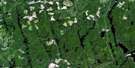
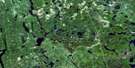
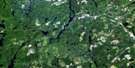
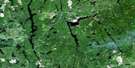
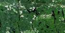
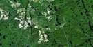
Sinclair Lake Satellite Image Map
Download Free Aerial Photo 041P14 at 1:50,000 scale
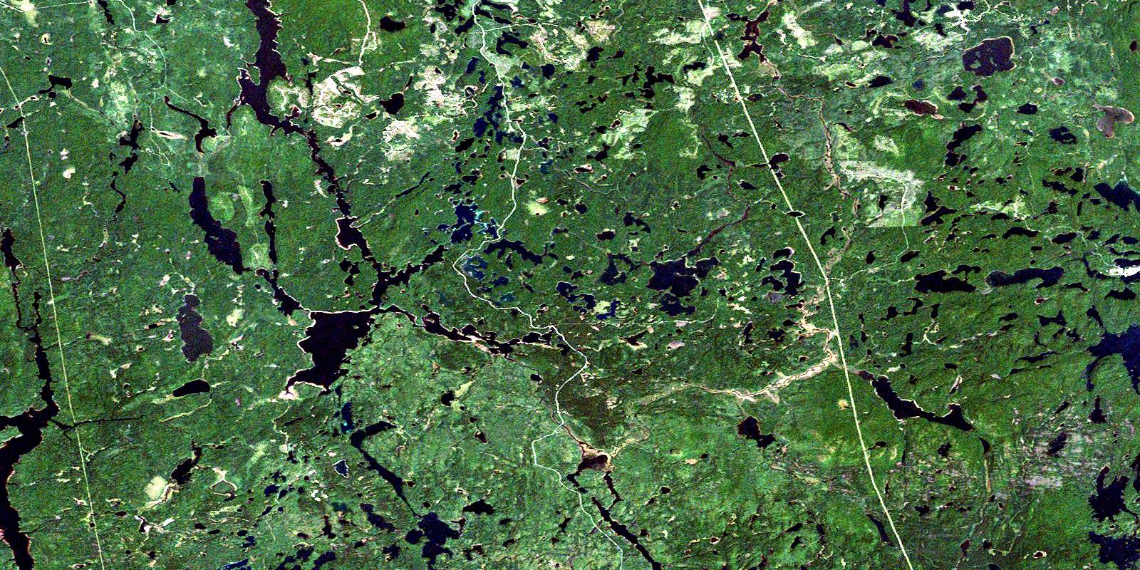
Sinclair Lake Satellite Imagery
To view this satellite map, mouse over the air photo on the right.
You can also download this satellite image map for free:
041P14 Sinclair Lake high-resolution satellite image map.
Maps for the Sinclair Lake aerial map sheet 041P14 at 1:50,000 scale are also available in these versions:
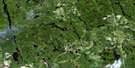
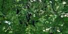
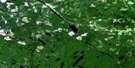
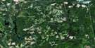
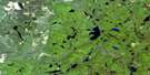
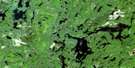
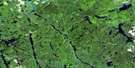
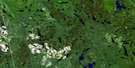
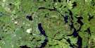
Sinclair Lake Surrounding Area Aerial Photo Maps
 |
 |
 |
 |
 |
 |
 |
 |
 |
 |
 |
 |
 |
 |
 |
 |
© Department of Natural Resources Canada. All rights reserved.
Sinclair Lake Gazetteer
The following places can be found on satellite image map 041P14 Sinclair Lake:
Sinclair Lake Satellite Image: Bays
Boot BayEarl Bay
Northeast Arm
Southeast Arm
Sinclair Lake Satellite Image: Geographical areas
BurrowsCabot
Emerald
Gouin
Halliday
Hutt
Kelvin
Kemp
Knight
Mattagami
Midlothian
Moher
Mond
Montrose
Natal
Nursey
Raymond
Semple
Sothman
Timiskaming
Togo
Sinclair Lake Satellite Image: Indian Reserves
Mattagami Indian Reserve 71Réserve indienne Mattagami 71
Sinclair Lake Satellite Image: Islands
Rawson IslandSinclair Lake Satellite Image: Lakes
Annie LakeAudrea Lake
Banner Lake
Bardwell Lake
Bayson Lake
Belle Lake
Bess Lake
Blair Lake
Bluebottle Lake
Bolton Lake
Bowl Lake
Bowsfield Lake
Bray Lake
Budd Lake
Burrows Lake
Cabot Lake
Campbell Lake
Canoeshed Lake
Caribou Lake
Cecil Lake
Chamandy Lake
Chicot Lake
Cork Lake
Corkscrew Lake
Deratnay Lake
Drop Lake
Dumbell Lake
Edleston Lake
Ember Lake
Fault Lake
Ferris Lake
Flat Lake
Fold Lake
Foy Lake
Frank Lake
Gelinas Lake
Grassy Lake
Groom Lake
Haddad Lake
Halliday Lake
Holbrooke Lake
Hutt Lake
Jeff Lake
Jumping Moose Lake
Junction Lake
Kapiskong Lake
Kelly Lake
Kwitosse Lake
Leaming Lake
Lehmann Lake
Little Reading Lake
Little Redstone Lake
Little Seganku Lake
Little Winding Lake
Lloyd Lake
Loonwing Lake
Lost Cabin Lake
Mac Lake
Macfie Lake
Marne Lake
Marshall Lake
Mattagami Lake
Mavis Lake
McLennan Lake
Melick Lake
Midlothian Lake
Mitre Lake
Mitt Lake
Moher Lake
Mond Lake
Montrose Lake
Mule Lake
Net Lake
North Moher Lake
Noswar Lake
Nugent Lake
Nursey Lake
Orling Lake
Otto Lake
Parting Lake
Patricia Lake
Penguin Lake
Perth Lake
Pigeon Lake
Pinic Lake
Pountney Lake
Radio Lake
Reading Lake
Redstone Lake
Redwing Lake
Relic Lake
Rhyolite Lake
Ring Lake
Robbie Lake
Rosetta Lake
Semple Lake
Seveninch Lake
Shear Lake
Silver Lake
Silverbirch Lake
Sinclair Lake
Sirola Lake
Slipper Lake
Smylie Lake
Sothman Lake
Spruce Lake
Strange Lake
Strike Lake
String Lake
Teddy Lake
Tee Bone Lake
Tory Lake
Trap Lake
Two Lodge Lake
Upper Grassy Lake
Upper Redwing Lake
Upper Winding Lake
Ward Lake
Waterman Lake
Weary Lake
Wellington Lake
Winding Lake
Wood Lake
Wrigley Lake
Sinclair Lake Satellite Image: Mountains
Sansawaju MountainSinclair Lake Satellite Image: Other municipal/district area - miscellaneous
MatachewanSinclair Lake Satellite Image: Conservation areas
Grassy River Halliday Lake Forests and Lowlands Conservation ReserveGrassy River-Mond Lake Lowlands and Ferris Lake Uplands Provincial Park
Sinclair Lake Satellite Image: Rivers
Burrows CreekDumbell Creek
Ember Creek
Gouin Creek
Grassy River
Hassard Creek
Hutt Creek
Kelvin Creek
Lehmann Creek
Marne Creek
Midlothian Creek
Moher Creek
Mond Creek
Nursey Creek
Parting Creek
Perth Creek
Redstone River
Redwing Creek
Relic Creek
Seganku Creek
Sothman Creek
© Department of Natural Resources Canada. All rights reserved.
041P Related Maps:
041P Gogama041P01 Obabika Lake
041P02 Pilgrim Creek
041P03 Thor Lake
041P04 Low Water Lake
041P05 Westree
041P06 Opikinimika Lake
041P07 Smoothwater Lake
041P08 Lady Evelyn Lake
041P09 Elk Lake
041P10 Gowganda
041P11 Shining Tree
041P12 Gogama
041P13 Mattagami Lake
041P14 Sinclair Lake
041P15 Matachewan
041P16 Charlton
