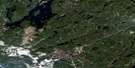
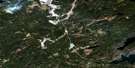
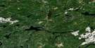
Grant Satellite Image Map
Download Free Aerial Photo 042L01 at 1:50,000 scale
Grant Satellite Imagery
To view this satellite map, mouse over the air photo on the right.
You can also download this satellite image map for free:
042L01 Grant high-resolution satellite image map.
Maps for the Grant aerial map sheet 042L01 at 1:50,000 scale are also available in these versions:
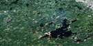
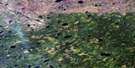
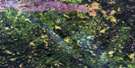
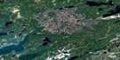
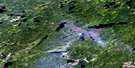
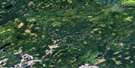
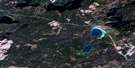
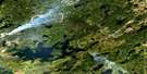
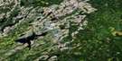
Grant Surrounding Area Aerial Photo Maps
 |
 |
 |
 |
 |
 |
 |
 |
 |
 |
 |
 |
 |
 |
 |
 |
© Department of Natural Resources Canada. All rights reserved.
Grant Gazetteer
The following places can be found on satellite image map 042L01 Grant:
Grant Satellite Image: Geographical areas
ChipmanGoodwin
Nettleton
Raynar
Grant Satellite Image: Lakes
Amoeba LakeAtikasibi Lake
Auger Lake
Braggan Lake
Calvert Lake
Chipman Lake
Clear Lake
Creeping Lake
Cyril Lake
Darkness Lake
Doug Lake
Dusk Lake
Fission Lake
Grant Lake
Jawbone Lake
Jemar Lake
Jobrin Lake
Johnson Lake
Kapeesawatan Lake
Kawakanika Lake
Kawin Lake
Kilross Lake
Krebs Lake
Legarde Lake
Lett Lake
Little Legarde Lake
Little Poverty Lake
Little Stampede Lake
Mungall Lake
Nettleton Lake
Obobka Lake
Ogahalla Lake
Oriental Lake
Pistol Lake
Poverty Lake
Prairie Lake
Relief Lake
Robertson Lake
Rooster Lake
Singing Lake
Stampede Lake
Stayner Lake
This Lake
Tooth Lake
Truax Lake
Upper Jobrin Lake
Wiggle Lake
Wingood Lake
Woodcock Lake
Young Lake
Grant Satellite Image: Rivers
Bawk CreekBraggan Creek
Calvert Creek
Drowning River
Dusk Creek
Fernow River
Jawbone Creek
Jemar Creek
Jobrin Creek
Kawakanika River
Kenogami River
Kilross Creek
Little Legarde River
Longstreth Creek
Lynx Creek
Mungall Creek
Nettleton Creek
Poverty Creek
Prairie Creek
Raynar Creek
Singing River
Smith Creek
Stampede Creek
Tilia Creek
Grant Satellite Image: Unincorporated areas
GrantJobrin
Opemisha
© Department of Natural Resources Canada. All rights reserved.
042L Related Maps:
042L Nakina042L01 Grant
042L02 Nakina
042L03 Kowkash
042L04 Elbow Lake
042L05 Toronto Lake
042L06 Hanover Lake
042L07 Esnagami Lake
042L08 Wababimiga Lake
042L09 Louella Falls
042L10 Percy Lake
042L11 Kapikotongwa Lake
042L12 Makoki Lake
042L13 Mahamo Lake
042L14 Ogoki Lake
042L15 Patience Lake
042L16 La Rose Lake
