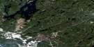
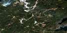
Louella Falls Satellite Image Map
Download Free Aerial Photo 042L09 at 1:50,000 scale
Louella Falls Satellite Imagery
To view this satellite map, mouse over the air photo on the right.
You can also download this satellite image map for free:
042L09 Louella Falls high-resolution satellite image map.
Maps for the Louella Falls aerial map sheet 042L09 at 1:50,000 scale are also available in these versions:
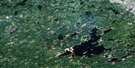
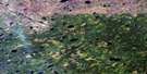
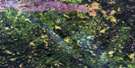
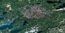
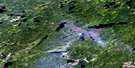
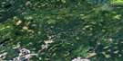
Louella Falls Surrounding Area Aerial Photo Maps
 |
 |
 |
 |
 |
 |
 |
 |
 |
 |
 |
 |
 |
 |
 |
 |
© Department of Natural Resources Canada. All rights reserved.
Louella Falls Gazetteer
The following places can be found on satellite image map 042L09 Louella Falls:
Louella Falls Satellite Image: Falls
Betty FallsCanyon Falls
Eagle Falls
Feagle Falls
Joyce Falls
Louella Falls
Vanderlip Falls
Louella Falls Satellite Image: Lakes
Baize LakeBressette Lake
Papoose Lake
Runway Lake
Sly Lake
Towart Lake
Yeldon Lake
Louella Falls Satellite Image: Conservation areas
Little Current River Provincial ParkLouella Falls Satellite Image: Rivers
Baize CreekBurlap Creek
Esnagami River
La Rose Creek
Little Current River
Little Squaw River
Muriel River
Muslin Creek
Papoose Creek
Runway Creek
Squaw River
Louella Falls Satellite Image: Road features
Muskeg Portage
© Department of Natural Resources Canada. All rights reserved.
042L Related Maps:
042L Nakina042L01 Grant
042L02 Nakina
042L03 Kowkash
042L04 Elbow Lake
042L05 Toronto Lake
042L06 Hanover Lake
042L07 Esnagami Lake
042L08 Wababimiga Lake
042L09 Louella Falls
042L10 Percy Lake
042L11 Kapikotongwa Lake
042L12 Makoki Lake
042L13 Mahamo Lake
042L14 Ogoki Lake
042L15 Patience Lake
042L16 La Rose Lake
