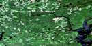
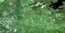
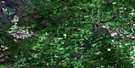
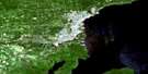
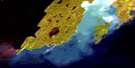
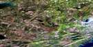
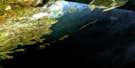
Shesheeb Bay Satellite Image Map
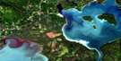
Download Free Aerial Photo 052A09 at 1:50,000 scale
Shesheeb Bay Satellite Imagery
To view this satellite map, mouse over the air photo on the right.
You can also download this satellite image map for free:
052A09 Shesheeb Bay high-resolution satellite image map.
Maps for the Shesheeb Bay aerial map sheet 052A09 at 1:50,000 scale are also available in these versions:
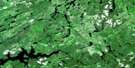
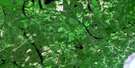
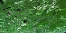
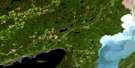
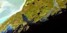
Shesheeb Bay Surrounding Area Aerial Photo Maps
 |
 |
 |
 |
 |
 |
 |
 |
 |
 |
 |
 |
 |
 |
© Department of Natural Resources Canada. All rights reserved.
Shesheeb Bay Gazetteer
The following places can be found on satellite image map 052A09 Shesheeb Bay:
Shesheeb Bay Satellite Image: Bays
Agate CoveBlack Bay
Clark Bay
Jean Pierre Bay
Loon Harbour
Marcil Bay
Moss Harbour
Otter Cove
Pleasant Harbour
Root Bay
Shesheeb Bay
Squaw Bay
Sturgeon Bay
Zeolite Bay
Shesheeb Bay Satellite Image: Capes
Agate PointBeeton Point
Black Bay Peninsula
Herron Point
Jean Pierre Point
Newash Point
Roche Debout Point
Root Point
Shesheeb Point
Starke Point
Stowe Point
Zeolite Point
Shesheeb Bay Satellite Image: Channels
Blind ChannelDevil's Gap
Nipigon Strait
Owen Channel
Roche Debout Channel
Shesheeb Bay Satellite Image: Islands
Arthur IslandBachand Island
Bill & Jim Islands
Birch Island
Blaisdell Island
Borden Island
Bourbonnais Island
Brodeur Island
Cedar Island
Chapleau Island
Coutlee Island
Davies Island
Fluor Island
Ford Island
Gordon Island
Gourdeau Island
Granite Island
Green Island
Hanbury Island
Hawk Island
Helen Island
Hood Island
Irvine Island
Jobin Island
Lamb Island
Lasher Island
Lowrey Island
McKay Island
Montgomery Island
Mood Island
Mystery Island
Newton Island
Otter Island
Provost Island
Puff Island
Pugsley Island
Rex Island
Sarah Island
Sarrat Island
Spain Island
Spar Island
St. Ignace Island
Swede Island
Tisdall Island
Tremblay Island
Willard Island
Shesheeb Bay Satellite Image: Lakes
Broom LakeDawson Lake
Iron Lake
Lake Superior
Laurie Lake
Moss Lake
Moss Lake
Otter Lake
Schelling Lake
Shelling Lake
Shesheeb Bay Satellite Image: Conservation areas
Puff Island Provincial Nature ReserveShesheeb Bay Provincial Nature Reserve
Shesheeb Bay Satellite Image: Rivers
Dawson CreekSturgeon River
Shesheeb Bay Satellite Image: Shoals
Dacres RockFoxhound Rock
Girard Rock
Manuel Rock
McGhie Rock
Newcombe Rock
Sail Rock
Schank Rock
Sovereign Rock

© Department of Natural Resources Canada. All rights reserved.
