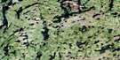
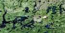
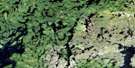
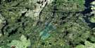
Watt Lake Satellite Image Map
Download Free Aerial Photo 064C07 at 1:50,000 scale
Watt Lake Satellite Imagery
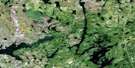
To view this satellite map, mouse over the air photo on the right.
You can also download this satellite image map for free:
064C07 Watt Lake high-resolution satellite image map.
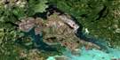
Maps for the Watt Lake aerial map sheet 064C07 at 1:50,000 scale are also available in these versions:
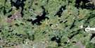
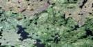
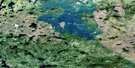
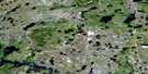
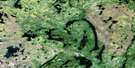
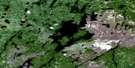
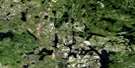
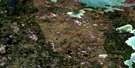
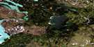
Watt Lake Surrounding Area Aerial Photo Maps
 |
 |
 |
 |
 |
 |
 |
 |
 |
 |
 |
 |
 |
 |
 |
 |
© Department of Natural Resources Canada. All rights reserved.
Watt Lake Gazetteer
The following places can be found on satellite image map 064C07 Watt Lake:
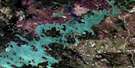
Watt Lake Satellite Image: Bays
Maskokupawitwin BayMetcalf Bay
Muhekun Bay
Watt Lake Satellite Image: Capes
Kikikwapis PointRaven Point
Sharp Peninsula
Watt Lake Satellite Image: Channels
Wapataka NarrowsWuskowakichiwunus Narrows
Watt Lake Satellite Image: Islands
Kachepanakak IslandKeeskipoochikun Island
Mikisew Island
Mistuhe Island
Munikomoo Island
Onootunaykway Island
Patton Island
The Manitou
Thorsteinson Island
Watt Lake Satellite Image: Lakes
Amy LakeBeatty Lake
Beaucage Lake
Bert Smith Lake
Chicken Lake
Deane Lake
Dismay Lake
Dobbyn Lake
Eira Lake
Granville Lake
Hutzcal Lake
Hutzcall Lake
Kilgour Lake
Kosapachekaywinasinne Lake
Malofie Lake
Mistumiskos Lake
Monk Lake
Omithaches Lake
Seahorse Lake
Trophy Lake
Watt Lake
Watt Lake Satellite Image: Rivers
Beatty CreekChurchill River
Finch Creek
Keewatin River
Kosapachekaywinasinne Creek
Mistumiskos Creek
Neepeesiakawamasik Creek
Rivière Churchill
Watt Lake Satellite Image: Road features
Jam PortagePauls Portage
Watt Lake Satellite Image: Unincorporated areas
Kosapachekaywinasinne
© Department of Natural Resources Canada. All rights reserved.
064C Related Maps:
064C Granville Lake064C01 Suwannee Lake
064C02 Wheatcroft Lake
064C03 Mcknight Lake
064C04 Mccallum Lake
064C05 Kamuchawie Lake
064C06 Kadeniuk Lake
064C07 Watt Lake
064C08 Turnbull Lake
064C09 Eden Lake
064C10 Sickle Lake
064C11 Mcgavock Lake
064C12 Laurie Lake
064C13 Mcmillan Lake
064C14 Lynn Lake
064C15 Cockeram Lake
064C16 Barrington Lake
