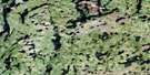
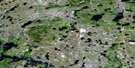
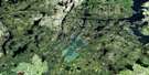
Lynn Lake Satellite Image Map
Download Free Aerial Photo 064C14 at 1:50,000 scale
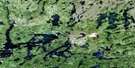
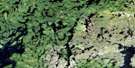
Lynn Lake Satellite Imagery
To view this satellite map, mouse over the air photo on the right.
You can also download this satellite image map for free:
064C14 Lynn Lake high-resolution satellite image map.
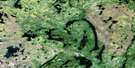
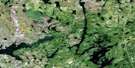
Maps for the Lynn Lake aerial map sheet 064C14 at 1:50,000 scale are also available in these versions:
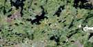
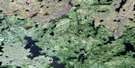
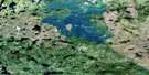
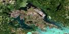
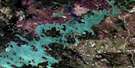
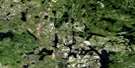
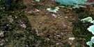
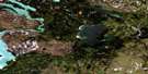
Lynn Lake Surrounding Area Aerial Photo Maps
 |
 |
 |
 |
 |
 |
 |
 |
 |
 |
 |
 |
 |
 |
 |
 |
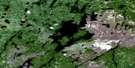
© Department of Natural Resources Canada. All rights reserved.
Lynn Lake Gazetteer
The following places can be found on satellite image map 064C14 Lynn Lake:
Lynn Lake Satellite Image: Bays
Roy BayLynn Lake Satellite Image: Capes
Rogers PointLynn Lake Satellite Image: Islands
Normandeau IslandSanderson Island
Walley Island
Lynn Lake Satellite Image: Lakes
Ace LakeBarbara Lake
Berge Lake
Betty Lake
Burge Lake
Casey Lake
Dutton Lake
Edward Brown Lake
Eileen Lake
Elb Lake
Eldon Lake
Eric Lake
Ex Lake
Flag Lake
Foster Lake
Frances Lake
Franklin Lake
Fraser Lake
Glad Lake
Goldsand Lake
Ken Lake
Lily Pond
Little Brightsand Lake
Lost Lake
Lynn Lake
Margaret Lake
Maynard Lake
McVeigh Lake
Merle Lake
Motriuk Lake
Nail Lake
Ralph Lake
Sheila Lake
Stick Lake
Suttie Lake
Vandekerckhove Lake
Veronica Lake
West Eric Lake
West Lynn Lake
Wye Lake
Zed Lake
Lynn Lake Satellite Image: Conservation areas
Burge Lake Provincial ParkBurge Lake Provincial Recreation Park
Zed Lake Provincial Park
Zed Lake Provincial Recreation Park
Lynn Lake Satellite Image: Rivers
Lynn RiverMuter Creek
Lynn Lake Satellite Image: Towns
Lynn LakeLynn Lake Satellite Image: Unincorporated areas
Lynn Lake
© Department of Natural Resources Canada. All rights reserved.
064C Related Maps:
064C Granville Lake064C01 Suwannee Lake
064C02 Wheatcroft Lake
064C03 Mcknight Lake
064C04 Mccallum Lake
064C05 Kamuchawie Lake
064C06 Kadeniuk Lake
064C07 Watt Lake
064C08 Turnbull Lake
064C09 Eden Lake
064C10 Sickle Lake
064C11 Mcgavock Lake
064C12 Laurie Lake
064C13 Mcmillan Lake
064C14 Lynn Lake
064C15 Cockeram Lake
064C16 Barrington Lake
