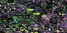
Brownfield Satellite Image Map
Download Free Aerial Photo 073D06 at 1:50,000 scale
Brownfield Satellite Imagery
To view this satellite map, mouse over the air photo on the right.
You can also download this satellite image map for free:
073D06 Brownfield high-resolution satellite image map.
Maps for the Brownfield aerial map sheet 073D06 at 1:50,000 scale are also available in these versions:
Brownfield Surrounding Area Aerial Photo Maps
 |
 |
 |
 |
 |
 |
 |
 |
 |
 |
 |
 |
 |
 |
 |
 |
© Department of Natural Resources Canada. All rights reserved.
Brownfield Gazetteer
The following places can be found on satellite image map 073D06 Brownfield:
Brownfield Satellite Image: Lakes
Boutets LakeGenest Lake
Montambeault Lake
Nelson Lake
Rosse Lake
Thompson Lake
Windy Lake
Brownfield Satellite Image: Major municipal/district area - major agglomerations
County of Flagstaff No. 29County of Paintearth No. 18
Flagstaff County
Municipal District of Provost No. 52
Brownfield Satellite Image: Rivers
Battle RiverNelson Creek
Ribstone Creek
Shorncliffe Creek
Brownfield Satellite Image: Unincorporated areas
Battle BendBattle Ridge
Brownfield
Eastervale
Kessler
Lakesend
Puffer
Silver Heights

© Department of Natural Resources Canada. All rights reserved.
