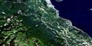
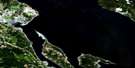
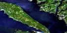
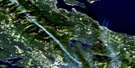
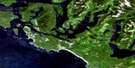
Forbidden Plateau Satellite Image Map
Download Free Aerial Photo 092F11 at 1:50,000 scale
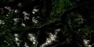
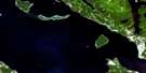
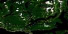
Forbidden Plateau Satellite Imagery
To view this satellite map, mouse over the air photo on the right.
You can also download this satellite image map for free:
092F11 Forbidden Plateau high-resolution satellite image map.
Maps for the Forbidden Plateau aerial map sheet 092F11 at 1:50,000 scale are also available in these versions:
Forbidden Plateau Surrounding Area Aerial Photo Maps
 |
 |
 |
 |
 |
 |
 |
 |
 |
 |
 |
 |
 |
 |
 |
 |
© Department of Natural Resources Canada. All rights reserved.
Forbidden Plateau Gazetteer
The following places can be found on satellite image map 092F11 Forbidden Plateau:
Forbidden Plateau Satellite Image: Bays
Boston BayForbidden Plateau Satellite Image: Capes
Old Camp PointForbidden Plateau Satellite Image: City
CourtenayForbidden Plateau Satellite Image: Geographical areas
Clayoquot Land DistrictComox Land District
Nelson Land District
Newcastle Land District
Nootka Land District
Forbidden Plateau Satellite Image: Glaciers
Aureole IcefieldAureole Snowfield
Cliffe Glacier
Comox Glacier
Moving Glacier
Forbidden Plateau Satellite Image: Indian Reserves
Pentledge Indian Reserve 2Réserve indienne Pentledge 2
Forbidden Plateau Satellite Image: Islands
Île de VancouverStuart Wood Island
Vancouver Island
Forbidden Plateau Satellite Image: Lakes
Aldermen LakesAllen Lake
Amphitheatre Lake
Anderson Lake
Arum Lake
Ash Pond
Aston Pond
Ball Lake
Battleship Lake
Beaufort Lake
Boston Lake
Capes Lake
Carey Lakes
Century Sam Lake
Charity Lake
Circlet Lake
Comox Lake
Cottingham Lake
Cougar Lake
Croteau Lake
Delight Lake
Divers Lake
Douglas Lake
Dove Lake
Drabble Lakes
Duncan Lake
Esther Lake
Faith Lake
Forbush Lake
Gem Lake
Gordon Wood Lake
Hairtrigger Lake
Hamilton Lake
Harris Lake
Hope Lake
Idiens Lake
Ink Lake
Jack Shark Lake
John Brown Lake
Johnson Lake
Johnston Lake
Kim Lake
Kooso Lake
Kwai Lake
Kwassun Lake
Lady Lake
Lake Beautiful
Lake Helen Mackenzie
Lunchtime Lake
Maple Lake
Mariwood Lake
McKenzie Lake
McPhee Lake
McQuillan Lake
Meadow Lake
Memory Lake
Milla Lake
Mirren Lake
Moat Lake
Netuts Lake
Nimnim Lake
Norm Lake
Panther Lake
Paradise Ponds
Pearl Lake
Pearse Lake
Pigeon Pond
Poum Lake
Ralph Lake
Rossiter Lake
Ruth Masters Lake
Seeam Lake
Silver Snag Lake
Simms Lake
Sunrise Lake
Tatsno Lakes
Teal Lake
Trout Lake
Tsable Lake
Tzela Lake
Wagner Lakes
Willemar Lake
Wolf Lake
Forbidden Plateau Satellite Image: Mountains
Alexandra PeakAlone Mountain
Argus Mountain
Augerpoint Mountain
Augurpoint Mountain
Beaufort Range
Black Cat Mountain
Boston Ridge
Capes Ridge
Castlecrag Mountain
Iceberg Peak
Indian Head Mountain
Indianhead Mountain
Jap Mountain
Jutland Mountain
Kookjai Mountain
Mitch Mountain
Mount Albert Edward
Mount Allan Brooks
Mount Becher
Mount Brooks
Mount Chief Frank
Mount Clifton
Mount Drabble
Mount Elma
Mount Frink
Mount George V
Mount Ginger Goodwin
Mount Harmston
Mount Hennessy
Mount Jutland
Mount Mitchell
Mount Regan
Mount Stubbs
Nikkei Mountain
Rees Ridge
Rough and Tumble Mountain
Strata Mountain
The Red Pillar
Tsable Mountain
Vancouver Island Mountains
Vancouver Island Ranges
Forbidden Plateau Satellite Image: Major municipal/district area - major agglomerations
Comox Valley Regional DistrictRegional District of Alberni-Clayoquot
Regional District of Comox-Strathcona
Forbidden Plateau Satellite Image: Conservation areas
Strathcona ParkWood Mountain Ski Park
Forbidden Plateau Satellite Image: Plains
Forbidden PlateauForbidden Plateau Satellite Image: Rivers
Arden CreekAsh River
Beaufort Creek
Beech Creek
Bloedel Creek
Boston Creek
Browns River
Capes Creek
Comox Creek
Cruickshank River
Cumberland Creek
Datsio Creek
Dove Creek
Eric Creek
First Supply Creek
Gem Creek
Ginger Goodwin Creek
Goodwin Creek
Goss Creek
Harding Creek
Headquarters Creek
Henshaw Creek
Idiens Creek
Idle Creek
Jackpot Creek
Karst Creek
Katlum Creek
Kweishun Creek
Millard Creek
Morrison Creek
Nellie Creek
Nimnim Creek
Norm Creek
Oyster River
Paradise Creek
Pearce Creek
Perseverance Creek
Piercy Creek
Piggott Creek
Portuguese Creek
Puntledge River
Ralph River
Ramparts Creek
Red Pillar Creek
Rees Creek
Shepherd Creek
Siokum Creek
Supply Creek
Toma Creek
Tremain Creek
Trent River
Tsable River
Tsolum River
Wattaway Creek
Willemar Creek
Forbidden Plateau Satellite Image: Unincorporated areas
BevanMount Washington
Puntledge
Union
Forbidden Plateau Satellite Image: Valleys
Comox GapCruickshank Canyon
Lone Tree Pass
Forbidden Plateau Satellite Image: Low vegetation
McKenzie MeadowsMurray Meadows
Paradise Meadows
Slingshot Meadows
Wattaway Meadows
Whiskey Meadows
Forbidden Plateau Satellite Image: Villages
Cumberland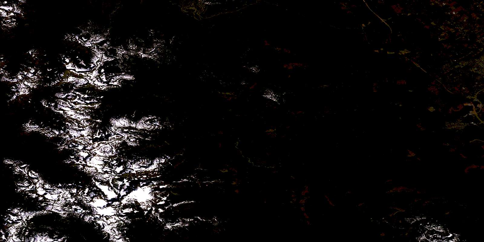
© Department of Natural Resources Canada. All rights reserved.
092F Related Maps:
092F Port Alberni092F01 Nanaimo Lakes
092F02 Alberni Inlet
092F03 Effingham River
092F04 Tofino
092F05 Bedwell River
092F06 Great Central Lake
092F07 Horne Lake
092F08 Parksville
092F09 Texada Island
092F10 Comox
092F11 Forbidden Plateau
092F12 Buttle Lake
092F13 Upper Campbell Lake
092F14 Oyster River
092F15 Powell River
092F16 Haslam Lake
