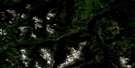
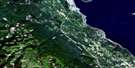
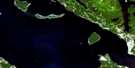
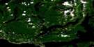
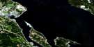
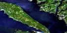
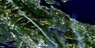
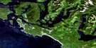
Alberni Inlet Satellite Image Map
Download Free Aerial Photo 092F02 at 1:50,000 scale
Alberni Inlet Satellite Imagery
To view this satellite map, mouse over the air photo on the right.
You can also download this satellite image map for free:
092F02 Alberni Inlet high-resolution satellite image map.
Maps for the Alberni Inlet aerial map sheet 092F02 at 1:50,000 scale are also available in these versions:
Alberni Inlet Surrounding Area Aerial Photo Maps
 |
 |
 |
 |
 |
 |
 |
 |
 |
 |
 |
 |
 |
 |
 |
 |
© Department of Natural Resources Canada. All rights reserved.
Alberni Inlet Gazetteer
The following places can be found on satellite image map 092F02 Alberni Inlet:
Alberni Inlet Satellite Image: Bays
Alberni InletHook Bay
Macktush Bay
Nahmint Bay
Port Alberni
Port Alberni Harbour
Stirling Arm
Two Rivers Arm
Uchucklesit Inlet
Underwood Cove
Alberni Inlet Satellite Image: Capes
Bilton PointDunsmuir Point
Hocking Point
Katharine Point
Lone Tree Point
Lupsi Cupsi Point
Polly Point
River Point
Stamp Point
Ten Mile Point
Alberni Inlet Satellite Image: Channels
Sproat NarrowsStamp Narrows
Alberni Inlet Satellite Image: City
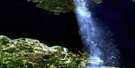
Port AlberniAlberni Inlet Satellite Image: Falls
Upper FallsAlberni Inlet Satellite Image: Geographical areas
Alberni Land DistrictBarclay Land District
Cameron Land District
Clayoquot Land District
Cowichan Lake Land District
Dunsmuir Land District
Alberni Inlet Satellite Image: Indian Reserves
Alberni Indian Reserve 2Chuchakacook Indian Reserve 4
Cous Indian Reserve 3
Kleykleyhous Indian Reserve 5
Réserve indienne Alberni 2
Réserve indienne Chuchakacook 4
Réserve indienne Cous 3
Réserve indienne Kleykleyhous 5
Alberni Inlet Satellite Image: Islands
Hohm IslandHoik Island
Île de Vancouver
Johnstone Island
Observatory Island
Sheep Island
Vancouver Island
Alberni Inlet Satellite Image: Lakes
Arrowsmith LakeBainbridge Lake
Cass Lake
Cox Lake
Devils Den Lake
Duck Lake
Father and Son Lake
Fishtail Lake
Hawthorn Lake
Henry Lake
Hidden Lake
Kammat Lake
Kildonan Lake
Lizard Lake
Lizard Pond
Nahmint Lake
Peak Lake
Rowbotham Lake
Sproat Lake
Summit Lake
Alberni Inlet Satellite Image: Mountains
Arbutus SummitDouglas Peak
Hannah Mountain
Hecate Mountain
Hiwatchas Mountain
Limestone Mountain
Logan Peak
McKinlay Peak
McLaughlin Ridge
Mount Arrowsmith
Mount Cokely
Mount Douglas
Mount Halliday
Mount Hankin
Mount Hannah
Mount Hooper
Mount McQuillan
Mount Olsen
Mount Parsons
Mount Spencer
Mount Underwood
Patlicant Mountain
The Hump
Vancouver Island Mountains
Vancouver Island Ranges
Alberni Inlet Satellite Image: Major municipal/district area - major agglomerations
Cowichan Valley Regional DistrictRegional District of Alberni-Clayoquot
Regional District of Nanaimo
Alberni Inlet Satellite Image: Conservation areas
China Creek ParkFosselli Park
Fossli Park
Mount Arrowsmith Park
Alberni Inlet Satellite Image: Rivers
Borden CreekCameron River
Cass Creek
Chesnucknuw Creek
Child Creek
China Creek
Coleman Creek
Cook Creek
Cop Creek
Corrigan Creek
Cous Creek
Debeaux Creek
Englishman River
Follinsbee Creek
Fosseli Creek
Fosselli Creek
Fossli Creek
Franklin Creek
Franklin River
French Creek
Handy Creek
Kammat Creek
Lockwood Creek
Lupsi Cupsi Creek
Macktush Creek
McBey Creek
McFarland Creek
McLaughlin Creek
McQuillan Creek
Mineral Creek
Museum Creek
Nahmint River
Nanaimo River
Nitinat River
North McFarland Creek
Owatchet Creek
Parsons Creek
Pool Creek
Rift Creek
Rogers Creek
Sadie Creek
Ship Creek
Somass River
St. Andrew Creek
St. Dennis Creek
Williams Creek
Yellows Creek
Alberni Inlet Satellite Image: Unincorporated areas
Arrowview HeightsCameron Heights
Franklin River
Locharkaig
Nahmint
Alberni Inlet Satellite Image: Valleys
King Solomon Basin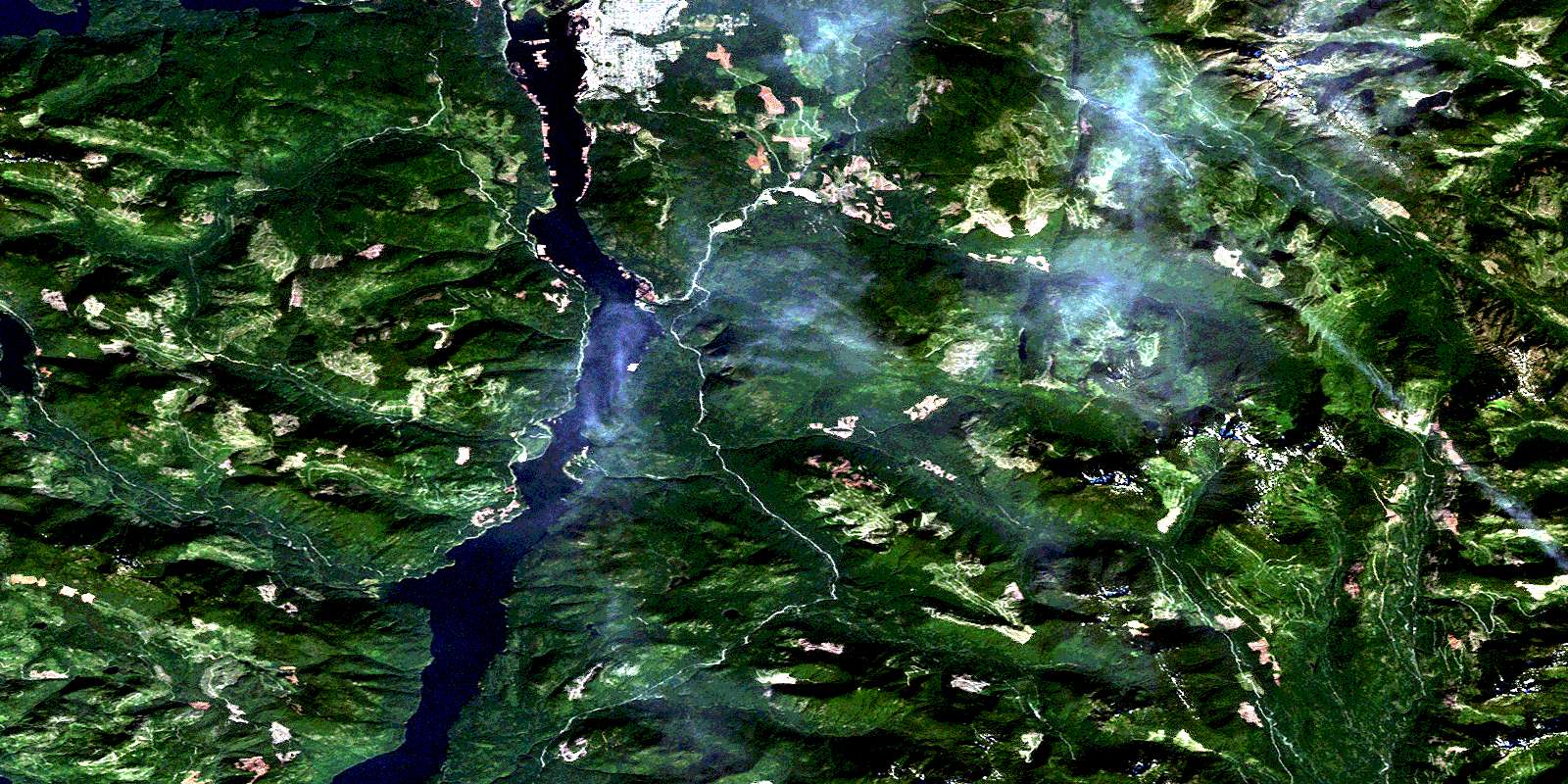
© Department of Natural Resources Canada. All rights reserved.
092F Related Maps:
092F Port Alberni092F01 Nanaimo Lakes
092F02 Alberni Inlet
092F03 Effingham River
092F04 Tofino
092F05 Bedwell River
092F06 Great Central Lake
092F07 Horne Lake
092F08 Parksville
092F09 Texada Island
092F10 Comox
092F11 Forbidden Plateau
092F12 Buttle Lake
092F13 Upper Campbell Lake
092F14 Oyster River
092F15 Powell River
092F16 Haslam Lake
