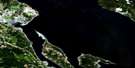
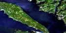
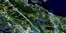
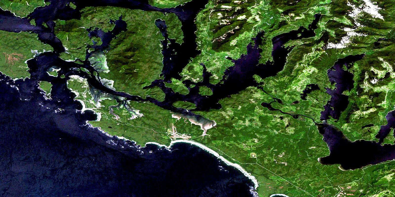
Tofino Satellite Image Map
Download Free Aerial Photo 092F04 at 1:50,000 scale
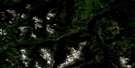
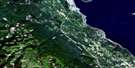
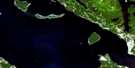
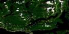
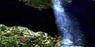
Tofino Satellite Imagery
To view this satellite map, mouse over the air photo on the right.
You can also download this satellite image map for free:
092F04 Tofino high-resolution satellite image map.
Maps for the Tofino aerial map sheet 092F04 at 1:50,000 scale are also available in these versions:
Tofino Surrounding Area Aerial Photo Maps
 |
 |
 |
 |
 |
 |
 |
 |
 |
 |
 |
 |
 |
 |
 |
 |
© Department of Natural Resources Canada. All rights reserved.
Tofino Gazetteer
The following places can be found on satellite image map 092F04 Tofino:
Tofino Satellite Image: Bays
Adventure CoveBerryman Cove
Cannery Bay
Clayoquot Arm
Cox Bay
Deer Bay
Disappointment Inlet
Duffin Cove
English Cove
Florencia Bay
Grice Bay
Gunner Harbour
Gunner Inlet
Hecate Bay
Heelboom Bay
Indian Bay
Irving Cove
Island Cove
Kennedy Cove
Lemmens Inlet
Long Bay
Mill Bay
Mosquito Harbour
Mud Bay
Rankin Cove
Ritchie Bay
Schooner Cove
Tofino Inlet
Tranquil Inlet
Warn Bay
Wickaninnish Bay
Windy Arm
Windy Bay
Tofino Satellite Image: Beaches
Chesterman BeachLong Beach
MacKenzie Beach
Radar Beaches
Tofino Satellite Image: Capes
Auseth PointBerryman Point
Corning Point
Cox Point
Esowista Peninsula
Ginnard Point
Green Point
Grice Point
Kraan Head
Low Peninsula
McCaw Peninsula
Meares Spit
Moser Point
Plover Point
Point Cox
Portland Point
Rassier Point
Robert Point
Schindler Point
Ten Mile Point
Usatzes Point
Tofino Satellite Image: Channels
Browning PassageCalmus Passage
Clayoquot Sound
Dawley Passage
Deadman Passage
Deception Channel
Duffin Passage
Epper Passage
Father Charles Channel
Fortune Channel
Heynen Channel
Matlset Narrows
Maurus Channel
Race Narrows
Templar Channel
Tsapee Narrows
Van Nevel Channel
Tofino Satellite Image: District municipality
TofinoTofino Satellite Image: Indian Reserves
Clayoqua Indian Reserve 6Cloolthpich Indian Reserve 12
Echachis Indian Reserve 2
Eelseuklis Indian Reserve 10
Esowista Indian Reserve 3
Ilthpaya Indian Reserve 8
Indian Island Indian Reserve 30
Kootowis Indian Reserve 4
Okeamin Indian Reserve 5
Onadsilth Indian Reserve 9
Opitsat Indian Reserve 1
Quisitis Indian Reserve 9
Réserve indienne Clayoqua 6
Réserve indienne Cloolthpich 12
Réserve indienne Echachis 2
Réserve indienne Eelseuklis 10
Réserve indienne Esowista 3
Réserve indienne Ilthpaya 8
Réserve indienne Indian Island 30
Réserve indienne Kootowis 4
Réserve indienne Okeamin 5
Réserve indienne Onadsilth 9
Réserve indienne Opitsat 1
Réserve indienne Quisitis 9
Réserve indienne Sutaquis 18
Réserve indienne Tin Wis 11
Réserve indienne Vargas Island 31
Réserve indienne Wya 7
Réserve indienne Yarksis 11
Sutaquis Indian Reserve 18
Tin Wis Indian Reserve 11
Tin-Wis 11
Vargas Island Indian Reserve 31
Wya Indian Reserve 7
Yarksis Indian Reserve 11
Tofino Satellite Image: Islands
Agnes IslandAlmond Islet
Arakun Islands
Arnet Island
Auseth Islet
Baxter Islet
Beck Island
Blackberry Islets
Box Island
Calf Island
Columbia Islet
Dark Island
Deadman Islets
Dinner Islets
Double Islets
Duc Island
Ducking Island
Dunlap Island
Echachis Island
Eik Islets
Fantasy Island
Felice Island
Flat Top Islands
Frank Island
Granite Island
Hansen Island
Île de Vancouver
Indian Island
Kirshaw Islets
Kraan Island
La Croix Group
Laddie Island
Lagoon Island
Lane Islet
Laylee Island
Lennard Island
Maltby Islets
Maple Islands
McBey Islets
McCall Island
Meares Island
Mikes Island
Monas Island
Morfee Island
Morpeus Island
Morpheus Island
Mugford Island
Neilson Island
Ocayu Island
Ridout Islets
Riley Island
Rugged Group
Saranac Island
Sharp Island
Similar Island
Sloman Island
Stockham Island
Stone Island
Strawberry Island
Stubbs Island
Tonquin Island
Trunk Islands
Vancouver Island
Vargas Island
Wakennenish Island
Warne Island
Wickaninnish Island
Wingen Islets
Wollan Islets
Woman Island
Wood Islets
Tofino Satellite Image: Lakes
Angora LakeAngus Lake
Clayoquot Lake
Ilthpaya Lake
Kennedy Lake
Macallan Lake
Mallard Lake
Muriel Lake
Surprise Lake
Wanetta Lake
Tofino Satellite Image: Mountains
Catface RangeLone Cone
Maitland Range
Mount Colnett
Muriel Ridge
Radar Hill
Salmonberry Mountain
Sea Peak
Vancouver Island Mountains
Vancouver Island Ranges
Vargas Cone
Tofino Satellite Image: Major municipal/district area - major agglomerations
Regional District of Alberni-ClayoquotTofino Satellite Image: Conservation areas
Clayoquot Arm ParkDawley Passage Park
Epper Passage Park
Kennedy Lake Park
Kennedy River Bog Park
Pacific Rim National Park Reserve of Canada
Réserve de parc national du Canada Pacific Rim
Wickaninnish Beach Park
Tofino Satellite Image: Rivers
Brother CreekClayoquot River
Elsul Creek
Fundy Creek
Ginnard Creek
Kennedy River
Kennfalls Creek
Kootowis Creek
Lost Shoe Creek
Marble Creek
Meares Creek
Onad Creek
Rankin Creek
Sand River
Sandhill Creek
Sharp Creek
Staghorn Creek
Sutton Mill Creek
Tofino Creek
Tranquil Creek
Virge Creek
Tofino Satellite Image: Shoals
Baxter ReefCoomes Bank
Elbow Bank
Eugvik Rock
Father Charles Rock
Gowlland Rocks
Hankin Rock
Incinerator Rock
Jensen Rock
Lovekin Rock
McKay Reef
Nob Rock
Passage Rock
Rankin Rocks
Sea Lion Rocks
Surprise Reef
Thompson Rock
Thorn Reef
Wilf Rock
Yellow Bank
Yellow Rocks
Tofino Satellite Image: Unincorporated areas
ClayoquotKakawis
Long Beach
Opitsat
Yarksis
© Department of Natural Resources Canada. All rights reserved.
092F Related Maps:
092F Port Alberni092F01 Nanaimo Lakes
092F02 Alberni Inlet
092F03 Effingham River
092F04 Tofino
092F05 Bedwell River
092F06 Great Central Lake
092F07 Horne Lake
092F08 Parksville
092F09 Texada Island
092F10 Comox
092F11 Forbidden Plateau
092F12 Buttle Lake
092F13 Upper Campbell Lake
092F14 Oyster River
092F15 Powell River
092F16 Haslam Lake
