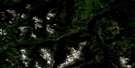
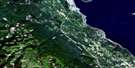
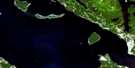
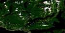
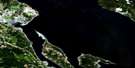
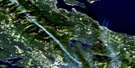
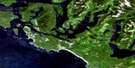
Upper Campbell Lake Satellite Image Map
Download Free Aerial Photo 092F13 at 1:50,000 scale
Upper Campbell Lake Satellite Imagery
To view this satellite map, mouse over the air photo on the right.
You can also download this satellite image map for free:
092F13 Upper Campbell Lake high-resolution satellite image map.
Maps for the Upper Campbell Lake aerial map sheet 092F13 at 1:50,000 scale are also available in these versions:
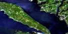
Upper Campbell Lake Surrounding Area Aerial Photo Maps
 |
 |
 |
 |
 |
 |
 |
 |
 |
 |
 |
 |
 |
 |
 |
 |
© Department of Natural Resources Canada. All rights reserved.
Upper Campbell Lake Gazetteer
The following places can be found on satellite image map 092F13 Upper Campbell Lake:
Upper Campbell Lake Satellite Image: Capes
Dolly Varden PointDollyvarden Point
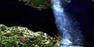
Upper Campbell Lake Satellite Image: Falls
Lady FallsMia Falls
Upper Campbell Lake Satellite Image: Geographical areas
Comox Land DistrictNootka Land District
Sayward Land District
Upper Campbell Lake Satellite Image: Islands
Île de VancouverVancouver Island
Upper Campbell Lake Satellite Image: Lakes
Bacon LakeBeadnell Lake
Beavertail Lake
Becher Lake
Bertha Lake
Buttle Lake
Camp Lake
Crater Lake
Crest Lake
Darkis Lake
Drum Lakes
Eena Lake
Elk Lake
Flume Lake
Gentian Lake
Gold Lake
Gooseneck Lake
Hawarth Lake
Landslide Lake
Mia Lake
Mud Lake
Myra Lake
Nola Lake
Raven Lake
Reginald Lake
Snake Lake
Snakehead Lake
Tlools Lake
Upper Campbell Lake
Upper Quinsam Lake
Volcano Lake
Wokas Lake
Upper Campbell Lake Satellite Image: Mountains
Big Den MountainCamel Ridge
Crest Mountain
Crown Mountain
Elkhorn Mountain
Horseshoe Mountain
Kings Peak
Lupin Mountain
Mount Adrian
Mount Cobb
Mount Colonel Foster
Mount Evelyn
Mount Filberg
Mount Flannigan
Mount Haig-Brown
Mount Heber
Mount Judson
Mount Laing
Mount Titus
Puzzle Mountain
Tyee Mountain
Vancouver Island Mountains
Vancouver Island Ranges
White Ridge
Upper Campbell Lake Satellite Image: Conservation areas
Strathcona ParkWhite Ridge Park
Upper Campbell Lake Satellite Image: Rivers
Adrian CreekBeadnell Creek
Beavertail Creek
Butterwort Creek
Campbell River
Cervus Creek
Crest Creek
Crowned Creek
Elk River
Filberg Creek
Gold River
Greenstone Creek
Hawkins Creek
Heber River
Horseshoe Creek
Idsardi Creek
Mia Creek
Mine Creek
Moh Creek
Nikie Creek
Puzzle Creek
Quinsam River
Ranald Creek
Salmon River
Saunders Creek
Sihun Creek
Tlools Creek
Volcano Creek
Wolf River
Upper Campbell Lake Satellite Image: Low vegetation
Boulding Bog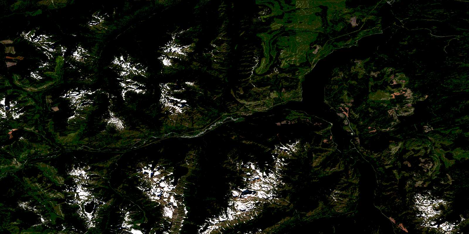
© Department of Natural Resources Canada. All rights reserved.
092F Related Maps:
092F Port Alberni092F01 Nanaimo Lakes
092F02 Alberni Inlet
092F03 Effingham River
092F04 Tofino
092F05 Bedwell River
092F06 Great Central Lake
092F07 Horne Lake
092F08 Parksville
092F09 Texada Island
092F10 Comox
092F11 Forbidden Plateau
092F12 Buttle Lake
092F13 Upper Campbell Lake
092F14 Oyster River
092F15 Powell River
092F16 Haslam Lake
