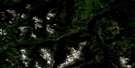
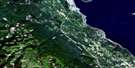
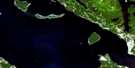
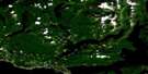
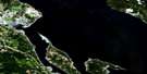
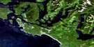
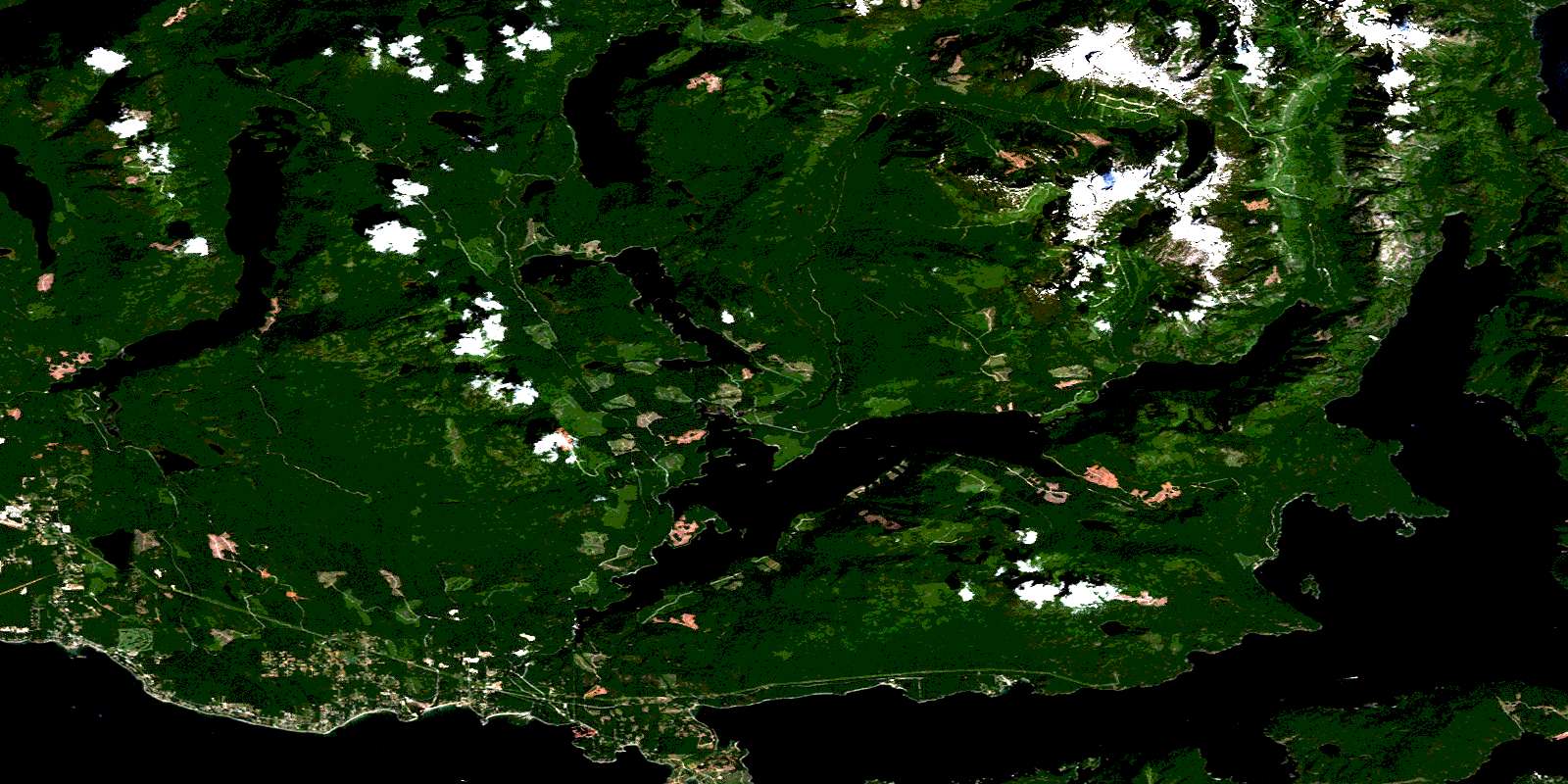
Haslam Lake Satellite Image Map
Download Free Aerial Photo 092F16 at 1:50,000 scale
Haslam Lake Satellite Imagery
To view this satellite map, mouse over the air photo on the right.
You can also download this satellite image map for free:
092F16 Haslam Lake high-resolution satellite image map.
Maps for the Haslam Lake aerial map sheet 092F16 at 1:50,000 scale are also available in these versions:
Haslam Lake Surrounding Area Aerial Photo Maps
 |
 |
 |
 |
 |
 |
 |
 |
 |
 |
 |
 |
 |
 |
 |
 |
© Department of Natural Resources Canada. All rights reserved.
Haslam Lake Gazetteer
The following places can be found on satellite image map 092F16 Haslam Lake:
Haslam Lake Satellite Image: Bays
Annis BayBaker Bay
Brew Bay
Earl Cove
Earls Cove
Fairview Bay
Frolander Bay
Granville Bay
Hotham Sound
Jervis Inlet
Lang Bay
Lena Bay
McMurray Bay
McRae Cove
Mermaid Cove
Saltery Bay
St. Vincent Bay
Stillwater Bay
Thunder Bay
Vanguard Bay
Haslam Lake Satellite Image: Capes
Ahlstrom PointAlbion Point
Ball Point
Berry Point
Black (Albion) Point
Cook Point
Culloden Point
Elephant Point
Kelly Point
Myrtle Point
Syren Point
Thunder Point
Haslam Lake Satellite Image: Channels
Agamemnon ChannelMalaspina Strait
Telescope Passage
Haslam Lake Satellite Image: Falls
Harmony FallsHaslam Lake Satellite Image: Geographical areas
Comox Land DistrictNew Westminster Land District
Texada Island Land District
Haslam Lake Satellite Image: Indian Reserves
Cokqueneets Indian Reserve 23Réserve indienne Cokqueneets 23
Réserve indienne Slayathlum 16
Slayathlum Indian Reserve16
Haslam Lake Satellite Image: Islands
Copper IslandEagle Island
Goat Island
Hardy Island
Harmony Islands
Junction Island
Nelson Island
Sykes Island
Haslam Lake Satellite Image: Lakes
Agnes LakeAlpha Lake
Arrowhead Lake
Barren Lake
Beaver Lake
Beta Lake
Brooks Lake
Confederation Lake
Deep Lake
Diadem Lake
Dodd Lake
Duck Lake
East Lake
Elephant Lake
Freda Lake
Gamma Lake
Giavanno Lake
Gordon Pasha Lake
Granite Lake
Grey Lake
Hammil Lake
Haslam Lake
Horseshoe Lake
Inland Lake
Ireland Lake
Khartoum Lake
Lac Godeau
Lena Lake
Lewis Lake
Little Horseshoe Lake
Liz Lake
Lizard Lake
Lois Lake
March Lake
McVey Lake
My Lake
Nanton Lake
Phelan Lake
Powell Lake
Rainy Day Lake
Rainyday Lake
Shoe Lake
Sonja Lake
Tony Lake
Useless Lake
Walt Lake
Windsor Lake
Haslam Lake Satellite Image: Mountains
Chaîne CôtièreCoast Mountains
Diadem Mountain
Hammil Hill
Leaning Tree Hill
Mount Mahony
Mount Troubridge
O'Connells Hill
Pacific Ranges
Parker Range
Smith Range
The Knuckles
The Sentinel
Tin Hat Mountain
Walts Hill
Haslam Lake Satellite Image: Major municipal/district area - major agglomerations
Powell River Regional DistrictHaslam Lake Satellite Image: Other municipal/district area - miscellaneous
Cokoqueneets SB 23Slayathlum SB 16
Haslam Lake Satellite Image: Conservation areas
Harmony Islands Marine ParkHaslam Lake Park
Inland Lake Park
Palm Beach Park
Saltery Bay Park
Haslam Lake Satellite Image: Rivers
Bishop CreekBrittain River
Campsite Creek
Community Creek
Dayton Creek
Deighton Creek
Egmont Creek
Freda Creek
Freil Creek
Horseshoe River
Jefferd Creek
Kelly Creek
Kellybrew Creek
Lang Creek
Lois River
Myrtle Creek
Park Creek
Powell River
Saltery Creek
Scanlon Creek
Treth Creek
Whittall Creek
Haslam Lake Satellite Image: River features
Princess Royal ReachHaslam Lake Satellite Image: Shoals
Myrtle RocksHaslam Lake Satellite Image: Unincorporated areas
Brew BayEarls Cove
Lang Bay
McCalls Landing
Myrtle Point
Saltery Bay
Sechelt Indian Government District
Stillwater
© Department of Natural Resources Canada. All rights reserved.
092F Related Maps:
092F Port Alberni092F01 Nanaimo Lakes
092F02 Alberni Inlet
092F03 Effingham River
092F04 Tofino
092F05 Bedwell River
092F06 Great Central Lake
092F07 Horne Lake
092F08 Parksville
092F09 Texada Island
092F10 Comox
092F11 Forbidden Plateau
092F12 Buttle Lake
092F13 Upper Campbell Lake
092F14 Oyster River
092F15 Powell River
092F16 Haslam Lake
