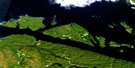
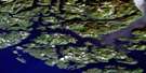
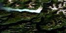
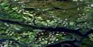
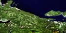
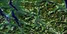
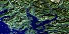
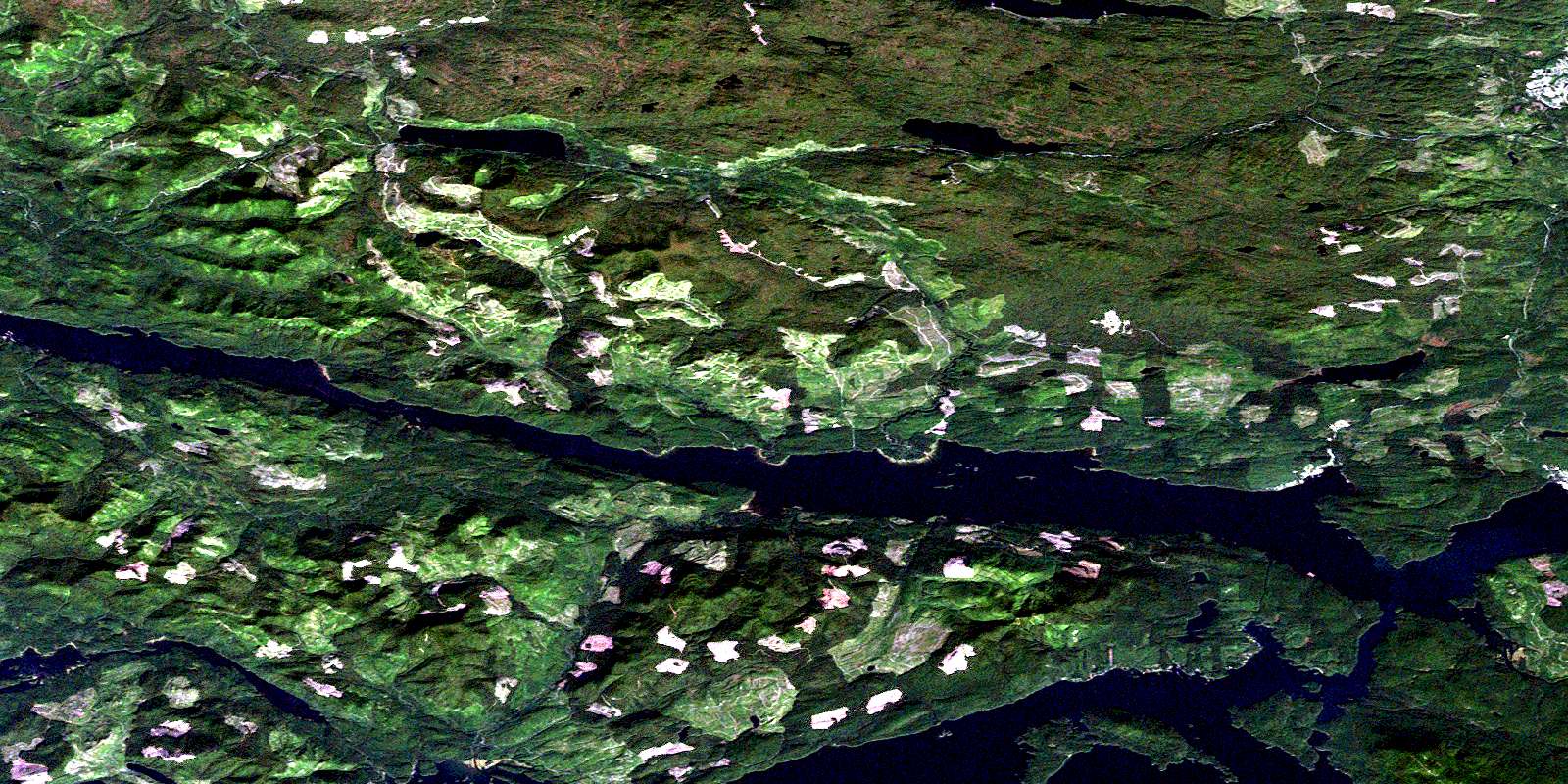
Quatsino Satellite Image Map
Download Free Aerial Photo 092L12 at 1:50,000 scale
Quatsino Satellite Imagery
To view this satellite map, mouse over the air photo on the right.
You can also download this satellite image map for free:
092L12 Quatsino high-resolution satellite image map.
Maps for the Quatsino aerial map sheet 092L12 at 1:50,000 scale are also available in these versions:
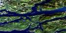
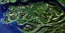
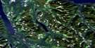
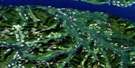
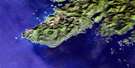
Quatsino Surrounding Area Aerial Photo Maps
 |
 |
 |
 |
 |
 |
 |
 |
 |
 |
 |
 |
 |
 |
 |
 |
© Department of Natural Resources Canada. All rights reserved.
Quatsino Gazetteer
The following places can be found on satellite image map 092L12 Quatsino:
Quatsino Satellite Image: Bays
Ahwhichaolto InletApple Bay
Atkins Cove
Bergh Cove
Coal Harbour
East Cove
Hecate Cove
Holberg Inlet
Jules Bay
Kokwina Cove
Koprino Harbour
Leeson Harbour
Neroutsos Inlet
Pamphlet Cove
Quatsino Sound
Robson Cove
Rupert Inlet
Spencer Cove
Varney Bay
Winter Harbour
Quatsino Satellite Image: Capes
Dahlstrom PointEvenson Point
Hankin Point
Henriksen Point
Holloway Point
Kenny Point
Kultah Point
Lakken Point
Leeson Point
Lindgren Point
Michelsen Point
Mickelsen Point
Norton Point
Ohlsen Point
Sorenson Point
Stewart Point
Thorp Point
Quatsino Satellite Image: Channels
Quatsino NarrowsQuatsino Satellite Image: District municipality
Port HardyQuatsino Satellite Image: Indian Reserves
Ah-we-cha-ol-to Indian Reserve 16Clatux Indian Reserve 9
Clienna Indian Reserve 14
Koprino Indian Reserve 10
Kultah Indian Reserve 4
Maquazneecht Island Indian Reserve 17
Pa-cat'l-lin-ne Indian Reserve 3
Pulcah Indian Reserve 15
Quatsino Subdivision Indian Reserve 18
Quattishe Indian Reserve 1
Réserve indienne Ah-we-cha-ol-to 16
Réserve indienne Clatux 9
Réserve indienne Clienna 14
Réserve indienne Koprino 10
Réserve indienne Kultah 4
Réserve indienne Maquazneecht Island 17
Réserve indienne Pa-cat'l-lin-ne 3
Réserve indienne Pulcah 15
Réserve indienne Quatsino Subdivision 18
Réserve indienne Quattishe 1
Réserve indienne Toh-quo-eugh 2
Réserve indienne Tsulquate 4
Toh-quo-eugh Indian Reserve 2
Tsulquate Indian Reserve 4
Wazulis 14
Quatsino Satellite Image: Islands
Cross IslandDiggs Islet
Dockyard Islet
Drake Island
Ildstad Islands
Ives Islet
Jesdal Islet
Kitten Island
Kitten Islet
Linthlop Islet
Makwazniht Island
Maquazneecht Island
Norgar Islet
Orr Island
Quatishe Island
Quattische Island
Schloss Island
Sherberg Island
Skedin Islet
Straggling Islands
Vancouver Island
Wedel Island
Quatsino Satellite Image: Lakes
Botel LakeColony Lake
Early Bird Cove
Frances Lake
Georgie Lake
Isle Lake
Kains Lake
Nahwitti Lake
Quatse Lake
Quatsino Satellite Image: Mountains
Holberg MountainHushamu Mountain
Mount Byng
Mount Fannin
Nahwitti Mountain
Pemberton Hills
Vancouver Island Mountains
Vancouver Island Ranges
Woodward Peak
Quatsino Satellite Image: Major municipal/district area - major agglomerations
Regional District of Mount WaddingtonQuatsino Satellite Image: Conservation areas
Marble River ParkQuatsino Satellite Image: Rivers
Absunstia CreekAweisha Creek
Bear Creek
Bish Creek
Bluebell Creek
Blumberg Creek
Caledonia Creek
Cascade Creek
Clesklagh Creek
Colony Creek
Denad Creek
Dick Booth Creek
Glenlion River
Glerup Creek
Goodspeed River
Hathaway Creek
Hawisnakwi Creek
Hepler Creek
Hushamu Creek
Jenkinson Creek
Kains Creek
Keekuyzed Creek
Kempson Creek
Klayina Creek
Koprino River
Kwokwesta Creek
Lower Ahwhichaolto Creek
Marble River
McNiffe Creek
Mead Creek
Nahshutti Creek
Nahwitti River
Nookneemish Creek
Nordstrom Creek
Nuknimish Creek
Pegattem Creek
Pugh Creek
Quashtin Creek
Quatse River
Simpson Creek
Stephens Creek
Tsulquate River
Upper Ahwhichaolto Creek
Wakalish Creek
Walkaleesh Creek
Wanokana Creek
Wanokanah Creek
Youghpan Creek
Quatsino Satellite Image: Shoals
Akre RocksAllan Bank
Glerup Rock
Jones Rock
Leeson Rock
McNiffe Rock
Newcomb Rocks
Newcombe Rocks
Percy Ledge
Pot Rock
Quatsino Satellite Image: Unincorporated areas
Coal HarbourQuatsino
© Department of Natural Resources Canada. All rights reserved.
092L Related Maps:
092L Alert Bay092L01 Schoen Lake
092L02 Woss Lake
092L03 Kyuquot
092L04 Brooks Peninsula
092L05 Mahatta Creek
092L06 Alice Lake
092L07 Nimpkish
092L08 Adam River
092L09 Minstrel Island
092L10 Alert Bay
092L11 Port Mcneill
092L12 Quatsino
092L13 Shushartie
092L14 Bradley Lagoon
092L15 Broughton Island
092L16 Kingcome Inlet
