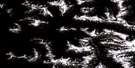
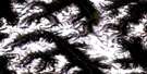
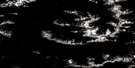
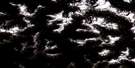
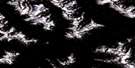
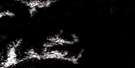
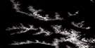
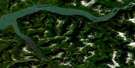
Khyex Satellite Image Map
Download Free Aerial Photo 103I05 at 1:50,000 scale
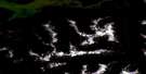
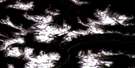
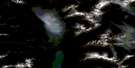
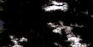
Khyex Satellite Imagery
To view this satellite map, mouse over the air photo on the right.
You can also download this satellite image map for free:
103I05 Khyex high-resolution satellite image map.
Maps for the Khyex aerial map sheet 103I05 at 1:50,000 scale are also available in these versions:
Khyex Surrounding Area Aerial Photo Maps
 |
 |
 |
 |
 |
 |
 |
 |
 |
 |
 |
 |
 |
 |
 |
 |
© Department of Natural Resources Canada. All rights reserved.
Khyex Gazetteer
The following places can be found on satellite image map 103I05 Khyex:
Khyex Satellite Image: Bays
Davies BayQuottoon Inlet
Khyex Satellite Image: Capes
Jane PointKhyex Satellite Image: Channels
Davies NarrowsNorth Arm of Work Channel
Wark Channel
Work Channel
Khyex Satellite Image: Indian Reserves
Kasiks River Indian Reserve 29Ksagwisgwas Indian Reserve 62
Ksagwisgwas Indian Reserve 63
Kyex Indian Reserve 64
Lachmach Indian Reserve 16
Maganktoon Indian Reserve 56
Réserve indienne Kasiks River 29
Réserve indienne Ksagwisgwas 62
Réserve indienne Ksagwisgwas 63
Réserve indienne Kyex 64
Réserve indienne Lachmach 16
Réserve indienne Maganktoon 56
Réserve indienne Wudzimagon 61
Wudzimagon Indian Reserve 61
Khyex Satellite Image: Lakes
Arden LakeDavies Lagoon
Lachmach Lake
Leverson Lake
Minerva Lake
Splitmountain Lake
Toon Lake
Khyex Satellite Image: Mountains
Chaîne CôtièreCoast Mountains
Cumulate Peak
Kasiks Mountain
Khyex Tower
Kitimat Ranges
Split Mountain
Thulme Peak
Khyex Satellite Image: Rivers
Antigonish CreekArden Creek
Exchamsiks River
Fortune Creek
Inver Creek
Kasiks River
Khyex River
Kwinitsa Creek
Kwinitsa River
Lachmach River
Leverson Creek
McNeil River
Thulme River
Toon River

© Department of Natural Resources Canada. All rights reserved.
103I Related Maps:
103I Terrace103I01 Mount Davies
103I02 Kitimat
103I03 Alastair Lake
103I04 Port Essington
103I05 Khyex
103I06 Salvus
103I07 Lakelse Lake
103I08 Chist Creek
103I09 Usk
103I10 Terrace
103I11 Exstew River
103I12 Khutzeymateen River
103I13 Kincolith
103I14 Oscar Peak
103I15 Kitsumkalum Lake
103I16 Dorreen
