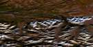
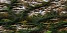
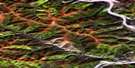
Dawson Satellite Image Map
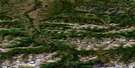
Download Free Aerial Photo 116B03 at 1:50,000 scale
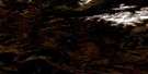
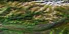
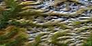
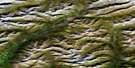
Dawson Satellite Imagery
To view this satellite map, mouse over the air photo on the right.
You can also download this satellite image map for free:
116B03 Dawson high-resolution satellite image map.
Maps for the Dawson aerial map sheet 116B03 at 1:50,000 scale are also available in these versions:
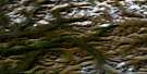
Dawson Surrounding Area Aerial Photo Maps
 |
 |
 |
 |
 |
 |
 |
 |
 |
 |
 |
 |
 |
 |
 |
 |
© Department of Natural Resources Canada. All rights reserved.
Dawson Gazetteer
The following places can be found on satellite image map 116B03 Dawson:
Dawson Satellite Image: Indian Reserves
Moosehide Creek 2Dawson Satellite Image: Islands
Dog IslandSister Island
Dawson Satellite Image: Mountains
Australian HillCripple Hill
Dago Hill
Grouse Mountain
Klondike Hills
Lovett Hill
Midnight Dome
Moosehide Hills
Moosehide Mountain
North Klondike Range
Ogilvie Mountains
Ogilvie Range
Preido Hill
Dawson Satellite Image: Conservation areas
Dawson Historical Complex National Historic Site of CanadaFormer Territorial Court House National Historic Site of Canada
Lieu historique national du Canada de l'Ancien-Palais-de-Justice-Territorial
Lieu historique national du Canada du Complexe-Historique-de-Dawson
Lieu historique national du Canada S.S. Keno
S.S. Keno National Historic Site of Canada
Dawson Satellite Image: Plains
Klondike PlateauYukon Plateau
Dawson Satellite Image: Rivers
4 Above Pup77 Pup
8 Below Pup
Alki Creek
Ballarat Creek
Bear Creek
Benson Creek
Bonanza Creek
Bradley Creek
Clear Creek
Coal Creek
Dawson Creek
Deadwood Creek
Dion Creek
Discovery Pup
Eight Pup
Eighty Pup
Fleuve Yukon
Fourth Creek
Fysh Creek
Hulme Creek
Hunker Creek
Jeckell Creek
Klondike River
Last Chance Creek
Last Chance Creek
Lee Creek
Lepine Creek
Lewes River
Moosehide Creek
No Name Creek
Noble Creek
North Rock Creek
Pepin Creek
Rock Creek
Ruiter Creek
Seventy Seven Pup
Shovel Creek
Small Creek
Sol Pup
Watt Creek
Yukon River
Dawson Satellite Image: Towns
DawsonDawson Satellite Image: Unincorporated areas
ArlingtonBear Creek
Fort Reliance
Klondike
Last Chance
Moosehide
Rock Creek
West Dawson
Dawson Satellite Image: Valleys
20 Pup21 Pup
Belcher Gulch
Bergamin Gulch
Bordeleau Gulch
California Gulch
Cripple Gulch
Dago Gulch
Examiner Gulch
Falconer Gulch
Fireman Gulch
Foster Gulch
Guysboro Gulch
Hattie Gulch
Henry Gulch
Jackson Gulch
Lovett Gulch
Quigley Gulch
Rabbit Gulch
Sawmill Gulch
Thirteen Gulch
Thomas Gulch
Tinhorn Gulch
Tintina Trench
Tintina Valley
Trail Gulch
Wet Gulch
Wood Gulch

© Department of Natural Resources Canada. All rights reserved.
116B Related Maps:
116B Dawson116B01 Lee Creek
116B02 Rabbit Creek
116B03 Dawson
116B04 Swede Creek
116B05 Fifteenmile River
116B06 Chandindu River
116B07 Tombstone River
116B08 Upper Klondike River
116B09 North Fork Pass
116B10 Seela Pass
116B11 No Title
116B12 Mount Harper
116B13 No Title
116B14 No Title
116B15 Kit Lake
116B16 Lomond Lake
