Gaultois Topo Map Online
Download Free Topo Map Sheet 001M12 at 1:50,000 scale
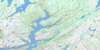
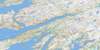
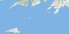
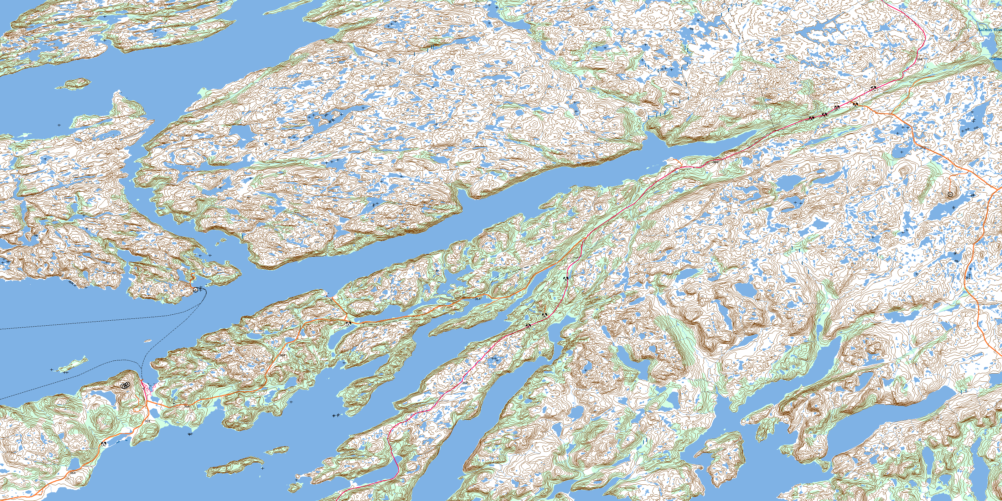
001M12 Gaultois Topo Map
To view this map, mouse over the map preview on the right.
You can also download this topo map for free:
001M12 Gaultois high-resolution topo map image.
Maps for the Gaultois topo map sheet 001M12 at 1:50,000 scale are also available in these versions:
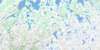
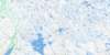
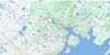
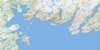
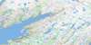
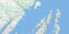
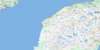
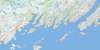
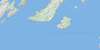
Gaultois Surrounding Area Topo Maps
 |
 |
 |
 |
 |
 |
 |
 |
 |
 |
 |
 |
 |
 |
 |
 |
© Department of Natural Resources Canada. All rights reserved.
Gaultois Gazetteer
The following places can be found on topographic map sheet 001M12 Gaultois:
Gaultois Topo Map: Bays
Back CoveBack Cove
Bald Cove
Baldens Cove
Barasway Harbour
Bay d'Espoir
Big Brook Cove
Big Sandy Cove
Bill Skinners Cove
Billy Skinners Cove
Black Duck Cove
Black Head Cove
Black Hole
Black Hole
Blackfish Cove
Bob White Cove
Bobby Herring Cove
Boldens Cove
Brimball Harbour
Broad Cove
Bubbles Cove
Buffet Cove
Bufford Cove
Cat Cove
Chaner Cove
Clay Cove
Cluett Bight
Coffee Cove
Cold Harbour
Connaigre Bay
Coopers Cove
Copper Cliff Cove
Cork Cove
Cox's Cove
Cuff Cove
Curley Cove
Dawson's Cove
Day Cove
Deep Bight
Deep Cove
Deer Cove
Dog Cove
Dolland Bight
Doting Hole
Eastern Bottom
Eastern Bottom Cove
Eastern Cove
Eastern Cove
Eastern Cove
Eastern Cove
Eastern Kings Cove
Eastern Rinding Cove
Ernest Hills Cove
Fish Cove
Flake Cove
Fly Away
Fox Cove
Friar Cove
Frostbite Cove
Furby's Cove
Gaultois Harbour
Grassy Cove
Great Bay de l'Eau
Great Harbour
Great Harbour Bight
Grip Cove
Handy Cove
Harbour Breton
Harbour le Gallais
Hardy Cove
Hardy's Cove
Harvey Cove
Hatcher Cove
Hatchet Cove
Hermitage Bay
Hermitage Cove
Herring Cove
Hughies Cove
Island Cove
Jerseyman's Harbour
Jim Green Cove
Kays Hole
Kearleys Cove
Kendells Cove
Kings Cove
Kippins Harbour
Krant Bight
Landing Cove
L'Anse à Flamme
Lilly's Cove
Little Bay
Longer Cove
Maria Cove
Matchems Cove
May Cove
McDonalds Cove
Merchant Cove
Michaels Cove
Middle Cove
Middle Head Cove
Mooring Cove
Muddy Hole
Nancys Cove
Nancys Hole
Northeast Arm
Northeast Arm Friar
Northwest Arm
Northwest Cove
Northwest Cove
Northwest Cove
Old Bay
Olive Cove
Partridge Cove
Patty Cove
Peters Cove
Piccaire Harbour
Pierceys Cove
Pigeon Hole
Pink Bottom
Potato Bed Cove
Red Cove
Robin Hood Cove
Round Cove
Rubbley Cove
Russells Cove
Salmonier Cove
Salmonier Cove
Salmonier Cove
Seal Cove
Seal Nest Cove
Shoal Cove
Shoal Cove
Shoal Cove
Snooks Harbour
Southeast Bight
Spirit Cove
Spruce Cove
Squires Cove
Stag Cove
Stickland Cove
Strouter Cove
Tan Pot (Cove)
Taylor Bay
Taylors Rocks Cove
The Bottom
The Locker
The Pocket
Thornhill Cove
Tickle Beach Cove
Tom Lees Cove
Western Cove
Western Cove
Western Kings Cove
Western Rinding Cove
Whetstone Cove
White Point Cove
Winter House Cove
Winter House Cove
Winter House Cove
Wreck Cove
Wreck Cove
Gaultois Topo Map: Capes
Ambrose HeadBald Point
Bald Point
Barrisway Point
Bay Point
Big Black Head
Big Brook Point
Big Head
Big Head
Big Head
Blow Me Down Head
Bobbit Point
Bobby Houses Point
Bobbys Point
Brem Point
Brimball Head
Buffet Point
Cape Mark
Collins Head
Connaigre Head
Cribbs Nose
Day Point
Deep Water Point
Deep Water Point
Deepwater Point
Deepwater Point
Deepwater Point
Dog Cove Head
Doughball Point
Downs Point
Eastern Head
First Otter Point
Fish Head
Fish Point
Flat Back Curve
Fox Burrow Point
Frenchman Head
Frenchman Head
Gimlet Point
Grassy Point
Green Point
Harry Soudens Head
Harry Youdens Head
Herring Net Point
Herring Net Point
Herring Point
High Head
Honeys Point
Hound Point
Indian Point
Indian Point
Iron Head
Island Head
Island Point
Jim McDonalds Point
Jimmy Houses Point
Krant Point
Land Point
Landing Point
Little Black Head
Little Copper Head
Long Point
Long Reach Point
Margery Head
Maria Cove Point
Matts Point
May Head
Middle Head
Miller Point
Mooring Cove Head
Mooring Cove Point
Muddy Hole Point
Murphy Point
Net Point
Net Point
Old Mans Point
Old Womans Cove Point
Passage Point
Peeping Point
Pig Point
Poor Bills Point
Raymond Point
Red Cove Head
Red Head
River Head
Round Cove Head
Russell Head
Salmon Point
Sandy Point
Sandy Point
Seal Rock Point
Second Otter Point
Shoal Cove Point
Shoal Point
Shoal Point
Simmonds Point
South Hay Point
Southeast Brook Point
Southern Sandy Point
Tell Cove Point
The Neck
Thornhill Point
Tickle Head
Tickle Point
Tilt Point
Tilting Cove Point
Tippers Point
Tom MacDonalds Point
Twaney Head
West Head
Western Point
White Point
White Point
Gaultois Topo Map: Caves
Whalers CaveGaultois Topo Map: Channels
Lampidoes PassageLittle Passage
Miller's Passage
The First Narrows
The Second Narrows
The Tickle
Gaultois Topo Map: Cliffs
Fish CliffGreeps Nest
Harveys Cliff
Paint Cliff
Gaultois Topo Map: Islands
Bois IslandDevils Island
Fox Island
Great Island
Hughies Island
Isle Galet
King Island
Lamy (Whale) Island
Little Devils Island
Little Fox Island
Little Island
Long Island
Middle Island
Taylor Island
The Matchems
Whale (Lamy) Island
Will Island
Gaultois Topo Map: Lakes
BarriswayBig Pond
Country Path Pond
Eastern Ponds
Gull Pond
Gull Pond
Harbour Gallais Pond
Inside Pond
Long Pond
Long Reach Pond
Middle Pond
Northeast Barasway
Otter Pond
Salmonier Pond
Sawpit Pond
Simmonds Barasway
Snooks Harbour Pond
Southern Bight Steady
The Barasway
Western Gull Pond
White Point Pond
Winter House Pond
Withrod Pond
Gaultois Topo Map: Mountains
Burnt GroundCrow Nest
Devils Knob
Garrison Hills
Harvey Hill
Mullins Hill
The Knob
The Level
The Park
Whales Back
Gaultois Topo Map: Rivers
Big BrookBlack Brook
Black Tom Brook
Bottom Brook
Bottom Brook
Broad Cove Brook
Cookroom Brook
Country Brook
Dry Brook
Eastern Brook
Garrison Hills Brook
Harrys Brook
Herring Net Brook
Juniors Brook
Middle Island Brook
Muskrat Brook
Northeast Brook
Northern Brook
Northwest Brook
Old Brook
Otter Brook
Rattling Brook
Rattling Brook
Rattling Brook
Salmon River
Sandy Brook
Shoal Brook
Simmons Brook
South East Brook
South West Brook
Southeast Brook
The Brook
The Brook
Trout Brook
Vallis Brook
Gaultois Topo Map: River features
Long ReachGaultois Topo Map: Road features
Robert Kendells PathGaultois Topo Map: Shoals
Bald RockBufford Rocks
Cannon Rock
Cats Claw
Cluett Rock
Connaigre Shoal
Crazy Betty
Devils Shoal
Fox Island Bank
Fox Island Rock
Goose Rock
Gull Rock
Gull Rock
Harbour Shoal
Kelly Rock
Kings Rocks
Mad Moll
Margery Rock
Miller Shoal
Parsons Rock
Poole Rock
Red Cove Rock
Robins Rock
Seal Island Rocks
Seal Rocks
Sloop Rock
Sunken Rocks
Taylor Island Rocks
Tell Rock
The Reef
The Rock
Virgin Rock
Yellow Rock
Gaultois Topo Map: Towns
GaultoisHermitage
Hermitage-Sandyville
Gaultois Topo Map: Unincorporated areas
BarachoixDawson's Cove
Furby's Cove
Great Harbour
Hardy's Cove
Little Bay West
Miller's Passage
Piccaire
Raymond Point
Red Cove
Round Cove
Sandyville
Gaultois Topo Map: Low vegetation
Low BarrenYellow Marsh
© Department of Natural Resources Canada. All rights reserved.
001M Related Maps:
001M Belleoram001M01 Ship Cove
001M02 Jude Island
001M03 Marystown
001M04 Grand Bank
001M05 Harbour Breton
001M06 Point Entragee
001M07 Baine Harbour
001M08 Merasheen
001M09 Harbour Buffett
001M10 Terrenceville
001M11 Belleoram
001M12 Gaultois
001M13 St Alban's
001M14 Hungry Grove Pond
001M15 Gisborne Lake
001M16 Sound Island
