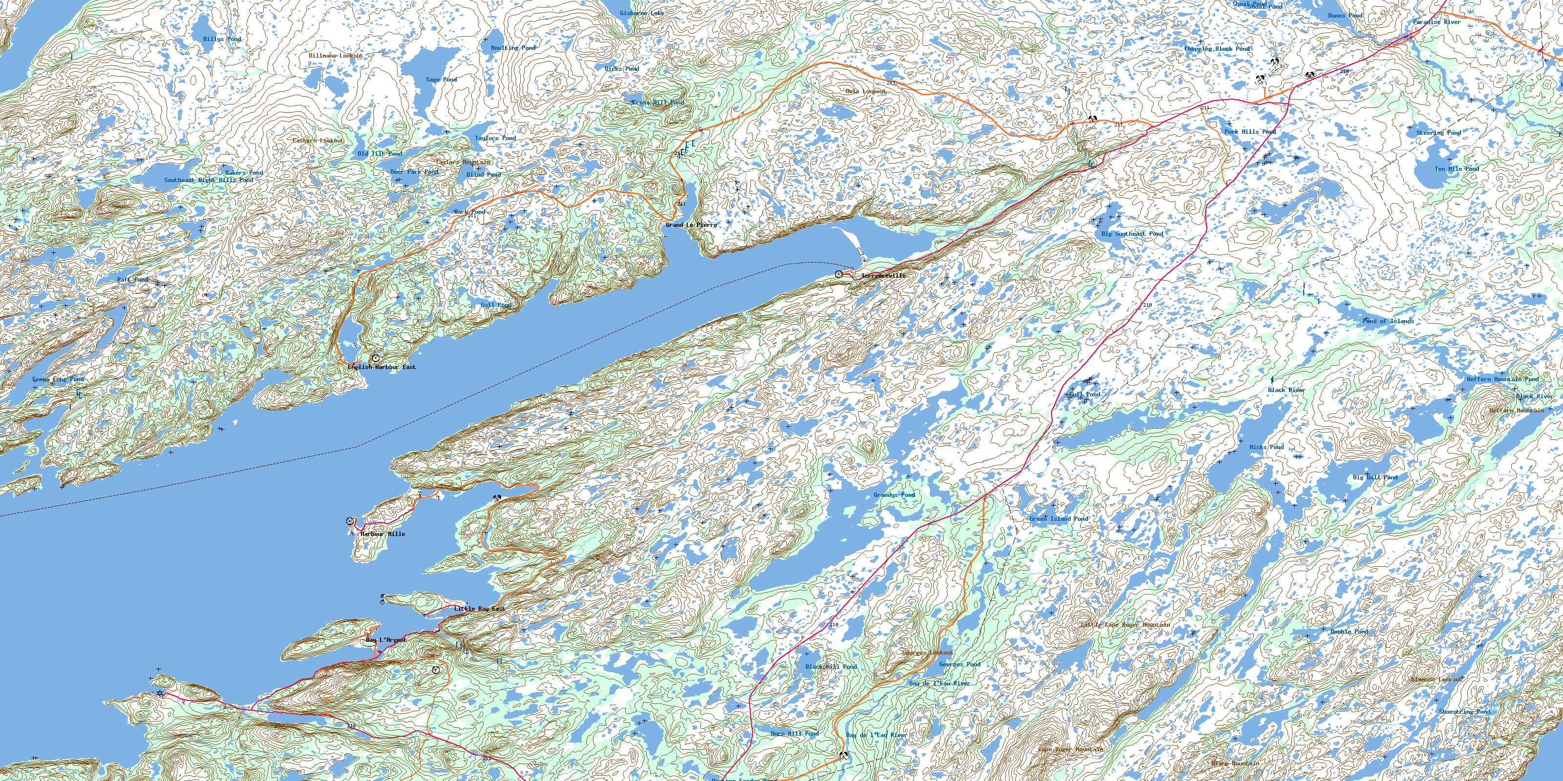
Terrenceville Topo Map Online
Download Free Topo Map Sheet 001M10 at 1:50,000 scale
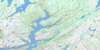
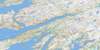
001M10 Terrenceville Topo Map
To view this map, mouse over the map preview on the right.
You can also download this topo map for free:
001M10 Terrenceville high-resolution topo map image.
Maps for the Terrenceville topo map sheet 001M10 at 1:50,000 scale are also available in these versions:
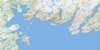
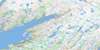
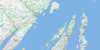
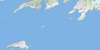
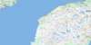
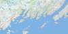
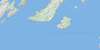
Terrenceville Surrounding Area Topo Maps
 |
 |
 |
 |
 |
 |
 |
 |
 |
 |
 |
 |
 |
 |
 |
 |
© Department of Natural Resources Canada. All rights reserved.
Terrenceville Gazetteer
The following places can be found on topographic map sheet 001M10 Terrenceville:
Terrenceville Topo Map: Bays
Ampleton CoveBack Cove
Battle Cove
Bay D'East
Bay L'Argent
Bay L'Argent Back Cove
Beachy Cove
Big Cove
Big Cove
Big Eastern Cove
Black Cove
Black Duck Hole
Black Point Cove
Black Point Cove
Bombards Cove
Bottom Cove
Broad Cove
Brook Cove
Brook Cove
Cape Cove
Charley Cove
Chiffy Cove
Cock and Hen Cove
Dog Cove
Doughball Cove
Dowden Hole
East Bay
English Harbour East
Femme Harbour
Fortune Bay
Fox Cove
Frenchmans Mesh Cove
Friars Hole
Gooseberry Cove
Grand Le Pierre Harbour
Green Cove
Hannafords Cove
Herring Cove
Herring Cove
Jack Fountain Cove
Jersey Cove
Jim Cove
Jimmys Cove
Joe Cove
Jonathans Cove
Killick Rock Cove
Kinsleys Cove
Kinsleys Gulch
Landing Cove
Langue de Cerf Cove
Little Bay de l'Eau
Little Eastern Cove
Little Harbour
Little Harbour
Little Scotts Cove
Long Harbour
Louse Hole
Lower Little Bay
May Cove
Meadow Cove
Mille Harbour
Mine Cove
Mine Cove
Mirrors Cove
Muddy Hole
Mullowneys Cove
New Harbour
Northeast Cove
Northwest Arm
Old Cove
Osmond Cove
Paradise Sound
Pays Cove
Pennells Harbour
Ragged Point Cove
Rats Hole Cove
Ravens Cove
Red Cove
Ryle Barrisway
Sawpit Cove
Scotts Cove
Shag Rock Cove
Shag Rock Coves
Shark Cove
Shoal Cove
Spudgel Cove
Swile Cove
Swiles Nest Cove
Tarnell Cove
Terrenceville Harbour
The Basin
Toms Cove
Twin Point Cove
West Cove
Western Cove
Western Harbour
White Point Cove
White Rock Cove
Wild Bight
Wild Cove
Yellow Cove
Young Bight
Terrenceville Topo Map: Beaches
Nancy ShoreSandy Beach
The Beach
Wild Shore
Terrenceville Topo Map: Capes
Anstay PointBack Cove Head
Back Cove Point
Bay de l'Eau Friar
Bay D'East Head
Black Point
Black Point
Bluff Point
Brimstone Point
Burn Cowhouse Point
Cape Mille
Chiffy Point
Clark Point
Cuff Head
Deep Water Point
Deepwater Point
Eastern Head
Eastern Head
Eastern Head
Eastern Point
Eastern Point
Flat Brook Point
Flat Point
Friar Point
Grand Le Pierre Head
Grassy Point
Green Point
Gull Point
Langue de Cerf Point
Little Bay Point
Long Point
Long Point
Middle Head
Mille Harbour Point
Old Mans Nose
Otter Point
Otter Rub
Otter Rub Point
Overhang Head
Pardys Point
Ragged Point
Ragged Point
Red Head
Rope Tails
Salmon Net Point
Salmon Net Stake
Sandy Point
Schooner Brook Point
Scratch Point
Seal Point
Sharp Point
Sheeps Hole Point
Shot Point
Stave Point
Swile Point
Tarnell Point
Tickle Point
Turbot Head
Western Head
Western Point
Western Point
White Point
White Point
Yellow Cove Friar
Terrenceville Topo Map: Caves
Frenchman's OvenTerrenceville Topo Map: Channels
The GripThe Gut
Terrenceville Topo Map: Cliffs
Blue CliffIndian Head
Red Cliff
Terrenceville Topo Map: Forests
Church WoodsGrinning Brook Woods
Old Joes Wood
Piccos Woods
Staircase Woods
Terrenceville Topo Map: Islands
Bay de l'Eau IslandBombards Island
New Harbour Island
Petticoat Island
Smock Island
Smock Islands
Stearin Island
Wood Island
Terrenceville Topo Map: Lakes
Bakers PondBar Pond
Bar Pond
Barasway Gull Pond
Bark Pond
Bay d'East Pond
Beaver Pond
Beaver Pond
Beaver Pond
Beaver Ponds
Beaver Ridge Pond
Big Deadfall Pond
Big Diver Pond
Big Goose Pond
Big Goose Pond
Big Grebe Pond
Big Gull Pond
Big Island Pond
Big Lake
Big Loo Pond
Big OtterPond
Big Pond
Big Southeast Pond
Billys Pond
Billys Pond
Black Duck Pond
Black Duck Ponds
Black Hill Pond
Blind Pond
Bootwood Pond
Bottle Pond
Bottle Pond
Brook Pond
Burnwoods Pond
Cape Roger Pond
Charlie Hustlers Pond
Chopping Block Pond
Clampwood Pond
Club Pond
Coffee Pond
Cow Pond
Crooked Pond
Cross Hill Pond
Cross Hills Pond
Crow Pond
Crow Pond
Curve Pond
Deer Hill Ponds
Deer Park Pond
Deer Pond
Dicks Pond
Dillmans First Pond
Dillmans Second Pond
Dog Pond
Double Pond
Double Ponds
Duck Pond
Duck Pond
Dunns Pond
Eastern Bay d'East Pond
Eastern Staircase Pond
English Harbour Barasway
Femme Gull Pond
Femme Long Pond
Femme Pond
First Berry Hill Pond
First Pond
Fishing Brook Pond
Five Island Pond
Flat Hill Pond
Fox Hill Pond
Gates Pond
Georges Pond
Georges Pond
Gisborne Lake
Goose Pond
Goose Pond
Goose Pond
Grandys Pond
Grassy Pond
Grebe Ponds
Green Island Pond
Gull Pond
Gull Pond
Gull Pond
Gull Pond
Gull Pond
Gull Pond
Gull Pond
Gull Pond
Half and Half Pond
Handy Pond
Harbour Pond
Hare Hill Pond
Hat Pond
Hawk Pond
Hay House Pond
Hay Pond
Head Pond
Heffern Mountain Pond
Heffern Pond
Horn Hill Pond
Joeys Barren Pond
Juniper Knob Pond
Kerosene Pond
Kettle Woods Pond
Kinsleys Pond
Line Pond
Little Barasway
Little Barasway Pond
Little Deadfall Pond
Little Diver Pond
Little Harbour Pond
Little Loo Pond
Little Loo Pond
Little Otter Pond
Little Southeast Brook Pond
Little Tilt Pond
Long Pond
Long Pond
Longue de Curf Barasway
Loo Pond
Loo Pond
Man O War Mark Pond
Mark Hill Pond
Markrock Pond
Micks Pond
Middle Big Pond
Mink Pond
Moose Pond
Moose Pond
Mooting Pond
Moulting Pond
Muddy Pond
Muskrat Pond
Naked Mans Pond
Nine Island Pond
Nipnose Pond
Nipnose Pond
Oil Jacket Pond
Old Joes Pond
Old Scrape Pond
Old Shade Pond
Old Tilt Pond
Otter Pond
Otter Pond
Otter Pond
Otter Pond
Outside Middle Pond
Partridge Pond
Pays Cove Gull Pond
Pays Cove Pond
Point Pond
Pole Pond
Pond of Islands
Pork Hills Pond
Powderhorn Pond
Raft Pond
Raft Pond
Rats Home Pond
Red Rock Pond
Round Pond
Round Pond
Rubble Pond
Ryles Barasway Pond
Sage Pond
Saints Pond
Salmonier Pond
Second Berry Hill Pond
Second Pond
Second Pond
Second Pond
Shag Rock Cove Pond
Shoal Pond
Shoal Pond
Shoestring Pond
Southeast Bight Hills Pond
Southern Gull Pond
Southern Hills Pond
Spudgel Cove Pond
Staircase Pond
Steering Pond
Stiff Gut Pond
Sugarloaf Barasway
Swiles Nest Pond
Taylors Mountain Pond
Taylors Pond
Tealeaf Pond
Ten Mile Pond
Terrenceville Barasway
Terrenceville Otter Ponds
The Barasway
The Still
Tilt Pond
Tom Grandys Pond
Tommy Joes Pond
Toms Pond
Trout Pond
West Cove Pond
Western Feeder Pond
Western Long Pond
Western Staircase Pond
Wickleys Pond
Youngs East Pond
Youngs West Pond
Terrenceville Topo Map: Mountains
Backy KnobBakers Hill
Beaver Ridge
Berry Hill
Billys Hill
Black Hill
Black Hill
Black Mountain
Bottom Brook Ridge
Breakheart
Bunkers Hill
Cape Roger Mountain
Caplin Hill
Cross Hill
Cross Hills
Deer Hill
Dillmans Lookout
Dog Cove Hill
Eastern Fox Hills
Eastern Lookout
Flahertys Hill
Georges Lookout
Giles Hill
Hare Droke Hill
Hare Hills
Heffern Mountain
Horn Hill
Little Cape Roger Mountain
Long Ridge
Margaret Antle Berry Hill
Mark Hill
Owls Lookout
Pork Hills
Red Hill
Rocky Hills
Round Hill
Round Hill
Sage Ridge
Simmons Lookout
Snooks Tolt
Southeast Bight Hills
Southern Hills
Staircase Hill
Sugarloaf Hill
Taylors Mountain
Western Fox Hills
Witchhazel Hill
Youngs Hill
Terrenceville Topo Map: Rivers
Bay de l'Eau RiverBay d'East Brook
Betty Brook
Big Southeast Brook
Black Duck Brook
Black River
Bottom Brook
Clam Brook
Doughball Brook
Duck Brook
Dunns Brook
Eastern Feeder
Fishing Brook
Grand Le Pierre Brook
Grinning Brook
Harbour Brook
Lakelys Rock Brook
Little Southeast Brook
Mare Brook
Middle Feeder
Northeast Brook
Paradise River
Pardys Brook
Rattling Brook
Ryle Barrisway Brook
Salmonier Brook
Schooner Brook
Shines Brook
Sugarloaf Brook
Swiles Nest Brook
Terenceville Brook
Terrenceville Brook
Terrenceville Topo Map: Shoals
Big Fish ShoalBlack Point Shoal
Black Point Shoal
Boat Rocks
Cuff Rocks
Drew Rock
Druid Rock
Fish Rock
Fox Cove Rock
Friar Shoal
Harbour Shoal
Hares Ear Rock
Hares Ears Shoal
Hay Ground Shoal
Jack Fountain Rock
Jim Rock
Jimmys Rock
Kelpie Ledge
Kelpy Rock
Little Shoal
Pays Cove Shoal
Shag Rock
Spudgel Cove Rocks
Western Friar Shoal
Western Rock Shoal
Terrenceville Topo Map: Miscellaneous sites
New CrossingOld Crossing
Terrenceville Topo Map: Towns
Bay L'ArgentEnglish Harbour East
Grand Le Pierre
Little Bay East
St. Bernard's-Jacques Fontaine
Terrenceville
Terrenceville Topo Map: Unincorporated areas
Bay de l'EauFemme
Harbour Mille
Harbour Mille-Little Harbour East
Jacques Fontaine
Jim Myles Garden
Little Harbour East
New Harbour
Pays Cove
St. Bernard's
Terrenceville Topo Map: Low vegetation
Grassy BarThe Flats
The Meadow
White Blanket
© Department of Natural Resources Canada. All rights reserved.
001M Related Maps:
001M Belleoram001M01 Ship Cove
001M02 Jude Island
001M03 Marystown
001M04 Grand Bank
001M05 Harbour Breton
001M06 Point Entragee
001M07 Baine Harbour
001M08 Merasheen
001M09 Harbour Buffett
001M10 Terrenceville
001M11 Belleoram
001M12 Gaultois
001M13 St Alban's
001M14 Hungry Grove Pond
001M15 Gisborne Lake
001M16 Sound Island
