Baine Harbour Topo Map Online
Download Free Topo Map Sheet 001M07 at 1:50,000 scale
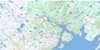
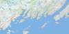
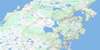
001M07 Baine Harbour Topo Map
To view this map, mouse over the map preview on the right.
You can also download this topo map for free:
001M07 Baine Harbour high-resolution topo map image.
Maps for the Baine Harbour topo map sheet 001M07 at 1:50,000 scale are also available in these versions:
Baine Harbour Surrounding Area Topo Maps
 |
 |
 |
 |
 |
 |
 |
 |
 |
 |
 |
 |
 |
 |
 |
 |
© Department of Natural Resources Canada. All rights reserved.
Baine Harbour Gazetteer
The following places can be found on topographic map sheet 001M07 Baine Harbour:
Baine Harbour Topo Map: Bays
Baileys CoveBaine Harbour
Bay de l'Eau
Beachy Cove
Beckford Cove
Big Cove
Big Cove
Boat Harbour
Bobbys Hole
Browns Cove
Buntons Cove
Butter Cove
Cape Roger Bay
Cape Roger Harbour
Channels Harbour
Claypit Cove
Coles Cove
Collins Cove
Coopers Cove
Councils Cove
Darbys Harbour
D'Argent Bay
Deep Cove
Deep Cove
Deep Cove
Doctors Cove
East Broad Cove
Eastern Head Cove
Flat Island Cove
Flat Island Harbour
Footes Cove
Footes Garden
Fowlers Cove
Gallows Harbour
Gilberts Cove
Grandys Cove
Great Bona Cove
Grebe Cove
Hay Cove
Jigger Cove
Jigging Cove
Jigging Cove
Jigging Cove
Jigging Cove
John Clarkes Gardens
Jude Harbour
Keeping Harbour
Killaminki Cove
Kings Cove
Lakes Cove
Little Bona Cove
Little Gallows Harbour
Little Harbour
Little Paradise Harbour
Mare Cove
Marticot Back Cove
Marticot Cove
Martin Harrons Cove
Mooring Cove
Mother Whittles Cove
Mussel Cove
Nonsuch Inlet
Normans Cove
Northeast Nonsuch Arm
Oderin Harbour
Paradise Harbour
Paradise Sound
Parkers Cove
Petit Forte Cove
Petit Forte Harbour
Placentia Bay
Presque Harbour
Pumblys Cove
Red Cove
Red Harbour
Red Scrape
Rodways Cove
Rushoon Harbour
Salamander Cove
Salmons Cove
Ship Cove
South East Bight
Southeast Bight
Southwest Nonsuch Arm
St. Joseph's Harbour
Sunker Cove
The Gully
The Rattle
Tides Hole
Traverses Cove
Vaters Cove
Watering Cove
West Broad Cove
Wild Cove
Wild Cove
Wild Cove
Baine Harbour Topo Map: Beaches
Long BeachSouthwest Beach
Baine Harbour Topo Map: Capes
Bay de l'Eau HeadBig Head
Black Point
Blue Point
Bluff Head
Boat Harbour Head
Brimstone Point
Broad Cove Head
Cape Roger
Crawleys Point
Deadman Head
Deep Cove Head
Dog Head
East Broad Cove Head
Eastern Head
Eastern Head
Eddy Point
Flat Island Point
Foots Point
Fox Point
Friar Point
Gallows Harbour Head
Green Point
Hobins Nose
Inkmans Point
Inside Sandy Point
Jigging Cove Head
Little Head
Long Island Point
Manny Point
Meadow Point
Millers Point
Nipper Head
Nonsuch Head
Northwest Point
Otter Burr
Poplars Head
Puffing Pig
Rattle Head
Red Cove Head
Red Harbour Head
Roches Head
Round Head
Rushoon Head
Salamander Point
Sams Head
Sandy Point
Sandy Point
Sandy Point
Smiths Point
Spurrier Point
Tide Point
Tides Hole Head
West Broad Cove Head
Wester Point
White Point
White Point
Baine Harbour Topo Map: Channels
Holloway PassagePushthrough Passage
Baine Harbour Topo Map: Cliffs
RedlandShattered Cliff
White Sail
Baine Harbour Topo Map: Islands
Burnt IslandBurnt Island
Burnt Islands
Cape Roger Island
Castle Island
Coachman Island
Cookroom Island
Cross (Grass) Island
Cross Island
Crow Island
Davis Island
Durdle Island
Emberleys Island
Flat Island
Flat Islands
Fox Island
Gallows Harbour Island
Glimshire Island
Gooseberry Island
Gooseberry Island
Green Island
Gull Island
Gull Islands
Harbour Island
Hay Island
Jerseyman Island
Jude Island
Little Copper Island
Little Gull Island
Little Island
Long Island
Marticot Island
Mouse Island
Oderin Island
Patrick Island
Petticoat Island
Shag Islands
Sound Island
Tinkershare Island
Woody Island
Woody Island
Yardie Island
Baine Harbour Topo Map: Lakes
Baileys PondBaine Harbour Pond
Bakers Pond
Ballard Pond
Beaver Pond
Big Brookside Gull Pond
Big Loo Pond
Big Pond
Big Steady
Black Duck Pond
Black Hill Pond
Broad Cove Pond
Club Pond
Coadys Garden Pond
Collins Cove Ponds
Country Pond
Crooked Pond
Deep Cove Ponds
Dirty Brook Pond
Fewers Pond
Footes Pond
Fowlers Pond
Garvet Stick Pond
Goose Pond
Goose Pond
Grassy Pond
Grebe Cove Pond
Gull Pond
Jack Fountain Gull Pond
Jigging Cove Pond
Jigging Cove Pond
Jim Jarvis Pond
Keeping Harbour Ponds
Killaminki Gullies
Killaminki Pond
Landwash Pond
Landwash Pond
Little Gull Pond
Long Gulch Pond
Long Gull Pond
Long Pond
Long Pond
Long Pond
Long Surf Big Pond
Long Surf Gull Pond
Longer Surf Pond
Loo Pond
Loo Pond
Lower Green Hill Pond
Mare Pond
Markrock Pond
Mooring Cove Ponds
Mountain Pond
Mulletts Pond
Northwest Pond
Old Tilt Pond
Otter Pond
Otter Pond
Outside Baileys Pond
Phillies Pond
Pine Pond
Powderhorn Pond
Puffing Pig Ponds
Rattle Pond
Reids Pond
Round Pond
Round Pond
Sandy Point Pond
Scotch Gullies
Scotch Pond
Shellbird Ponds
Shoestring Pond
Snooks Pond
Tides Hole Pond
Tom Butlers Loo Pond
Twin Ponds
Upper Green Hill Pond
West Harbour Big Pond
West Long Shore Gull Pond
Western Feeder Pond
Western Feeder Ponds
Western Gull Pond
Western Landwash Pond
Wild Cove Inside Ponds
Wild Cove Outside Pond
Woody Ridge Pond
Baine Harbour Topo Map: Mountains
Big HillBlack Hill
Brimstone Hill
Deer Hill
Footes Hill
Hill With Rocks
Horse's Head
Jigging Cove Hill
Northwest Hill
Osmond Hill
Otters Hill
Powderhorn Hill
Powderhorn Hill
Roche Peak
Roches Peak
Rushoon Hill
Snooks Hill
White Sail Head
Woody Ridge
Baine Harbour Topo Map: Rivers
Bay de l'Eau RiverBottom Brook
Eastern Feeder
Kings Brook
Middle Feeder
Rattle Brook
Rushoon River
Scotch Brook
Scotts Brook
Tides Hole Brook
Western Feeder
Western Feeder
Baine Harbour Topo Map: Shoals
Anchor Cove SunkersBill White Rock
Black Rock
Breeches Rock
Chimney Rocks
Dollar Rock Sunker
Duck Rock Shoal
Fords Rock
Great Colombier Rocks
Green Island Shoal
Gull Rock
Gull Rocks
Gull Shoal
Hay Island Bank
Heptige Rock
Hiscock Rocks
Larkin Shoal
Long Island Bank
Middle Shoal
New Bank
Nonsuch Bank
Normans Cove Rocks
Rough Rocks
Stanley Rocks
Steering Rock
Steering Rocks
The Friar
The Sunker
Washball Rock
Whites Rock
Baine Harbour Topo Map: Towns
Baine HarbourParkers Cove
Red Harbour
Rushoon
Baine Harbour Topo Map: Unincorporated areas
Boat Harbour WestBrookside
Burns Cove
Burnt Island
Darbys Harbour
Davis Island
Deep Cove
Flat Island
Great Bona
Great Paradise
Little Bona
Little Harbour
Little Harbour
Little Harbour West
Little Paradise
Oderin
Petit Forte
Port Anne
Port Elizabeth
South East Bight
Southeast Bight
Southeast Bight
St. Joseph's
Baine Harbour Topo Map: Valleys
Coadys GardenManuels Gulch
Baine Harbour Topo Map: Low vegetation
Toms Bottom
© Department of Natural Resources Canada. All rights reserved.
001M Related Maps:
001M Belleoram001M01 Ship Cove
001M02 Jude Island
001M03 Marystown
001M04 Grand Bank
001M05 Harbour Breton
001M06 Point Entragee
001M07 Baine Harbour
001M08 Merasheen
001M09 Harbour Buffett
001M10 Terrenceville
001M11 Belleoram
001M12 Gaultois
001M13 St Alban's
001M14 Hungry Grove Pond
001M15 Gisborne Lake
001M16 Sound Island
