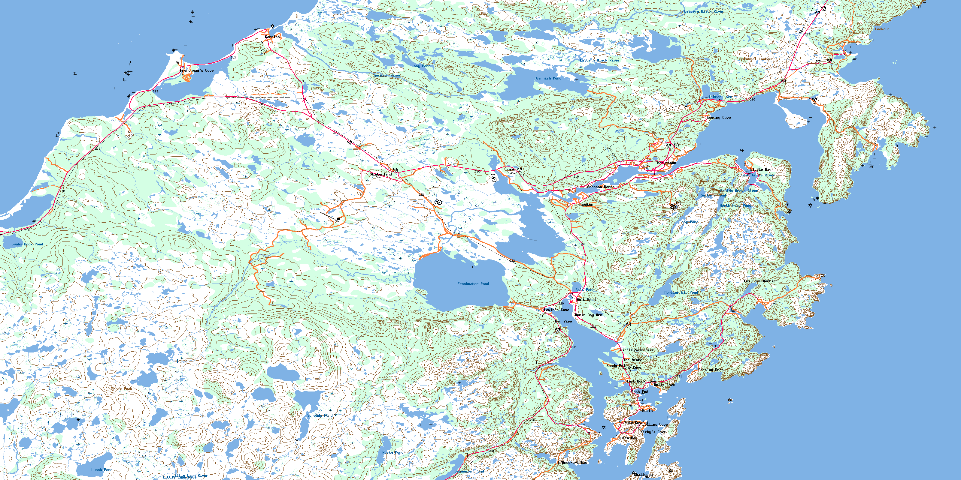
Marystown Topo Map Online
Download Free Topo Map Sheet 001M03 at 1:50,000 scale
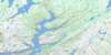
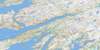
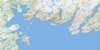
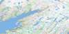
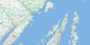
001M03 Marystown Topo Map
To view this map, mouse over the map preview on the right.
You can also download this topo map for free:
001M03 Marystown high-resolution topo map image.
Maps for the Marystown topo map sheet 001M03 at 1:50,000 scale are also available in these versions:
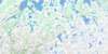
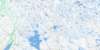
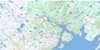
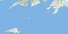
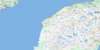
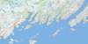
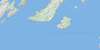
Marystown Surrounding Area Topo Maps
 |
 |
 |
 |
 |
 |
 |
 |
 |
 |
 |
 |
 |
 |
 |
 |
© Department of Natural Resources Canada. All rights reserved.
Marystown Gazetteer
The following places can be found on topographic map sheet 001M03 Marystown:
Marystown Topo Map: Bays
Antles CoveBack Cove
Back Cove
Bakers Cove
Baldwins Cove
Beau Bois Cove
Big Cuckold Cove
Black Cove
Black Head Cove
Blow Me Down Cove
Boat Cove
Brakes Cove
Brakes Cove
Bread and Butter Cove
Brown Cove
Burin Inlet
Butlers Cove
Caplin Cove
Cashel Cove
Cat Cove
Corbin Cove
Creston Inlet
Crockers Cove
Croney Cove
Cuckold
D'Argent Bay
Deadman Cove
Deek Cove
Deep Cove
Dock Cove
Doctors Cove
Doughball Cove
Drakes Cove
Duricle Cove
Footes Cove
Fortune Bay
Fox Cove
Frenchman's Cove
Gould Cove
Graze Cove
Great Burin Harbour
Gripe Cove
Hamens Cove
Herring Cove
Herring Cove
Ice House Cove
Island Cove
Jean de Baie
Jean de Baie Harbour
Jean de Baie Island Cove
Jigging Cove
Kirbys Cove
L'Anse à l'Eau
Lewin's Cove
Little Bay
Little Burin Harbour
Little Garnish Barasway
Little Mortier Bay
Little Neck Cove
Long Cove
Lower Mooring Cove
Man O'War Cove
Mortier Arm
Mortier Bay
Mosquito Cove
Murleys Cove
Noeling Cove
Norris Cove
Paddy Cove
Pardys Folly
Path End Cove
Pats Cove
Peace Cove
Placentia Bay
Point Cove
Powers Cove
Puzzle Cove
Red Land Cove
Robin Cove
Rock Harbour
Rock Harbour Point Cove
Rodgers Cove
Seal Cove
Seal Cove
Ship Cove
Southwest Arm
Southwest Arm
Spanish Room
Spoon Cove
Tides Cove
Tizzard Cove
Upper Mooring Cove
Western Cove
Whale Cove
White Wood Cove
Whites Cove
Wild Cove
Wild Cove
Wild Coves
Marystown Topo Map: Beaches
Golden SandsJones Beach
The Dock
The Ridge
Wild Beach
Marystown Topo Map: Capes
Beazleys PointBig Head
Birchy Point
Bluff Point
Bobbys Point
Bras Point
Breakheart Point
Breakheart Point
Bugdens Point
Connors Point
Coopers Head
Corbin Head
Cow Head
Creephole Point
Darbys Head
Deepwater Point
Dock Point
Doctors Cove Point
Dodding Head
Doughball Head
Duricle Point
Eastern Head
Eastern Head
Fish Head
Footes Point
Footes Point
Frenchman's Head
Galton Point
Garrison Point
George Point
Go By Point
Gould Head
Grouse Point
Herringnet Point
Hodders Point
Hooper Point
Island Rock Point
Jean de Baie Head
Jean de Baie Point
Jeans Point
Jorgensen Point
Kettle Point
Lantern Neck
Lewins Head
Little Doughball Point
Longcove Point
Middle Head
Molton Point
Mooring Cove Head
Mortier Head
Neck Point
Nest Head
Paddy Head
Pardy Point
Parsons Point
Pitchers Point
Powers Cove Head
Puzzle Head
Rock Harbour Point
Sandy Point
Sandy Point
Seal Cove Head
Seal Cove Point
Skiffsail Point
Spanish Room Point
Spoon Point
The Cuckold
Tides Cove Point
Troak Point
Upper Head
Western Head
Western Head
White Point
White Point
White Point
Whitehorse Point
Winter Point
Marystown Topo Map: Channels
Bull GutBurin Passage
Puds Hole
The Eddies
The Narrows
Tibbos Hole
Marystown Topo Map: Cliffs
Blow Me DownBlue Scrape
Ochre Cliff
Shatter Cliff
The Ladder
Whitepatch
Marystown Topo Map: Forests
Black Hills WoodsKellys Wood
Pupnut Copse
Marystown Topo Map: Islands
Ball IslandBirchy Island
Burin Island
Burnt Island
Charlie Island
Colombier Island
Croney Island
Dock Island
George Island
Goat Island
Gooseberry Island
Harbour Islands
Iron Island
Jean de Baie Islands
Jersey Island
Mooring Cove Island
Nut Island
Pardy Island
Poor Island
Saul Island
Shalloway Island
Simmons Island
Stable Island
Sugarloaf Island
The Droke Island
Tites Island
Western Island
White Island
Willys Island
Woody Island
Woody Island
Marystown Topo Map: Lakes
Abrahams PondAnchor Droke Ponds
Arthurs Pond
Barasway Pond
Barbours Pond
Bare Bum Pond
Battlin Pond
Bear Pond
Beaver Brook Pond
Beaver Pond
Beaver Pond
Beaver Pond
Bench Board Pond
Berry Hill Pond
Big Bellies Pond
Big Hill Pond
Big Mashes Pond
Big Pond
Big Pond
Big Rush Pond
Bill Fitzpatrick Ponds
Bill Kenway Pond
Birchy Brook Pond
Black Duck Pond
Black Duck Ponds
Black Head Pond
Black Head Pond
Black River Pond
Black Rock Pond
Bloomy Gull Pond
Blue Scrape Pond
Bluff Head Pond
Bolands Pond
Bowes Pond
Brown Ridge Pond
Burin Gull Ponds
Burks Pond
Burnt Barasway
Burnt Barasway Gully
Burnt Barasway Pond
Burnt Woods Pond
Burrs Pond
Butchers Pond
Carbrace Pond
Cashel Cove Pond
Cat Cove Pond
Clam Pond
Clam Pond
Clanceys Hill Pond
Clanceys Inside Pond
Clanceys Pond
Clanceys Pond
Clarks Pond
Claudys Pond
Collins Pond
Conways Pond
Corner Pond
Country Gull Pond
Country String of Ponds
Cow House Pond
Crab Pond
Crooked Pond
Cuckold Cove Pond
Curtis Pond
Deadmans Pond
Deep Pond
Deep Pond
Devils Kitchen Pond
Doctors Cove Pond
Ducey Gullies
Duck Pond
Dukes Pond
Eastern Gull Pond
Eastern Rocky Ridge Pond
Eastern Rush Pond
Eastern Tilt Hill Pond
Eddies Pond
Folletts Pond
Foolish Pond
Frenchman's Cove Barasway
Freshwater Pond
Garnish Barasway
Garnish Pond
George Legges Pond
George Manuels Pond
Givens Pond
Glenden Pond
Glens Pond
Goat Island Pond
Goddards Pond
Goose Pond
Goose Pond
Grand Beach Barasway
Grassy Banks Ponds
Great Garnish Barasway
Gripe Cove Pond
Guards Pond
Gull Pond
Gull Pond
Gull Pond
Gull Pond
Halfway Woods Pond
Harrys Pond
Hawks Nest Pond
Hebers Lookout Pond
High Barrens
Honeys Pond
Hotters Pond
Hummocks Pond
Indian River Pond
Inkpens Pond
Inside Doughball Pond
Inside Pond
Island Pond
Island Pond
Island Pond
Island Pond
Janes Pond
Janes Pond
Jean de Baie Barasway
Jim Ansteys Pond
Jim Farrells Pond
Joe Cluetts Pond
Joes Pond
Johnny Greens Pond
Johnnys Pond
Johns Pond
Juniper Point Pond
Juniper Pond
Juniper Pond
Kennedys Pond
Kerosene Oil Pond
Kettle Pond
Kidmans Pond
Kidney Ponds
Landing Place Pond
L'Anse-a-l 'Eau Big Pond
Lanterns Pond
Lily Pond
Linton Lake
Little Bellies Pond
Little Bench Board Pond
Little Clam Pond
Little Duricle Pond
Little Main Brook Pond
Little Pond
Little Round Pond
Little Rush Pond
Little Wall Pond
Lobans Pond
Log Hill Pond
Long Cove Pond
Long Pond
Long Pond
Long Pond
Long Pond
Long Pond
Long Pond
Long Pond
Long Pond
Long Pond Gully
Loo Pond
Lost Hill Pond
Lower Honeys Pond
Lower Long Pond
Lunch Pond
Main Brook Pond
Main Brook Pond
Main Brook Ponds
Mashes Pond
Maugys Pond
Mayos Pond
Middle Honeys Pond
Middle Pond
Morgans Pond
Mortier Big Pond
Mortier Round Pond
Muddy Hole Pond
Muskrat Pond
Muskrat Pond
Naked Mans Pond
Neils Pond
North Bloomy Pond
North West Pond
Northwest Feeder Pond
Northwest Pond
Otter Pond
Otter Pond
Otter Pond
Paddys Pond
Painters Pond
Pardys Inside Pond
Pardys Pond
Peninsula Pond
Piccos Pond
Pig Brook Pond
Piker
Point of Woods Pond
Ponys Pond
Pools Pond
Port au Bras Ponds
Powers Pond
Pupnut Pond
Rattling Brook Pond
Revels Pond
Rocky Pond
Rocky Pond
Rocky Pond
Rocky Pond
Rocky Ponds
Rolands Pond
Round Pond
Round Pond
Round Pond
Round Pond
Rush Pond
Rush Pond
Rushy Pond
Rushy Pond
Rushy Pond
Rushy Ponds
Russ Feeder Pond
Sail Point Pond
Salmonier Pond
Salt Pond
Salters Pond
Salters Pond
Sandfly Pond
School House Pond
Seal Cove Barasway
Shallow Pond
Shatter Cliff Pond
Shearstick Pond
Southern Bloomy Pond
Southwest Feeder Pond
Stern Ponds
String of Ponds
Strouds Pond
Summer Pond
Swabs Dock Pond
Swile Cove Gullies
Swile Cove Inside Pond
Swile Cove Outside Pond
Tea Pond
The Angle
The Gully
Thornes Pond
Tickle Pond
Tommy Cluetts Pond
Trout Pond
Trout Ponds
Wall Pond
Wall Pond
Warswood Pond
Washing Tub Pond
Western Cove Pond
Western Droke Pond
Western Pond
Western Rocky Ridge Ponds
Western Rush Pond
Western Tilt Hill Pond
Wet Tilt Pond
White Horn Hill Ponds
White Rock Ponds
Widgeon Pond
Willys Pond
Witchhazel Pond
Woody Island Pond
Marystown Topo Map: Marine navigation features
Port au BrasMarystown Topo Map: Mountains
Aarons HillBacon Hill
Beacon Hill
Big Hill
Big Hill
Big Hill
Birchy Brook Hill
Bloomy
Boulder Hill
Brown Ridge
Cashel Lookout
Clanceys Hill
Cooks Lookout
Deadmans Cove Hill
Dog Head
Dogwood Hills
Eastern Rocky Ridge
Fox Hill
Fox Hummocks
Garnish Tolt
Green Hill
Halfway Woods Hill
Horseshoe Hill
Hungry Ridge
Jemmy's Lookout
Loughlins Hill
Mashes Hill
Middle Ridge
Mount Serat
Mount Vincent
Neds Hill
Ochre Cliff
Otter Hill
Priests Hill
Rotten Hill
Salmonier Hill
Salters Hill
Sharp Peak
Shearstick Hill
Spell Hill
Strouds Ridge
Sugar Loaf
Sugar Loaf (Hill)
The Tolt
Tilt Hill
Western Rocky Ridge
Wet Tilt Hill
White Hill
White Horn Hill
Witchhazel Hill
Marystown Topo Map: Conservation areas
Frenchman's Cove Provincial ParkFreshwater Pond Provincial Park
Marystown Topo Map: Plains
Abrahams PlainMarystown Topo Map: Rivers
Barasway BrookBasin Brook
Beaver Brook
Big Salmonier Brook
Birchy Brook
Black River
Blue Scrape Brook
Bottom Brook
Burnt Barasway Brook
Clam Brook
Clam Pond Brook
Clanceys Feeder
Doughball Brook
Dyke Brook
Eastern Black River
Emberleys Brook
Garnish River
Glenden River
Goulds Grave River
Indian River
Juniper Brook
Little Lawn River
Little Salmonier Brook
Little St. Lawrence River
Mackerel Brook
Main Brook
Main Brook
Muddy Hole Brook
Northeast Brook
Northwest Brook
Northwest Feeder
Northwest Feeder
Old Hill Brook
Olivers Brook
Pendulum Brook
Pig Brook
Piker Brook
Poverty Brook
Raggedy River
Rock Harbour Brook
Shearstick Brook
Smelt Brook
Southwest Feeder
St. Lawrence River
The Forks
Tides Brook
Tides Cove River
Waterfall Brook
West Brook
Wigwam Brook
Wild Cove Pond Brook
Marystown Topo Map: River features
Kellys TurnMarystown Topo Map: Shoals
Badger RockBartlett Rock
Big Nest
Big Shoal
Black Head Rock
Black Head Shoal
Blow Me Down Sunker
Brandy Rocks
Breakheart Rock
Bullen Rock
Chicks Rock
Cranten Rock
Croney Rock
Croney Shoal
Curb Rocks
Curtis's Rock
Dodding Rock
Duck Rock
Duck Rock
Duck Rock Sunker
Father Penney
Galloper Rock
George True Rock
Givers Rock
Gob Rock
Green Point Shoal
Gregory Rock
Harbour Rock
Harbour Shoal
Holland Rock
Hooper Rock
Jeans Rock
Jerrys Rock
Jerseyman Rock
John Cluett Rock
Jones Rock
Keynes Rock
Laurence Rock
Lawrences Rock
Little Badger Rock
Little Green Point Shoal
Little Nest
Mallays Rock
Middle Ground
Mine Rock
Never Fail
Old Man Shoal
Old Peter
Old Woman Rock
Outside Rock
Oven Rock
Pick Ledge
Point Shoal
Poor Island Shoal
Poor Rock
Powers Rock
Puddy Rock
Ragged Clift
Rolf Rock
Russel Rock
Salters Rock
Sam Ledge
Saul Island Rock
Seal Rock
Silver Rocks
Skiffsail Rock
Stag Rock
Sunken Rock
Thomas Rock
Tom Dimmers Rock
Tom Holt
Uncle Dickies Burr
Uncle Joe Rock
Wards Rock
Western Head Rock
Western Rock
Western Rock
Western Shoal
White Horse
White Horse Rock
White Point Rocks
White Rock
White Scrape Rock
Woody Island Rock
Marystown Topo Map: Towns
BurinFox Cove-Mortier
Frenchman's Cove
Garnish
Lewin's Cove
Marystown
Winterland
Marystown Topo Map: Unincorporated areas
Bay ViewBeau Bois
Black Duck Cove
Bull Cove
Bulls Cove
Burin Bay
Burin Bay Arm
Collins Cove
Creston
Creston North
Duricle
Epworth
Epworth - Great Salmonier
Epworth and Great Salmonier
Fox Cove
Great Burin
Great Salmonier
Jean de Baie
Kirby's Cove
L'Anse-à-l'Eau
Little Bay
Little Salmonier
Long Cove
Marystown South
Mooring Cove
Mortier
Pardy Island
Path End
Port au Bras
Rock Harbour
Salmonier
Salt Pond
Sandy Point
Shalloway
Ship Cove
Spanish Room
Stepaside
Swabs Dock
The Droke
Wandsworth
Whale Cove
Marystown Topo Map: Valleys
Big Pond BottomBig Pond Bottom (Valley)
Devils Kitchen
Happy Valley
Jacks Bottom
Marystown Topo Map: Low vegetation
Dun Fish BarrensOld Hill Marsh
© Department of Natural Resources Canada. All rights reserved.
001M Related Maps:
001M Belleoram001M01 Ship Cove
001M02 Jude Island
001M03 Marystown
001M04 Grand Bank
001M05 Harbour Breton
001M06 Point Entragee
001M07 Baine Harbour
001M08 Merasheen
001M09 Harbour Buffett
001M10 Terrenceville
001M11 Belleoram
001M12 Gaultois
001M13 St Alban's
001M14 Hungry Grove Pond
001M15 Gisborne Lake
001M16 Sound Island
