Cape St. John Topo Map Online
Download Free Topo Map Sheet 002E14 at 1:50,000 scale
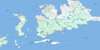
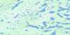
002E14 Cape St. John Topo Map
To view this map, mouse over the map preview on the right.
You can also download this topo map for free:
002E14 Cape St. John high-resolution topo map image.
Maps for the Cape St. John topo map sheet 002E14 at 1:50,000 scale are also available in these versions:
Cape St. John Surrounding Area Topo Maps
 |
 |
 |
|
 |
 |
 |
 |
 |
 |
 |
 |
 |
 |
 |
 |
© Department of Natural Resources Canada. All rights reserved.
Cape St. John Gazetteer
The following places can be found on topographic map sheet 002E14 Cape St. John:
Cape St. John Topo Map: Bays
Briny CoveCape Cove
Mad Rock Cove
Manful Bight
Notre Dame Bay
Seal Island Bight
Cape St. John Topo Map: Capes
Baie Verte PeninsulaBluff Head
Gunning Point
Manful Head
Middle Bill
Ragged Point
South Bill
Cape St. John Topo Map: Islands
Gull IslandCape St. John Topo Map: Shoals
Bishop's RockMad Rock
Mother Burke Rock
Shoal Rock
Cape St. John Topo Map: Valleys
Queen Gulch
© Department of Natural Resources Canada. All rights reserved.
002E Related Maps:
002E Botwood002E01 Weir's Pond
002E02 Gander River
002E03 Botwood
002E04 Hodges Hill
002E05 Robert's Arm
002E06 Point Leamington
002E07 Comfort Cove-Newstead
002E08 Carmanville
002E09 Fogo
002E10 Twillingate
002E11 Exploits
002E12 Little Bay Island
002E13 Nippers Harbour
002E14 Cape St. John
002E16 Little Fogo Islands
