Gander River Topo Map Online
Download Free Topo Map Sheet 002E02 at 1:50,000 scale
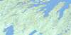
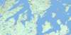
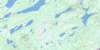
002E02 Gander River Topo Map
To view this map, mouse over the map preview on the right.
You can also download this topo map for free:
002E02 Gander River high-resolution topo map image.
Maps for the Gander River topo map sheet 002E02 at 1:50,000 scale are also available in these versions:
Gander River Surrounding Area Topo Maps
 |
 |
 |
|
 |
 |
 |
 |
 |
 |
 |
 |
 |
 |
 |
 |
© Department of Natural Resources Canada. All rights reserved.
Gander River Gazetteer
The following places can be found on topographic map sheet 002E02 Gander River:
Gander River Topo Map: Lakes
Bellman's PondBig Pond
Brinks Pond
Burnt Lake
Consideration Pond
Constant Pond
Dans Pond
Dildo Pond
First Pond
Fourth Pond
Fox Pond
Island Pond
Island Pond
Jonathans First Pond
Jonathan's Pond
Jonathans Second Pond
Jonathans Third Pond
Little Rocky Pond
Little Salmon Pond
Long Pond
Long Pond
O'Brien Lake
Penny's Pond
Rocky Pond
Rocky Pond
Salmon Pond
Second Pond
South Pond
Ten Mile Lake
Third Pond
Twin Ponds
Gander River Topo Map: Conservation areas
Jonathan's Pond Provincial ParkNewfoundland T'Railway Provincial Park
Gander River Topo Map: Rivers
Bellman's BrookGander River
Indian Arm Brook
Island Pond Brook
Joe Batts Brook
Jonathan's Brook
Jumper Brook
Millers Brook
Salmon River
Weir's Brook
Gander River Topo Map: Towns
AppletonGander
Glenwood
Gander River Topo Map: Unincorporated areas
Lake O'BrienO'Brien
© Department of Natural Resources Canada. All rights reserved.
002E Related Maps:
002E Botwood002E01 Weir's Pond
002E02 Gander River
002E03 Botwood
002E04 Hodges Hill
002E05 Robert's Arm
002E06 Point Leamington
002E07 Comfort Cove-Newstead
002E08 Carmanville
002E09 Fogo
002E10 Twillingate
002E11 Exploits
002E12 Little Bay Island
002E13 Nippers Harbour
002E14 Cape St. John
002E16 Little Fogo Islands
