Point Leamington Topo Map Online
Download Free Topo Map Sheet 002E06 at 1:50,000 scale
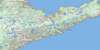
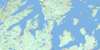
002E06 Point Leamington Topo Map
To view this map, mouse over the map preview on the right.
You can also download this topo map for free:
002E06 Point Leamington high-resolution topo map image.
Maps for the Point Leamington topo map sheet 002E06 at 1:50,000 scale are also available in these versions:
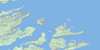
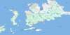
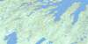
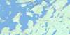
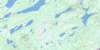
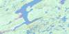
Point Leamington Surrounding Area Topo Maps
 |
 |
 |
|
 |
 |
 |
 |
 |
 |
 |
 |
 |
 |
 |
 |
© Department of Natural Resources Canada. All rights reserved.
Point Leamington Gazetteer
The following places can be found on topographic map sheet 002E06 Point Leamington:
Point Leamington Topo Map: Bays
Askel CoveBabies Cove
Baptist Cove
Bard Island Cove
Barrow Cove
Bay of Exploits
Bay Point Cove
Beaver Brook Cove
Besom Cove
Big Cove
Boat Harbour
Bobs Cove
Brets Cove
Brook Harbour
Browns Arm
Budgell Harbour
Burnt Bay
Butler Cove
Cabbage Harbour
Charles Arm
Cold Harbour
Cooks Cove
Cooks Cove
Cottrells Cove
Cumlins Cove
Cutnows Cove
Foulke Cove
Fox Cove
Framptons Cove
Gain Cove
Glovers Harbour
Govers Harbour
Great Muddy Hole
Green Island Cove
Gull Cove
Harvey's Cove
Hoskins Harbour
Indian Cove
Indian Cove
Jeffries Cove
Jobs Cove
Joe's Cove
Lannings Cove
Lawrence Harbour
Little Arm East
Little Arm West
Little Burnt Bay
Little Indian Cove
Little Muddy Hole
Little North Harbour
Little Northwest Arm
Man of War Cove
Masons Cove
Mill Cove
Milord Arm
Moore's Cove
Mouse Cove
North Harbour
Northwest Bottom
Osmonton Arm
Paradise Cove
Pidwell Cove
Point Leamington Harbour
Porters Cove
Powderhouse Cove
Purbeck Cove
Randells Cove
Randells Cove
Rendells Cove
Ritters Arm
Salt Pond Cove
Sand Cove
Sandy Cove
Saunders Cove
Sharrons Cove
Shoal Cove
South Arm
Southeast Arm
Southern Head Cove
Southwest Arm
Southwest Bottom
Squid Cove
St. John's Bay
St. John's Harbour
Stanhope Cove
Stocking Harbour
Strong Island Sound
Swan Island Harbour
Tea Arm
Thwart Island Harbour
Twisty Ann's Cove
Ward Cove
West Arm
Whitehorn Cove
Wigwam Cove
Wild Bight
Wild Bight
Point Leamington Topo Map: Beaches
Laceys BeachPoint Leamington Topo Map: Capes
Bay PointBills Point
Birchy Head
Brimstone Head
Cabbage Harbour Head
Cumlins Head
Dock Point
Glovers Point
Govers Point
Indian Point
Island Point
Jims Head
Lawrence Head
Leamington Point
Little Northwest Arm Head
Long Point
Mill Point
Muddy Hole Point
North Harbour Head
Pleasant Point
Rice Head
Shoal Tickle Point
Southeast Arm Point
Southern Head
Tea Point
Thimble Tickle Head
Ward Head
Wigwam Point
Yates Point
Point Leamington Topo Map: Channels
Chrises GutHornet Gut
Main Channel
Shoal Tickle
Southern Passage
Winter Tickle
Point Leamington Topo Map: Islands
Beach IslandBerry Island
Besom Island
Big Bay Island
Big Island
Big Island
Birchy Island
Blackberry Island
Burnt Island
Burnt Island
Cat Island
Cull Island
Cuttle Island
Duck Islands
East Hare Island
Freak Island
Frying Pan Island
Gillet Island
Goat Island
Goat Islands
Granfer Island
Grassy Island
Grassy Island
Green Island
Green Island
Gull Island
High Grego Island
Hornet Island
Hummock Island
Indian Cove Island
James Island
Jobs Island
Lacey Island
Little Berry Island
Little Grego Island
Lobster Island
Long Island
Long Island
Mouse Island
Mouse Island
Mussel Bed Island
Mussel Island
Ochre Pit Island
Pigeon Island
Pigeon Islands
Pond Island
Red Currant Island
Rice Island
Rudder Island
Sailor Island
Spruce Islands
Strong Island
Sunday Island
Swan Island
Swan Islands
Thomas Rowsell Island
Thwart Island
Tinker Island
Tinker Island
Upper Black Island
Upper Duck Island
Ward Island
West Hare Island
Woody Island
Yellow Fox Island
Point Leamington Topo Map: Lakes
Askel LakeAskel Pond
Babies Cove Pond
Bard Island Pond
Bard Pond
Barr'd Pond
Big Lake
Big Otter Pond
Big Twins Ponds
Bobbies Pond
Bog Dam Pond
Budgell Pond
Burnt Pond
Cleaves Lake
Cooks Pond
Daws Pond
Diver Pond
Fall Pond
Fall Pond
Four Mile Lake
Grassy Pond
Grassy Pond
Island Pond
Laceys Pond
Lewis Lake
Line Pond
Little Arm Pond
Little Martin Lake
Little Pond
Long Pond
Long Pond
Martin Lake
Matties Pond
Middle Pond
Mill Pond
Mill Pond
Mill Pond
Mine Pond
Mud Lake
Nanny Bag Lake
Otter Pond
Pine Pond
Rocky Pond
Saltwater Pond
Sharrons Pond
Side Pond
Side Pond
Southern Lake
Squid Pond
Stowaway Pond
Twin Pond
Twin Ponds
Winter Tickle Lake
Point Leamington Topo Map: Mountains
Nanny Bag HillRowsells Hill
Point Leamington Topo Map: Rivers
Charles BrookMatties Brook
New Bay River
Two Mile Brook
West Arm Brook
Point Leamington Topo Map: Sea features
Thimble TicklesPoint Leamington Topo Map: Shoals
Gull RockLong Rock
Man of War Rock
Passage Rocks
Seal Rock
Point Leamington Topo Map: Towns
EmbreeLeading Tickles
Leading Tickles West
Little Burnt Bay
Point Leamington
Point of Bay
Point Leamington Topo Map: Unincorporated areas
Brown's ArmBrown's Arm-Porterville
Bulley's Cove
Charles Brook
Cottrell's Cove
Cull Island
Glovers Harbour
Glover's Harbour
Leading Tickles
Leading Tickles East
Leading Tickles South
Masons Cove
Pleasantview
Porterville
Salt Pond Cove
Southeast Arm
Stanhope
Point Leamington Topo Map: Villages
Paradise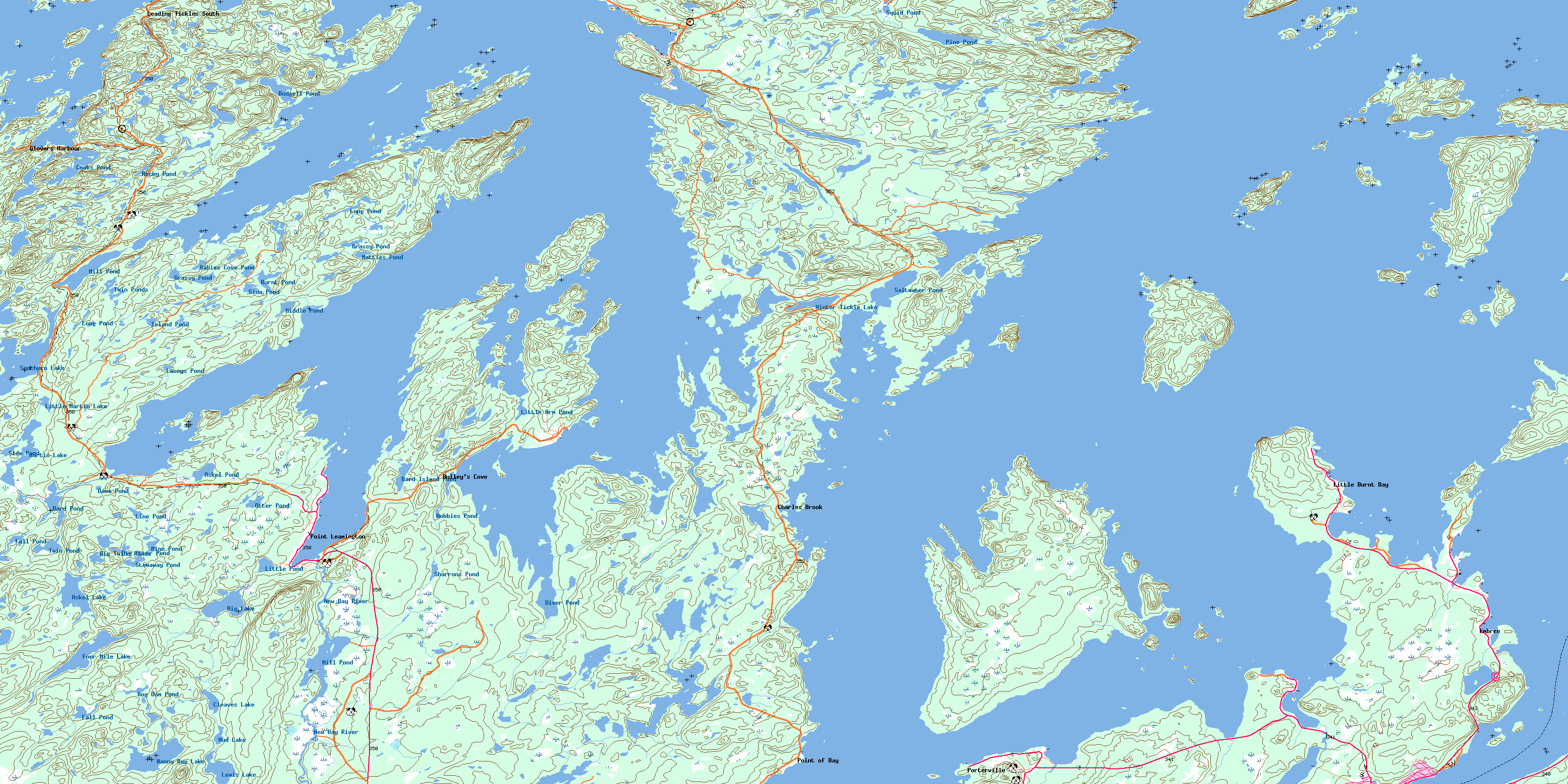
© Department of Natural Resources Canada. All rights reserved.
002E Related Maps:
002E Botwood002E01 Weir's Pond
002E02 Gander River
002E03 Botwood
002E04 Hodges Hill
002E05 Robert's Arm
002E06 Point Leamington
002E07 Comfort Cove-Newstead
002E08 Carmanville
002E09 Fogo
002E10 Twillingate
002E11 Exploits
002E12 Little Bay Island
002E13 Nippers Harbour
002E14 Cape St. John
002E16 Little Fogo Islands
