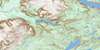
Main Gut Topo Map Online
Download Free Topo Map Sheet 012B08 at 1:50,000 scale
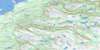
012B08 Main Gut Topo Map
To view this map, mouse over the map preview on the right.
You can also download this topo map for free:
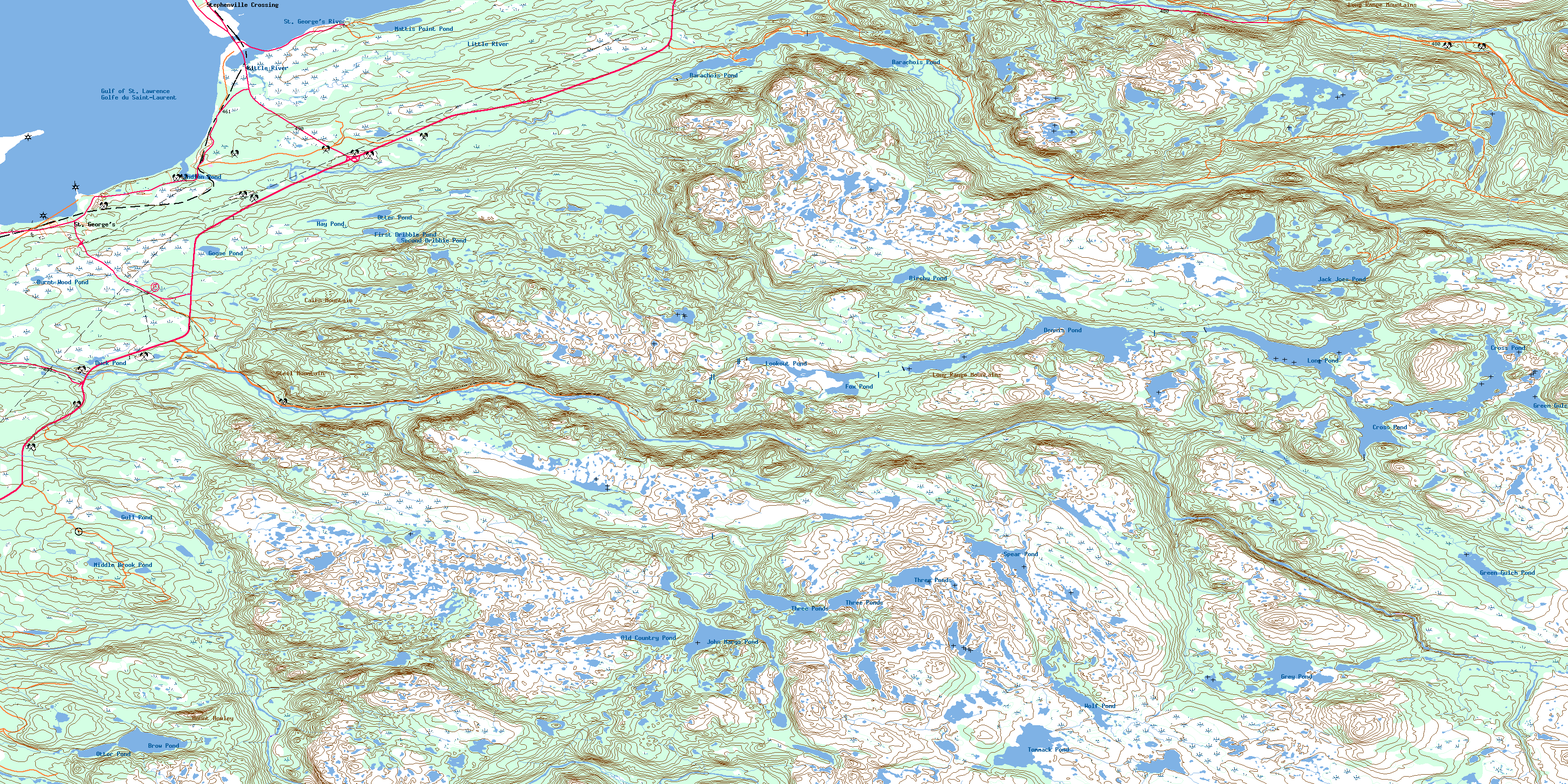
012B08 Main Gut high-resolution topo map image.
Maps for the Main Gut topo map sheet 012B08 at 1:50,000 scale are also available in these versions:
Main Gut Surrounding Area Topo Maps
 |
 |
||
 |
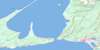 |
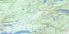 |
|
 |
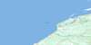 |
 |
|
 |
 |
 |
© Department of Natural Resources Canada. All rights reserved.
Main Gut Gazetteer
The following places can be found on topographic map sheet 012B08 Main Gut:
Main Gut Topo Map: Bays
Flat BayGolfe du Saint-Laurent
Gulf of St. Lawrence
Indian Cove
Rothesay Bay
St. George's Bay
St. George's Harbour
Main Gut Topo Map: Capes
Burnt PointCarters Point
Harbour Point
Messervey Point
Messervy Point
Turf Point
Main Gut Topo Map: Channels
Calvary GulchMain Gut
Main Gut Topo Map: Islands
Flat IslandMain Gut Topo Map: Lakes
Barachois PondBirchy Pond
Brow Pond
Burnt Wood Pond
Cross Pond
Dennis Pond
Duck Pond
First Dribble Pond
Fox Pond
Goose Pond
Green Gulch Pond
Green Gulch Pond
Grey Pond
Gull Pond
Hay Pond
Indian Pond
Jack Joes Pond
John Marys Pond
Long Pond
Lookout Pond
Mattis Point Pond
Middle Brook Pond
Old Country Pond
Otter Pond
Otter Pond
Second Dribble Pond
Spear Pond
Three Ponds
Tommack Pond
Wolf Pond
Main Gut Topo Map: Mountains
Bear HillCairn (Steel) Mountain
Cairn Mountain
Grey Hill
Long Range Mountains
Mount Howley
Soldiers Hill
Steel Mountain
White Hill
Main Gut Topo Map: Conservation areas
Barachois Pond Provincial ParkBarachois Provincial Park
Black Bank Provincial Park
Newfoundland T'Railway Provincial Park
Main Gut Topo Map: Rivers
Barry BrookBirchy Brook
Clam Brook
Coal Brook
Cross Pond Brook
Donalds Brook
Dribble Brook
Fischells Brook
Flat Bay Brook
French Island Brook
Joe Delaneys Brook
Journois Brook
Little Barachois Brook
Little River
Lookout Brook
Middle Brook
Sheep Brook
Southwest Brook
Spear Brook
St. George's River
Stanleys Brook
Surveyors Brook
Three Brooks
Tight Brook
White Hill Brook
Wolf Brook
Main Gut Topo Map: Shoals
Sand BankSeal Rocks
Main Gut Topo Map: Towns
St. George'sStephenville Crossing
Main Gut Topo Map: Unincorporated areas
Barachois BrookMattis Point
Seal Rocks
© Department of Natural Resources Canada. All rights reserved.
