Neveisik Island Topo Map Online
Download Free Topo Map Sheet 013G15 at 1:50,000 scale
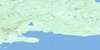
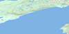
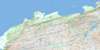
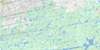
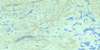
013G15 Neveisik Island Topo Map
To view this map, mouse over the map preview on the right.
You can also download this topo map for free:
013G15 Neveisik Island high-resolution topo map image.
Maps for the Neveisik Island topo map sheet 013G15 at 1:50,000 scale are also available in these versions:
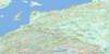
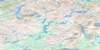
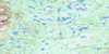
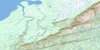
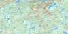
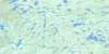
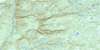
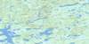
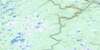
Neveisik Island Surrounding Area Topo Maps
 |
 |
 |
 |
 |
 |
 |
 |
 |
 |
 |
 |
 |
 |
 |
 |
© Department of Natural Resources Canada. All rights reserved.
Neveisik Island Gazetteer
The following places can be found on topographic map sheet 013G15 Neveisik Island:
Neveisik Island Topo Map: Bays
Barrel CoveHamilton Inlet
Lower Sandy Cove
Pelter Cove
Port Disappointment
Round Harbour
Sandy Cove
Swallow Harbour
Neveisik Island Topo Map: Beaches
Harbour GraceNeveisik Island Topo Map: Capes
Bellas PointBig Point
Frenchman Point
High Point
Old House Point
Reed Point
Sandy Cove Head
Smokey Point
Trout Point
Neveisik Island Topo Map: Channels
Little Shoal TickleShoal Tickle
St. John's Tickle
Neveisik Island Topo Map: Cliffs
Red CliffNeveisik Island Topo Map: Islands
Acadia IslandsAndy Island
Bear Island
Green Island
Gull Island
HainesIsland
Handy Island
Indian Island
Island Rock
Neveisik Island
Outer Barred Islands
Rocky Islands
St. John Island
Trout Island
Neveisik Island Topo Map: Lakes
Clear PondDeer Hill Pond
Deer Pond
Lake Melville
Long Steady
Otter Brook Pond
Pancake Pond
Sandy Cove Pond
Shiwaks Pond
Stag Pond
Upper Sandy Cove Pond
Neveisik Island Topo Map: Mountains
Mealy MountainsNeveisik Island Topo Map: Rapids
Marks RapidsShellbird Rapids
Neveisik Island Topo Map: Rivers
Beaver BrookEnglish River
Frenchmans Brook
Grants Brook
Lochan River
Peter Lewis Brook
Peter Lewis Brook
Sandy Cove Brook
Trout Cove Brook
Neveisik Island Topo Map: Shoals
Blue Seal ShoalLareto Shoal
Neveisik Island Topo Map: Valleys
Antler CirqueNeveisik Island Topo Map: Low vegetation
Crosswater Marshes
© Department of Natural Resources Canada. All rights reserved.
013G Related Maps:
013G Lake Melville013G01 No Title
013G02 No Title
013G03 No Title
013G04 Kenamu River
013G05 Kenemich River
013G06 No Title
013G07 No Title
013G08 No Title
013G09 No Title
013G10 Etagaulet River
013G11E Eskimo Paps
013G11W Eskimo Paps
013G12E Epinette Point
013G12W Epinette Point
013G13E Mulligan Bay
013G13W Mulligan Bay
013G14E Etagaulet Point
013G14W Etagaulet Point
013G15E Neveisik Island
013G15W Neveisik Island
013G16E No Title
013G16W No Title
