Aroostook Topo Map Online
Download Free Topo Map Sheet 021J13 at 1:50,000 scale
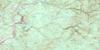
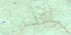
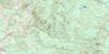
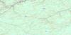
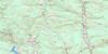
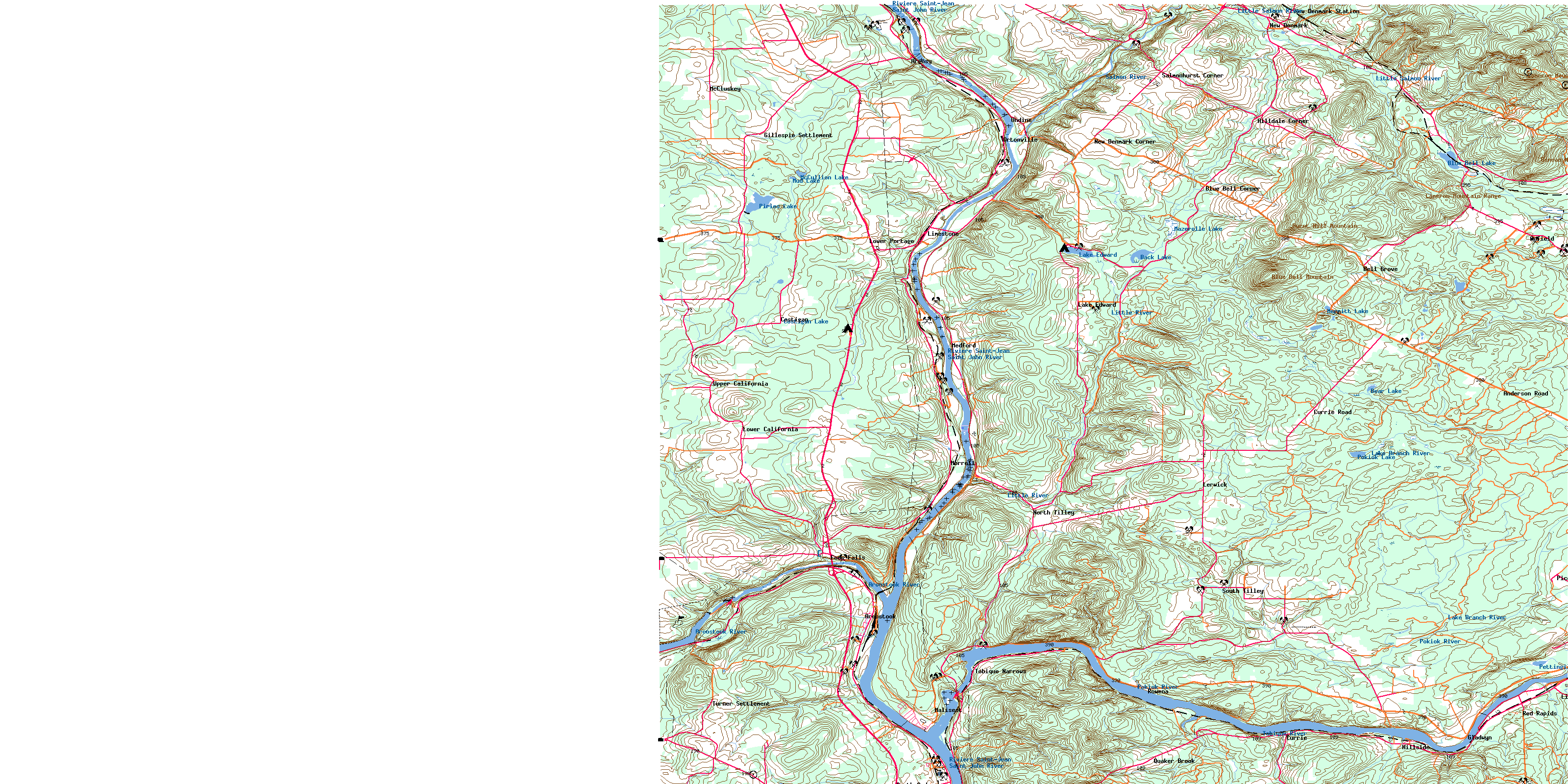
021J13 Aroostook Topo Map
To view this map, mouse over the map preview on the right.
You can also download this topo map for free:
021J13 Aroostook high-resolution topo map image.
Maps for the Aroostook topo map sheet 021J13 at 1:50,000 scale are also available in these versions:
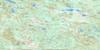
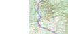
Aroostook Surrounding Area Topo Maps
 |
 |
 |
 |
 |
 |
 |
 |
 |
 |
 |
 |
 |
 |
 |
 |
© Department of Natural Resources Canada. All rights reserved.
Aroostook Gazetteer
The following places can be found on topographic map sheet 021J13 Aroostook:
Aroostook Topo Map: Beaches
Big FlatAroostook Topo Map: Capes
Indian PointAroostook Topo Map: Geographical areas
DenmarkGrand Falls
Aroostook Topo Map: Indian Reserves
Tobique 20Aroostook Topo Map: Lakes
Back LakeBear Lake
Blue Bell Lake
Costigan Lake
Lake Edward
Mazerolle Lake
McCullion Lake
Merritt Lake
Mud Lake
Pettingill Lake
Piries Lake
Pokiok Lake
Round Lake
Toad Pond
Aroostook Topo Map: Mountains
Blue Bell MountainBurnt Hill Mountain
Cameron Mountain
Cameron Mountain Range
Foundry Ridge
Geneau Mountain
Horseback Hill
Klokledahl Hill
Tompkins Ridge
Aroostook Topo Map: Conservation areas
Ancienne église unie St. JamesFormer St. James United Church
Aroostook Topo Map: Rivers
Aroostook RiverBear Brook
Beaver Brook
Big Flat Brook
Blue Bell Brook
Boutot Brook
Brinkman Brook
Caldwell Brook
Caldwell Brook
Caldwell Brook
Caribou Brook
Celmo Brook
Cochrane Brook
Craig Brook
Curry Brook
Dead Brook
Demerchant Brook
DeMerchant Brook
Dixon Brook
Dyers Brook
East Branch Limestone Stream
East Branch Pokiok River
East Limestone River
Falls Brook
Finnemore Brook
Four Falls Stream
Gallagher Brook
Gillespie Brook
Godin Brook
Graham Brook
Indian Brook
Johnston Brook
Jones Brook
Keating Brook
Lake Branch River
Left Branch Brook
Left Branch Pokiok River
Left Hand Branch Blue Bell Brook
Left Hand Branch Caldwell Brook
Left Hand Branch Pokiok River
Left Hand Branch Trout Brook
Left Hand Trout Brook
Limestone River
Limestone Stream
Little River
Little Salmon River
McGillen Brook
Merritt Brook
Mill Brook
Narrows Brook
Neilson Brook
Odellach River
Outlet Brook
Pelky Brook
Perkins Brook
Plante Brook
Pokiok River
Quaker Brook
Rasmussen Brook
Right Branch Brook
Right Hand Branch Blue Bell Brook
Right Hand Branch Caldwell Brook
Rivière Saint-Jean
Roberts Brook
Rodgers Brook
Saint John River
Salmon River
Salmonhurst Brook
Snaiky Brook
Snakity Brook
Streets Brook
Tibbits Brook
Tibbitts Brook
Toad Pond Brook
Tobique River
Trout Brook
West Caldwell Brook
West Caldwell Brook
Aroostook Topo Map: Unincorporated areas
Anderson RoadAndover
Anfield
Argosy
Aroostook Junction
Aroostook Portage
Bell Grove
Blue Bell
Blue Bell Corner
Caldwell Brook
California
Carlingford
Cliffordvale
Costigan
Currie
Currie Road
Davis
Four Falls
Gillespie
Gillespie Settlement
Gladwyn
Grand Falls Portage
Hazeldean
Hilldale Corner
Hillside
Lake Edward
Lerwick
Licford
Limestone
Lower California
Lower Portage
Maliseet
McCluskey
Medford
Millicete
Morrell
Morrill
New Denmark
New Denmark
New Denmark Corner
New Denmark Station
North Tilley
Ortonville
Pearl
Piccadilly
Quaker Brook
Ranger Settlement
Red Rapids
Rowena
Salmonhurst
Salmonhurst Corner
South Tilley
Tilley
Tinker
Tobique Narrows
Tobique River
Turner Settlement
Undine
Upper California
Yone
Aroostook Topo Map: Valleys
Dry GulchLucys Gulch
Aroostook Topo Map: Villages
Andover-PerthAroostook
Perth
Perth-Andover
© Department of Natural Resources Canada. All rights reserved.
021J Related Maps:
021J Woodstock021J01 Minto
021J02 Burtts Corner
021J03 Millville
021J04 Woodstock
021J05 Florenceville
021J06 Coldstream
021J07 Napadogan
021J08 Boiestown
021J09 Doaktown
021J10 Hayesville
021J11 Juniper
021J12 Perth-Andover
021J13 Aroostook
021J14 Plaster Rock
021J15 Tuadook Lake
021J16 Mckendrick Lake
