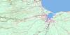
Tabusintac River Topo Map Online
Download Free Topo Map Sheet 021P06 at 1:50,000 scale
021P06 Tabusintac River Topo Map
To view this map, mouse over the map preview on the right.
You can also download this topo map for free:
021P06 Tabusintac River high-resolution topo map image.
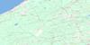
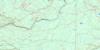
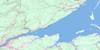
Maps for the Tabusintac River topo map sheet 021P06 at 1:50,000 scale are also available in these versions:
Tabusintac River Surrounding Area Topo Maps
 |
 |
 |
|
 |
 |
 |
|
 |
 |
 |
|
 |
 |
 |
 |
© Department of Natural Resources Canada. All rights reserved.
Tabusintac River Gazetteer
The following places can be found on topographic map sheet 021P06 Tabusintac River:
Tabusintac River Topo Map: Bays
French CoveHierlihys Cove
Murrays Cove
Neguac Bay
Tabusintac River Topo Map: Beaches
Neguac BeachTabusintac River Topo Map: Capes
Barnabys NoseCap Blanc
Cap de Meule
Cap Nord
Frank Hyde Point
Indian Point
McKenzie Point
McRobie Point
Pointe à Charles Comeau
Pointe à Damase
Pointe à Ferdinand
Pointe à Honoré
Pointe du Vieux-Boom
Popple Point
Robichauds Point
Tabusintac River Topo Map: Channels
Upper Long StretchTabusintac River Topo Map: Geographical areas
AllardvilleAlnwick
Gloucester
Newcastle
Northumberland
Saint-Isidore
Saumarez
Tabusintac River Topo Map: Indian Reserves
Tabusintac 9Tabusintac River Topo Map: Islands
Campbells IslandOld Dans Island
Redpine Island
Robertsons Island
Sheep Island
Tabusintac River Topo Map: Lakes
Neguac LagoonTabusintac River Topo Map: Mountains
North Tabusintac HillSouth Tabusintac Hill
Tabusintac River Topo Map: Rapids
Rapide BlancTabusintac River Topo Map: Rivers
Barnabys Nose BrookBartibog River
Beans Brook
Becks Brook
Big Bear Brook
Big Bear Brook
Big Brook
Big Brook
Big Eskedelloc River
Big Hole Brook
Big Hole Brook
Big Marsh Brook
Big Tracadie River
Brandy Brook
Camp Forbes Brook
Caribou Brook
Clearwater Brook
Coal Mine Brook
Codfish Brook
Cove Brook
Cowassaget Stream
Davidson Brook
Davidsons Brook
Deep Gulch Brook
Deep Pine Brook
Foriens Brook
Frank Hyde Brook
French Cove Brook
Gaspereau Brook
Godins Brook
Greystone Brook
Hay Landing Brook
High Landing Brook
Jam Brook
Johnson Brook
Leech River
Little Bear Brook
Little Eskedelloc
Little Eskedelloc River
Little North Brook
Little South Branch Big Tracadie River
Little South Branch River
Little South Tracadie River
Little Tracadie River
Lord and Foy Brook
Maliaget Brook
Maliget Brook
Malpec Brook
McKnights Brook
McLeods Brook
McLeod's Brook
McRobie Brook
Meadow Brook
Middle Brook
Moose Brook
North Branch Burnt Church River
North Brook
North Brook
Otter Brook
Pisiguit Brook
Portage Brook
Portage River
Red Landing Brook
Rivière des Caches
Rivière du Portage
Robinson Brook
Ruisseau à Allain
Ruisseau à Tom
Ruisseau Aimée
Ruisseau aux Trois-Ormes
Ruisseau de la Mollasse
Spring Brook
Stilson Brook
Straight Brook
Stymest Millstream
Stymiests Mill Brook
Tabusintac River
Tracadie River
Trout Brook
Weeks Brook
Wildcat Brook
Tabusintac River Topo Map: River features
Devils ElbowLong Stretch
Long Stretch
Tabusintac River Topo Map: Unincorporated areas
AllainvilleAllardville
Allardville East
Bear Landing
Breau Road
Cain Point
Cains Point
Christies Landing
Comeau Settlement
Covedell
Daulnay
Fairisle
Gaythorne
Grattan
Jeanne Mance
Jeanne-Mance
Lauvergot
Lavillette
Lower Neguac
Morrissy
Old Dans Landing
Price Settlement
Robichaud Settlement
Saint-Wilfred
Savoy
St. Wilfred
Stymiest Road
Tabusintac
Veniot
Tabusintac River Topo Map: Valleys
Blakes GulchCronins Gulch
Dionne Gulch
Duillaume Gulch
Dunbar Gulch
Gormans Gulch
Gulch à Anastase
Gulch à Cyrille
Gulch à Geordie
Gulch à Isaïe
Loggies Gulch
Russells Gulch
Youngs Gulch
Tabusintac River Topo Map: Low vegetation
Anglin PlainBig Marsh
Black Lands
Tabusintac River Topo Map: Villages
Tracadie Camp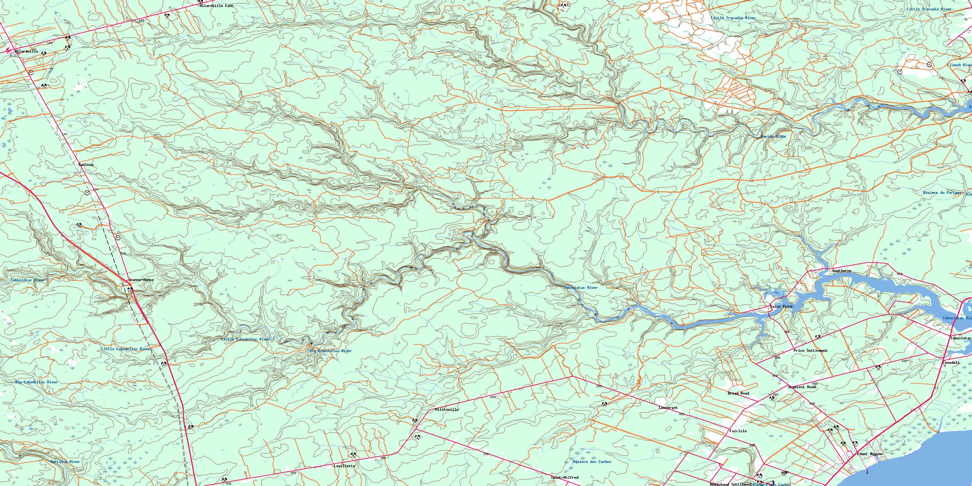
© Department of Natural Resources Canada. All rights reserved.
