Grande-Anse Topo Map Online
Download Free Topo Map Sheet 021P14 at 1:50,000 scale
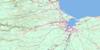
021P14 Grande-Anse Topo Map
To view this map, mouse over the map preview on the right.
You can also download this topo map for free:
021P14 Grande-Anse high-resolution topo map image.
Maps for the Grande-Anse topo map sheet 021P14 at 1:50,000 scale are also available in these versions:
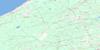
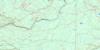
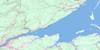
Grande-Anse Surrounding Area Topo Maps
 |
 |
 |
|
 |
 |
 |
|
 |
 |
 |
|
 |
 |
 |
 |
© Department of Natural Resources Canada. All rights reserved.
Grande-Anse Gazetteer
The following places can be found on topographic map sheet 021P14 Grande-Anse:
Grande-Anse Topo Map: Bays
Anse BleueBaie de Caraquet
Baie de Chaleur
Baie des Chaleurs
Blue Cove
Caraquet Bay
Chaleur Bay
Grande Anse
Nepisiguit Bay
Nipisiguit Bay
Grande-Anse Topo Map: Beaches
Lobster BeachPlage Dugas
Grande-Anse Topo Map: Capes
Cap PeléCape Play
Grindstone Point
Oyster Point
Point Caplin
Point May
Pointe aux Roseaux
Pointe des Deux-Rivières
Rousseau Point
Grande-Anse Topo Map: Geographical areas
CaraquetGloucester
New Bandon
Paquetville
Grande-Anse Topo Map: Conservation areas
Caraquet Provincial ParkPokeshaw Provincial Park
Village historique acadien
Grande-Anse Topo Map: Rivers
Little Pokeshaw RiverMcIntosh Creek
Northwest Caraquet River
Petite rivière Caraquet
Pokeshaw River
Rivière Caraquet
Rivière du Nord
Ruisseau Castor
Ruisseau des Prairies
Ruisseau Madeleine
Southwest Caraquet River
Grande-Anse Topo Map: Shoals
Oyster BankGrande-Anse Topo Map: Towns
CaraquetGrande-Anse Topo Map: Unincorporated areas
Anse-BleueBlack Rock
Blue Cove
Dugas
Haut Caraquet
Haut-Caraquet
New Bandon
Pokeshaw
Riorden
Riordon
Sainte-Anne-du-Bocage
St. Joseph Settlement
Ste-Anne-du-Bocage
St-Léolin
Stonehaven
Village-des-Poirier
Village-Saint-Paul
Village-St-Paul
Grande-Anse Topo Map: Villages
BertrandGrande-Anse
Maisonnette
Saint-Léolin

© Department of Natural Resources Canada. All rights reserved.
