Shakespeare Island Topo Map Online
Download Free Topo Map Sheet 052H09 at 1:50,000 scale
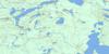
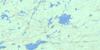
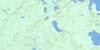
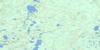
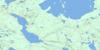
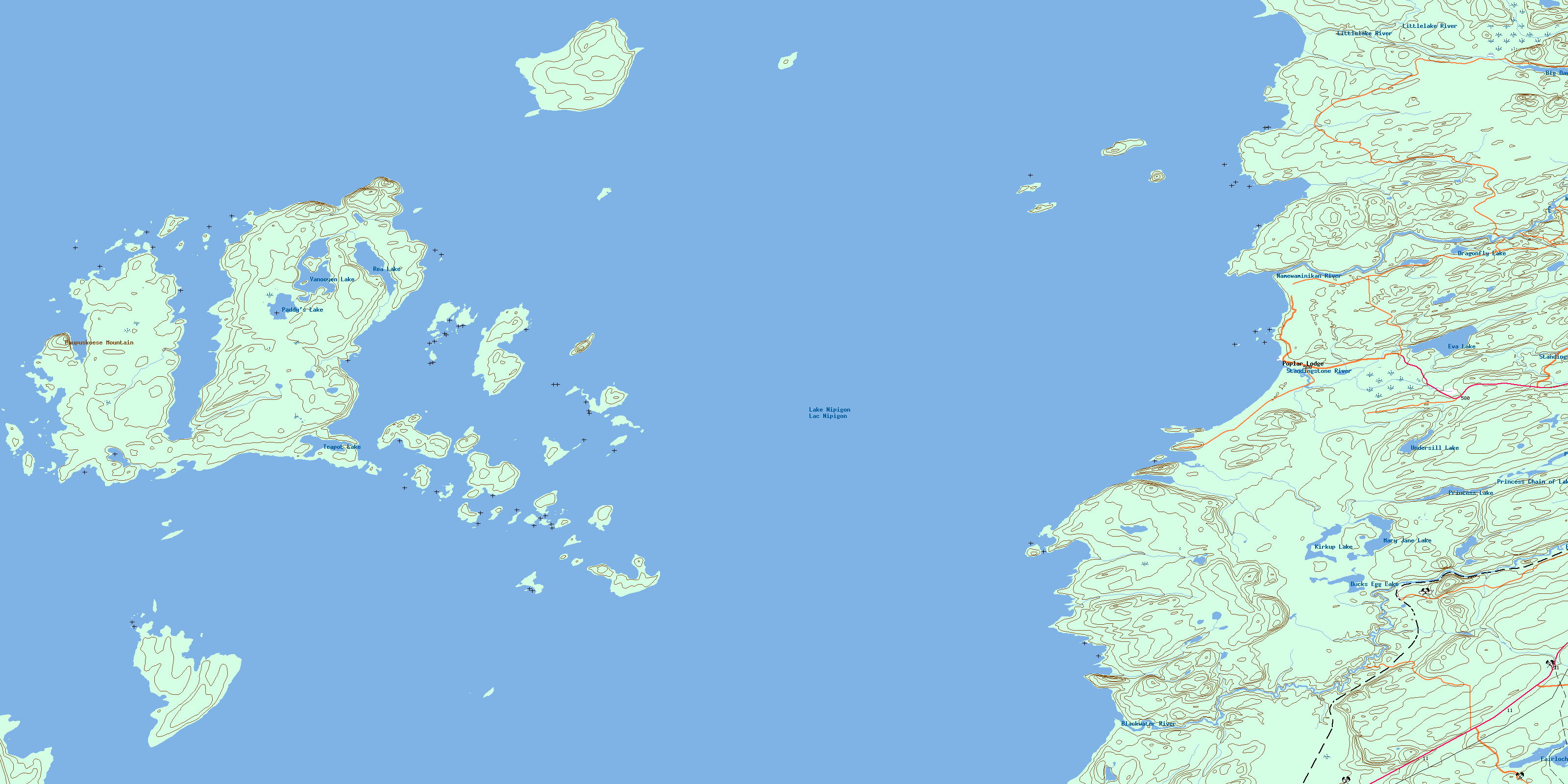
052H09 Shakespeare Island Topo Map
To view this map, mouse over the map preview on the right.
You can also download this topo map for free:
052H09 Shakespeare Island high-resolution topo map image.
Maps for the Shakespeare Island topo map sheet 052H09 at 1:50,000 scale are also available in these versions:
Shakespeare Island Surrounding Area Topo Maps
 |
 |
 |
 |
 |
 |
 |
 |
 |
 |
 |
 |
 |
 |
 |
 |
© Department of Natural Resources Canada. All rights reserved.
Shakespeare Island Gazetteer
The following places can be found on topographic map sheet 052H09 Shakespeare Island:
Shakespeare Island Topo Map: Bays
Alexandra HarbourBish Bay
Colter's Harbour
Cregie's Harbour
Grant Point Harbour
Hat Mountain Harbour
High Hill Harbour
Lesperance Harbour
Lion Bay
McRitchie Shortcut
Mink Harbour
North High Hill Harbour
South High Hill Harbour
West's Bay
Shakespeare Island Topo Map: Beaches
Devil's WalkShakespeare Island Topo Map: Capes
Abeki PointGrant Point
King's Head
Patch Point
Pay Point
Poplar Point
Speke Point
Shakespeare Island Topo Map: Geographical areas
DorotheaEva
Kitto
Sandra
Summers
Thunder Bay
Shakespeare Island Topo Map: Islands
Alexandra IslandAmikwian Island
Assef Islands
Ball Island
Black Island
Carson Islands
Cedar Island
Dockrey Islands
Eaglenest Islands
Eight Mile Island
Flatland Island
Hat Mountain Island
Katatota Island
Little Flatland Island
Little Lonely Island
Lone Island
Love Island
Luck Island
Macoun Islands
Nawnaga Island
Pewabis Island
Preston Island
Red Willow Islands
Shakespeare Island
Wesab Island
Shakespeare Island Topo Map: Lakes
Big Dawson LakeDragonfly Lake
Ducks Egg Lake
Eva Lake
Fairloch Lake
Kirkup Lake
Lac Nipigon
Lake Nipigon
Mary Jane Lake
Paddy's Lake
Princess Chain of Lakes
Princess Lake
Rea Lake
Teapot Lake
Undersill Lake
Vanooyen Lake
Shakespeare Island Topo Map: Mountains
Paupuskeese MountainShakespeare Island Topo Map: Other municipal/district area - miscellaneous
BeardmoreNakina
Shakespeare Island Topo Map: Rivers
Blackwater RiverHigh Hill Creek
Littlelake River
Namewaminikan River
Sandy Creek
Standingstone River
Shakespeare Island Topo Map: Towns
GreenstoneShakespeare Island Topo Map: Unincorporated areas
Poplar LodgeWarneford
© Department of Natural Resources Canada. All rights reserved.
052H Related Maps:
052H Nipigon052H01 Nipigon
052H02 Shillabeer Lake
052H03 Eaglehead Lake
052H04 Lac Des Iles
052H05 Armistice Lake
052H06 Cheeseman Lake
052H07 Black Sturgeon Lake
052H08 Orient Bay
052H09 Shakespeare Island
052H10 Grand Bay
052H11 Kabitotikwia Lake
052H12 Holinshead Lake
052H13 Uneven Lake
052H14 Gull Bay
052H15 Kelvin Island
052H16 Livingstone Point
