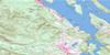
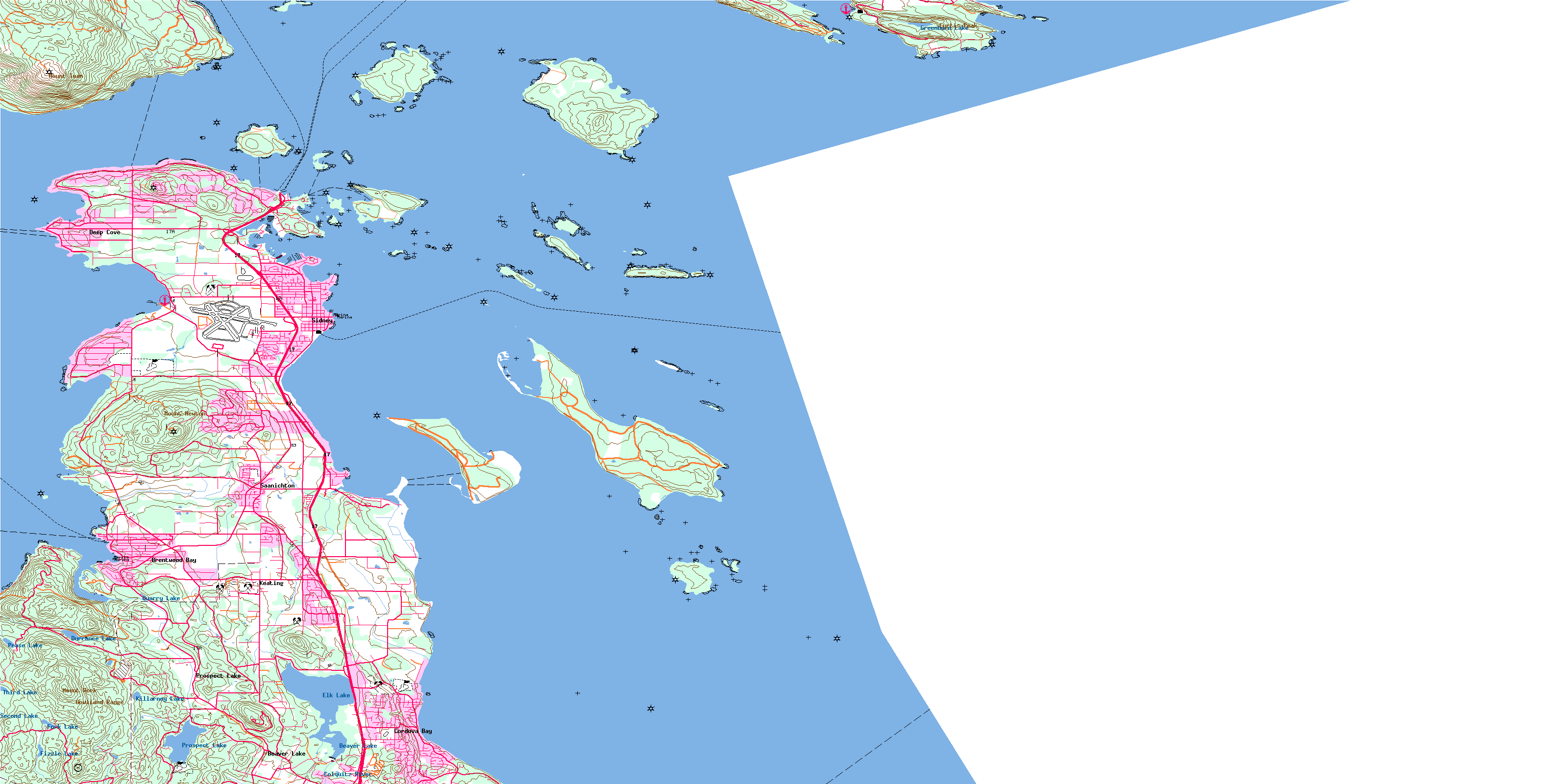
Sidney Topo Map Online
Download Free Topo Map Sheet 092B11 at 1:50,000 scale
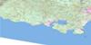
092B11 Sidney Topo Map
To view this map, mouse over the map preview on the right.
You can also download this topo map for free:
092B11 Sidney high-resolution topo map image.
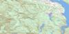
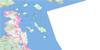
Maps for the Sidney topo map sheet 092B11 at 1:50,000 scale are also available in these versions:
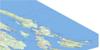
Sidney Surrounding Area Topo Maps
 |
 |
||
 |
 |
||
 |
 |
||
© Department of Natural Resources Canada. All rights reserved.
Sidney Gazetteer
The following places can be found on topographic map sheet 092B11 Sidney:
Sidney Topo Map: Bays
All BayBazan Bay
Bedwell Harbour
Blue Heron Basin
Brentwood Bay
Bryden Bay
Butchart Cove
Camp Bay
Canned Cod Bay
Canoe Bay
ColesBay
Cordova Bay
Deep Cove
Drummond Bay
Egeria Bay
Ferguson Cove
Fulford Harbour
Hagan Bight
Lewis Bay
Patricia Bay
Peter Cove
Princess Bay
Roberts Bay
Royal Cove
Saanich Inlet
Saanichton Bay
Smokehouse Bay
Smugglers Nook
Swartz Bay
Thomson Cove
Tod Inlet
Towner Bay
Trader Bay
Tsehum Harbour
Sidney Topo Map: Beaches
Eagle BeachHamsterley Beach
Island View Beach
Sayward Beach
Sidney Topo Map: Capes
Armstrong PointCape Keppel
Carney Point
Charmer Point
Coal Point
Cordova Spit
Cowichan Head
Curteis Point
Fir Cone Point
Gowlland Point
Hamley Point
Harry Point
Harvey Point
Hay Point
Henderson Point
Higgs Point
Indian Point
Isabella Point
James Spit
Kamai Point
Kamaree Point
Killer Whale Point
Kingfisher Point
Mill Point
Moses Point
Nymph Point
Parkin Point
Pelorus Point
Point Fairfax
Quadros Point
Reynard Point
Roberts Point
Saanich Peninsula
Schmidt Point
Seymour Point
Sidney Spit
Sluggett Point
Swartz Head
Teece Point
Thumb Point
Tilly Point
Tom Point
Turgoose Point
Wales Point
Wallace Point
Warrior Point
Waymond Point
Whittaker Point
Wilhelm Point
Willis Point
Wymond Point
Yarrow Point
Sidney Topo Map: Channels
Boundary PassByers Passage
Colburne Passage
Cordova Channel
Gosse Passage
Haro Strait
Hughes Passage
Iroquois Passage
John Passage
Miners Channel
Moresby Passage
Page Passage
Prevost Passage
Satellite Channel
Shute Passage
Sidney Channel
Stranger Passage
Swanson Channel
Sidney Topo Map: Cliffs
Kanaka BluffOaks Bluff
Richardson Bluff
Sidney Topo Map: District municipality
Central SaanichHighlands
North Saanich
Saanich
Sidney Topo Map: Geographical areas
Cowichan Land DistrictHighland Land District
Lake Land District
North Saanich Land District
Saltspring Island Land District
South Saanich Land District
Victoria Land District
Sidney Topo Map: Indian Reserves
Bare Island Indian Reserve 9Cole Bay Indian Reserve 3
East Saanich Indian Reserve 2
Fulford Harbour Indian Reserve 5
Pender Island Indian Reserve 8
Réserve indienne Bare Island 9
Réserve indienne Cole Bay 3
Réserve indienne East Saanich 2
Réserve indienne Fulford Harbour 5
Réserve indienne Pender Island 8
Réserve indienne Senanus Island 10
Réserve indienne South Saanich 1
Réserve indienne Union Bay 4
Senanus Island Indian Reserve 10
South Saanich Indian Reserve 1
Union Bay Indian Reserve 4
Sidney Topo Map: Islands
Arbutus IslandBlunden Islet
Brackman Island
Brethour Island
Chads Island
Clive Island
Coal Island
Comet Island
Daphne Islet
D'Arcy Island
Dock Island
Domville Island
Fernie Island
Forrest Island
Gooch Island
Goudge Island
Greig Island
Gulf Islands
Halibut Island
Harlock Islet
Hood Island
Île de Vancouver
Imrie Island
Isabella Island
James Island
Johnson Islet
Ker Island
Knapp Island
Kolb Island
Little D'Arcy Island
Little Group
Little Shell Island
Mandarte Island
Moresby Island
Musclow Islet
North Pender Island
Patrol Island
Pellow Islets
Piers Island
Portland Island
Pym Island
Reay Island
Rubly Island
Rum Island
Russell Island
Saltspring Island
Senanus Island
Sheep Island
Shell Island
Sidney Island
South Pender Island
Tortoise Island
Tortoise Islets
Vancouver Island
Young Island
Sidney Topo Map: Lakes
Beaver LakeDurrance Lake
Durrant Lake
Eagles Lake
Elk Lake
Fizzle Lake
Fork Lake
Greenburn Lake
Heal Lake
Killarney Lake
Pease Lake
Prospect Lake
Quarry Lake
Second Lake
Third Lake
Sidney Topo Map: Military areas
Champ de tir Anse de SaanichChamp de tir Détroit de Haro
Champ de tir Heals
Haro Strait Range
Heals Range
Saanich Inlet Range
Sidney Topo Map: Mountains
Bear HillCloake Hill
Cole Hill
Curtis Peak
Gowlland Range
Hermit Hill
Horth Hill
Keating Ridge
Mount Newton
Mount Tuam
Mount Wark
Mount Work
Observatory Hill
Partridge Hills
Saddle Hill
Stanford Hill
Sidney Topo Map: Major municipal/district area - major agglomerations
Capital Regional DistrictCowichan Valley Regional District
Sidney Topo Map: Conservation areas
Brentwood Bay ParkD'Arcy Island Marine Park
D'Arcy Island Park
Gowlland Tod Park
Isle-de-Lis Marine Park
John Dean Park
McDonald Park
Princess Margaret Marine Park
Refuge d'oiseaux de Shoal-Harbour
Shoal Harbour Bird Sanctuary
Sidney Spit Marine Park
Wain Park
Sidney Topo Map: Provinces
British ColumbiaColombie-Britannique
Sidney Topo Map: Rivers
Chalet CreekColquitz River
Craigflower Creek
Durrance Creek
Graham Creek
Greenburn Creek
Hagan Creek
Mill Stream
O'Donnel Creek
Pease Creek
Reay Creek
Sandhill Creek
Ten Ten Creek
Tetayut Creek
Tod Creek
Viaduct Creek
Sidney Topo Map: River features
Squally ReachSidney Topo Map: Shoals
Arachne ReefCanoe Rock
Cap Rocks
Cecil Rock
Celia Reefs
Chesil Bank
Cooper Reef
Darcy Shoals
D'Arcy Shoals
Dyer Rocks
Fairway Patch
Graham Rock
Joan Rock
John Rock
Kelp Reefs
Little Zero Rock
Munroe Rock
North Cod Reef
Peck Reef
Rose Rock
Sallas Rocks
Shute Reef
South Cod Reef
Sunk Rock
Turnbull Reef
Unit Rocks
Wain Rock
White Rocks
Zero Rock
Sidney Topo Map: Towns
SidneySidney Topo Map: Unincorporated areas
ArdmoreBazan Bay
Beaver Lake
Bedwell Harbour
Brentwood Bay
Cordova Bay
Deep Cove
Elk Lake
James Island
Keating
Mount Newton
Prospect Lake
Saanichton
South Pender
Swartz Bay
Tod Inlet
© Department of Natural Resources Canada. All rights reserved.
