Sooke Topo Map Online
Download Free Topo Map Sheet 092B05 at 1:50,000 scale
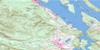
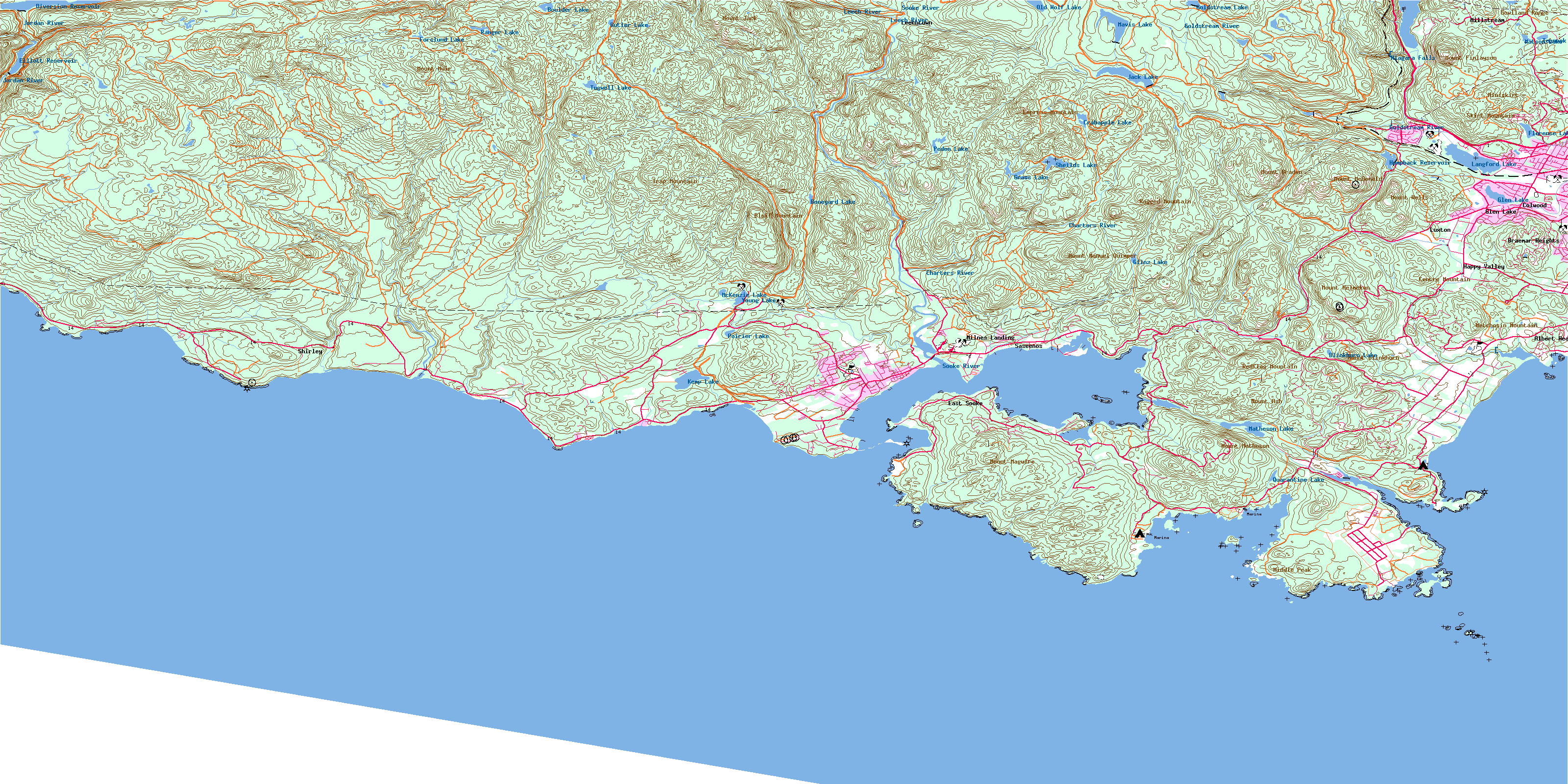
092B05 Sooke Topo Map
To view this map, mouse over the map preview on the right.
You can also download this topo map for free:
092B05 Sooke high-resolution topo map image.
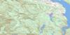
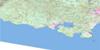
Maps for the Sooke topo map sheet 092B05 at 1:50,000 scale are also available in these versions:
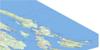
Sooke Surrounding Area Topo Maps
 |
 |
||
 |
 |
||
 |
 |
||
© Department of Natural Resources Canada. All rights reserved.
Sooke Gazetteer
The following places can be found on topographic map sheet 092B05 Sooke:
Sooke Topo Map: Bays
Anderson CoveBecher Bay
Campbell Bay
Campbell Cove
Cooper Cove
Finlayson Arm
Hutchinson Cove
Iron Mine Bay
Murder Bay
Orveas Bay
Parker Bay
Parry Bay
Pedder Bay
Quarantine Cove
Roche Cove
Saanich Inlet
Sooke Basin
Sooke Bay
Sooke Harbour
Sooke Inlet
Whirl Bay
Sooke Topo Map: Beaches
French BeachGordons Beach
Weir Beach
Sooke Topo Map: Capes
Alldridge PointBeechey Head
Billings Point
Billings Spit
Caffery Point
Cape Calver
Christie Point
Christopher Point
Church Point
Company Point
Creyke Point
Cudlip Point
Edye Point
Eliza Point
Fossil Point
George Point
Glacier Point
Goodridge Peninsula
Harrison Point
Helgesen Point
Hill Head
Hoskyn Point
Kellett Point
Lorimer Point
Manor Point
Muir Point
Ned Point
O'Brien Point
Otter Point
Parsons Point
Parsons Spit
Pim Head
Point Ash
Point No Point (Glacier Point)
Possession Point
Rocky Point
Saanich Peninsula
Sheringham Point
Simpson Point
Smyth Head
Trollope Point
Watt Point
Weir Point
Whiffin Spit
Whitney-Griffiths Point
William Head
Woodward Point
Yates Point
Sooke Topo Map: Caves
Florence Lake CaveSooke Topo Map: Channels
Détroit de Juan de FucaEemdyk Passage
Juan de Fuca Strait
Race Passage
Sooke Topo Map: City
ColwoodLangford
Sooke Topo Map: District municipality
HighlandsMetchosin
Sooke
Sooke Topo Map: Falls
Niagara FallsSooke Topo Map: Geographical areas
Esquimalt Land DistrictGoldstream Land District
Highland Land District
Malahat Land District
Metchosin Land District
Otter Land District
Renfrew Land District
Sooke Land District
Sooke Topo Map: Indian Reserves
Becher Bay Indian Reserve 1Becher Bay Indian Reserve 2
Fraser Island Indian Reserve 6
Goldstream Indian Reserve 13
Lamb Island Indian Reserve 5
Long Neck Island Indian Reserve 9
Réserve indienne 1 T'Sou-ke
Réserve indienne 2 T'Sou-ke
Réserve indienne Becher Bay 1
Réserve indienne Becher Bay 2
Réserve indienne Fraser Island 6
Réserve indienne Goldstream 13
Réserve indienne Lamb Island 5
Réserve indienne Long Neck Island 9
Réserve indienne Sooke 1
Réserve indienne Sooke 2
Réserve indienne T'Sou-ke 1
Réserve indienne T'Sou-ke 2
Réserve indienne Twin Island 10
Réserve indienne Village Island 7
Réserve indienne Whale Island 8
Sooke Indian Reserve 1
Sooke Indian Reserve 2
T'Sou-ke Indian Reserve 1
T'Sou-ke Indian Reserve 2
Twin Island Indian Reserve 10
Village Island Indian Reserve 7
Whale Island Indian Reserve 8
Sooke Topo Map: Islands
Arden IsletArgyle Islet
Argyle Islets
Bedford Islands
Bentinck Island
Church Island
Cub Islets
Donaldson Island
Frazer Island
Gillespie Island
Goodridge Islands
Haystock Islets
Île de Vancouver
John Parker Islands
Lamb Island
Large Bedford Island
Little Church Island
North East Islets
Secretary (Donaldson) Island
Shelter Islands
South Bedford Island
South East Islets
South West Islets
Swordfish Island
Vancouver Island
Village Islands
West Bedford Island
Wolf Island
Wolfe Island
Sooke Topo Map: Lakes
Bert LakeBlinkhorn Lake
Boneyard Lake
Boulder Lake
Butler Lake
Crabapple Lake
Diversion Reservoir
Elliott Reservoir
Florence Lake
Forslund Lake
Glen Lake
Glinz Lake
Goldstream Lake
Grass Lake
Humpback Reservoir
Jack Lake
Kemp Lake
Langford Lake
Matheson Lake
Matson Lake
Mavis Lake
McKenzie Lake
Metchosin Lagoon
Old Wolf Lake
Peden Lake
Poirier Lake
Quarantine Lake
Ranger Lake
Sheilds Lake
Sherwood Lake
Sherwood Pond
Teanook Lake
Tugwell Lake
Witty's Lagoon
Young Lake
Sooke Topo Map: Military areas
Bentinck Island RangeChamp de manoeuvre Mary Hill
Champ de manoeuvre Rocky Point
Champ de tir Île de Bentinck
Mary Hill Training Area
Rocky Point Training Area
Sooke Topo Map: Mountains
Babbington HillBluff Mountain
Broom Hill
Buck Hill
Camas Hill
Centre Mountain
Church Hill
Empress Mountain
Garibaldi Hill
Gowlland Range
Iron Mine Hill
Jack Mountain
Mary Hill
Metchosin Mountain
Middle Peak
Miles Hill
Miniskirt
Montreal Hill
Montreul Hill
Mount Ash
Mount Blinkhorn
Mount Braden
Mount Finlayson
Mount Jack
Mount Maguire
Mount Manuel Quimper
Mount Matheson
Mount McDonald
Mount Muir
Mount Wells
MountHelmcken
Muir Mountain
Ragged Mountain
Red Flag Mountain
Redflag Mountain
Single Hill
Skirt Mountain
Sooke Hills
South Rise Hill
Sugarloaf
Trap Mountain
Triangular Hill
Vancouver Island Mountains
Vancouver Island Ranges
Wells Mountain
Wolf Hill
Sooke Topo Map: Major municipal/district area - major agglomerations
Capital Regional DistrictSooke Topo Map: Conservation areas
French Beach ParkGoldstream Park
Langford Centennial Park
Matheson Lake Park
Sooke Mountain Park
Sooke Potholes Park
Sooke Topo Map: Plains
Dewdney FlatsSooke Topo Map: Provinces
British ColumbiaColombie-Britannique
Sooke Topo Map: Rivers
Alligator CreekArbutus Creek
Ayum Creek
Barnes Creek
Begg Creek
Bilston Creek
Charters Creek
Charters River
Cole Creek
Colwood Creek
De Mamiel Creek
De Maniel Creek
Demaniel Creek
Desolation Creek
Doerr Creek
Eaglet Creek
Firehall Creek
Fisherman Creek
Frenchome Creek
Gillespie Creek
Goldstream River
Golledge Creek
Golledge River
Goudie Creek
Hewitt Creek
Jacob Creek
Jordan River
Kemp Stream
King Creek
Kirby Creek
Langford Creek
Lannon Creek
Leech River
Macdonald Creek
Mary Vine Creek
Metchosin Creek
Mill Stream
Mink Creek
Muir Creek
Niagara Creek
Old Wolf Creek
Orveas Creek
Parasite Creek
Pike Creek
Poirier Creek
Rockbottom Creek
Rough Creek
Sandcut Creek
Sandstone Creek
Saseenos Creek
Sherwood Creek
Sooke River
Swallow Creek
Todd Creek
Tugwell Creek
Veitch Creek
Vera Brook
Vye Creek
Waugh Creek
Wildwood Creek
Williamson Creek
Wolfe Creek
Sooke Topo Map: Shoals
Anchor RockGrant Rocks
Great Race Rock
Kellett Reef
Middle Ground
North Race Rock
Race Rocks
Rosedale Rock
West Race Rocks
Sooke Topo Map: Unincorporated areas
Albert HeadBear Mountain
Braemar Heights
East Sooke
Glen Lake
Goldstream
Happy Valley
Langford Station
Leechtown
Luxton
Millstream
Milnes Landing
Milnes Landing
Otter Point
Rocky Point
Rocky Point
Saseenos
Shirley
William Head
Sooke Topo Map: Valleys
Niagara CanyonSkookum Gulch
© Department of Natural Resources Canada. All rights reserved.
