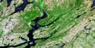
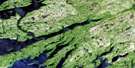
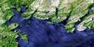
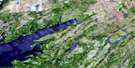
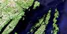
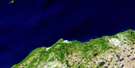
Harbour Buffett Satellite Image Map
Download Free Aerial Photo 001M09 at 1:50,000 scale
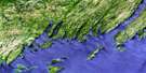
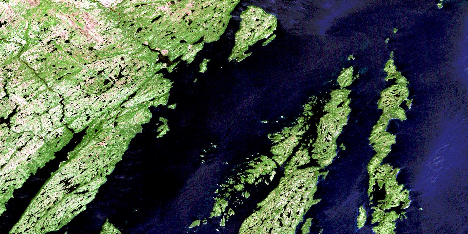
Harbour Buffett Satellite Imagery
To view this satellite map, mouse over the air photo on the right.
You can also download this satellite image map for free:
001M09 Harbour Buffett high-resolution satellite image map.
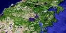
Maps for the Harbour Buffett aerial map sheet 001M09 at 1:50,000 scale are also available in these versions:
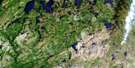
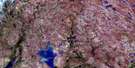
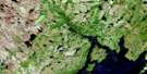
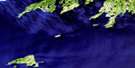
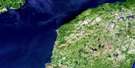
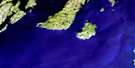
Harbour Buffett Surrounding Area Aerial Photo Maps
 |
 |
 |
 |
 |
 |
 |
 |
 |
 |
 |
 |
 |
 |
 |
 |
© Department of Natural Resources Canada. All rights reserved.
Harbour Buffett Gazetteer
The following places can be found on satellite image map 001M09 Harbour Buffett:
Harbour Buffett Satellite Image: Bays
Arnold's CoveBack Cove
Baker Cove
Bar Haven
Bear Cove
Best's Harbour
Big Dog Harbour
Big Southwest Cove
Broad Cove
Browns Cove
Buffett Harbour
Butts Hole
Civil East Cove
Clattice Harbour
Coffins Cove
Collett Cove
Collins Cove
Cooper Cove
Cooper Cove
Cooper's Cove
Crabbe Cove
Davis Cove
Deep Cove
Deep Cove
Dog Harbour
Doting Hole
Doting Hole
Dunn Cove
Glendon Cove
Grandies Cove
Great Brule Harbour
Great Sandy Harbour
Haddock Cove
Hay Cove
Haystack Harbour
Hennesy Cove
Holletts Cove
Jean de Gaunt Cove
Jean de Gaunt Harbour
Ladder Cove
Little Brule Harbour
Little Harbour
Little Sandy Harbour
Merchant Cove
Merry Harbour
Nan Cove
New Harbour
North East Cove
North Wild Cove
Northeast Cove
Paradise Sound
Placentia Bay
Port Royal
Port Royal Arm
Port Royal Cove
Riley Cove
Smiths Cove
Southwest Cove
Spencer Cove
Spencers Cove
St. Bernard's Cove
Thibaut Cove
Tom Murray Cove
Toms Bottom
Harbour Buffett Satellite Image: Capes
Barren PointBenny Point
Brimstone Head
Brown Head
Brule Harbour Head
Burin Peninsula
Calls Point
Carroll Point
Clattice Harbour Head
Culleton Head
Dewden Point
Dog Harbour Head
Dog Harbour Neck
Grassy Point
Greep Head
Gulch Head
Gunning Point
Hospital Head
James Point
Jigging Point
Kearney Head
Ladder Cove Head
Long Beach Point
Long Island Point
Macweiches Point
Nan Point
New Harbour Head
Otter Point
Otter Point
Parfrey Head
Parfrey Point
Pond Head
Red Point
Redhead Point
Rose au Rue Point
Stickland Point
Tacks Head
Tobins Point
West Point
Western Cove Head
Harbour Buffett Satellite Image: Channels
Bordeaux GutCentral Channel
Eastern Channel
Judges Gut
Sayers Gut
Western Channel
Harbour Buffett Satellite Image: Islands
Bagg's IslandBar Haven Island
Barren Island
Barren Island
Batts Island
Beerberry Islands
Bell Island
Big Dock Island
Big Island
Billy Green Islands
Bird Island
Bordeaux Island
Bread Island
Buffett Island
Burnt Island
Butler Island
Chambers Island
Cheese Island
Circle Island
Civil East Island
Collett Cove Island
Cooper Island
Crane Island
Creve Island
Creve Islands
Dicks Island
Dog Harbour Island
Duck Island
Duck Island
Duck Island
Fish Islands
Flat Island
Galton Island
George Best Island
George Dock Island
Goose Island
Gooseberry Island
Gray Gull Island
Great Coat Island
Green Island
Green Island
Green Island
Green Island
Green Island
Greens Island
Gull Islands
Hangmans Island
Harbour Island
Harbour Islands
Holletts Island
Holletts Islands
Hound Island
Isaac Island
Isle Valen
Jarvis Islands
Jean de Gaunt Island
King Island
Little Butler Island
Little Chambers Island
Long Island
Long Island
Lower Dock Island
Lower Gray Gull Islands
Marshall Island
Merasheen Island
Middle Island
Moor Island
North Tilt Island
Northwest Island
Og Island
Parfrey Island
Pincher Island
Pinnacle Island
Rabbit Island
Ragged Islands
Riley Island
Rose au Rue Island
Ryans Island
Saddleback Island
Sand Island
Shag Island
Shag Roost
Ship Island
Smith Island
South Tilt Island
Spruce Island
Stearin Island
Sugarloaf Island
The Castle
Trap Island
Vigors Island
West Island
White Island
White Islands
Harbour Buffett Satellite Image: Lakes
Gates PondNine Island Pond
Saltwater Pond
Harbour Buffett Satellite Image: Mountains
Hare's EarsJean de Gaunt Hill
Ledwick Hills
Lower Castle
Tacks Lookout
Tom Bottem Hill
Tom Bottom Hill
Toms Bottom Hill
Upper Castle
Harbour Buffett Satellite Image: Rivers
Black RiverParadise River
Sandy Harbour River
Skippers Brook
Harbour Buffett Satellite Image: River features
Long ReachHarbour Buffett Satellite Image: Shoals
Bar Haven BankBig Rock
Big Shoal
Brandies Shoal
Brule Shoal
Buffett Bank
Coombes Rock
Cross Rocks
Deep Water Bank
Dock Island Sunker
Duck Rock
Duck Rocks
Duck Rocks
Forked Duck Rock
Grandies Rocks
Grandmother Rocks
Green Island Rock
Harbour Rock
Harry Rock
Haystack
Haystack Bank
Little Harbour Rock
Mackerel Shoal
Mark Rock
Matthew Rock
Monks Ground
Net Rock
Roost Rock
Sam Adams Shoal
Saturday Ledge
Seal Rock
Seal Rocks
Shag Rocks
Shag Roost
Shag Roost Sunkers
Shoal Bank
Stearin Rock
The Castles
The Jerseyman
Tinker Rocks
Wareham Rock
Western Rock
Western Sunker
Whales Back Rock
White Island Bank
Williams Rock
Winging Rock
Yellow Rock
Harbour Buffett Satellite Image: Towns
Arnold's CoveHarbour Buffett Satellite Image: Unincorporated areas
Baker CoveBar Haven
Best's Harbour
Broad Cove
Coffin Cove
Cooper's Cove
Davis Cove
Glendon Cove
Great Brule
Harbour Buffett
Harbour Island
Haystack
Jean de Gaunt Island
Kingwell
Little Brule
Monkstown
Northeast Harbour Buffett
Peaches Cove
Port Royal
Prowseton
Rose au Rue
Sandy Harbour
Spencers Cove
Tacks Beach
The Tickles
Western Cove
© Department of Natural Resources Canada. All rights reserved.
001M Related Maps:
001M Belleoram001M01 Ship Cove
001M02 Jude Island
001M03 Marystown
001M04 Grand Bank
001M05 Harbour Breton
001M06 Point Entragee
001M07 Baine Harbour
001M08 Merasheen
001M09 Harbour Buffett
001M10 Terrenceville
001M11 Belleoram
001M12 Gaultois
001M13 St Alban's
001M14 Hungry Grove Pond
001M15 Gisborne Lake
001M16 Sound Island
