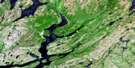
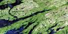
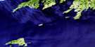
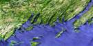
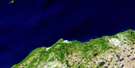
Point Entragee Satellite Image Map
Download Free Aerial Photo 001M06 at 1:50,000 scale
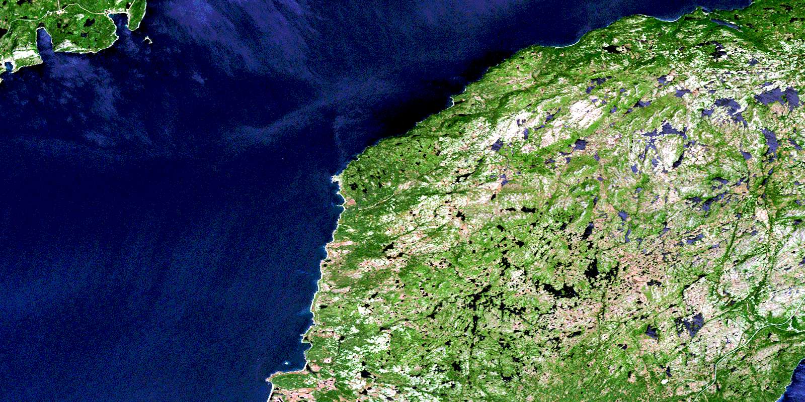
Point Entragee Satellite Imagery
To view this satellite map, mouse over the air photo on the right.
You can also download this satellite image map for free:
001M06 Point Entragee high-resolution satellite image map.
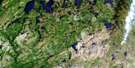
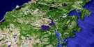
Maps for the Point Entragee aerial map sheet 001M06 at 1:50,000 scale are also available in these versions:
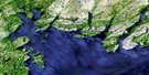
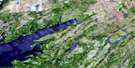
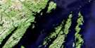
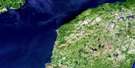
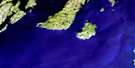
Point Entragee Surrounding Area Aerial Photo Maps
 |
 |
 |
 |
 |
 |
 |
 |
 |
 |
 |
 |
 |
 |
 |
 |
© Department of Natural Resources Canada. All rights reserved.
Point Entragee Gazetteer
The following places can be found on satellite image map 001M06 Point Entragee:
Point Entragee Satellite Image: Bays
Andleys CoveBack Cove
Bakeapple Cove
Belle Bay
Big Friar Cove
Blue Pinion Harbour
Brown Harbour
Browns Harbour
Canoe Cove
Caplin Cove
Country Path Cove
D'Argent Bay
Deep Bight
Doughball Cove
East Green Point Cove
Eastern Cove
English Harbour West
Fortune Bay
Fox Cove
Grand Jersey Cove
Grand John Cove
Gush Cove
Jones Cove Bottom
Little Friar Cove
Middle Head Cove
Otter Cove
Peltry Cove
Peltry North Cove
Rosée Harbour
Round Nap Cove
Seal Cove
Shepperds Cove
St. Jacques Harbour
Tilt Cove
Venison Cove
Weather Puff Cove
West Green Point Cove
Western Cove
Wild Cove
Wood Cove
Point Entragee Satellite Image: Beaches
Long BankLong Beach
Point Entragee Satellite Image: Capes
Big Doughball HeadBig Head
Bluff Head
Bluff Point
Crow Head
Devil Brook Head
Fish Rock Head
Garden Point
Grand Jersey Head
Grand John Head
Grand John Point
Harbour My God Point
Little Head
Middle Head
Miller Head
North Point
Otter Cove Point
Pat Anne Point
Point Enragée
Red Head
Red Landing Head
Scott Point
Sharp Point
Sharp Point
Tilt Point
West Point
West Sharp Point
Western Point
Western Point
Wild Cove Point
Wolf Head
Point Entragee Satellite Image: Forests
Eastern NeckRound Nap Wood
Point Entragee Satellite Image: Islands
Browns Harbour IslandDevil Brook Island
English Harbour Island
St. Jacques Island
Point Entragee Satellite Image: Lakes
Andleys PondBarasway de Plate
Barasway de Plate Pond
Beaver Ponds
Big Doughball Pond
Big Pond
Big Pond
Big Steel Pond
Black Duck Pond
Bobs Hill Pond
Bridals Pond
Brook Cove Pond
Brook Pond
Browns Harbour Pond
Catgut Pond
Charlies Pond
Cheesemans Pond
Clam Brook
Ducey Bark Pond
Foot of the Neck Pond
Football Pond
Goose Pond
Grand Jervais Gull Pond
Grand John Barasway
Grand John Gull Pond
Grand John Pond
Grandfather Lookout Pond
Gull Pond
Gull Pond
Harbour My God Barasway
Harbour My God Long Pond
Hay Ponds
Hideaway Pond
Horn Hill Pond
Inside Oil Pond
Inside Pond
Island Pond
Jerrys Pond
Jones Cove Pond
Jugtilt Pond
Kelp Shade Pond
Lily Pond
Little Doughball Pond
Little Loo Pond
Little River Ponds
Long Pond
Long Pond
Long Pond on the Neck
Loo Pond
Loo Pond
Lookout Ponds
Lower Western Cove Pond
Millers Woods Pond
Northwest Pond
Oil Ponds
Otter Pond
Outside Bobs Pond
Outside Pond
Pat Anne Pond
Peaches Pond
Peltry Barasway
Peltry Pond
Raggedy River Ponds
Redland Cove Pond
Redland Pond
Rocky Brook Pond
Saucepan Hill Pond
Scotts Barasway
Scotts Great Pond
Scotts Little Pond
Seal Cove Pond
Second Pond
Shepperds Pond
Southeast Pond
The Flats
Third Pond
Tilt Ponds
Tom Butlers Loo Pond
Uncle Johns Pond
Walshes Pond
Weather Puff Pond
Western Gull Pond
White Mountain Pond
Wood Cove Pond
Point Entragee Satellite Image: Mountains
Big HillBluff Head
Bobs Hills
Bottle Hill
Brown Lookout
Buttercup Hill
Garnish Blue Hills
Grandfather Lookout
Grandys Lookout
Hare Hill
Horn Hill
Horse Chops
Kelp Shade Hills
Long Tilt Hill
Lookout
Lookout(Hill)
Northwest Mountain
Pat Anne Hill
Pin Hill
Powderhorn Hill
Saucepan Hill
Scotts Hill
Snotchin Hill
The Rubbles
Tilt Hill
Western Lookout
Whales Trunk
White Mountain
Point Entragee Satellite Image: Rivers
Black RiverCatgut Brook
Daylongs Brook
Devil Brook
Doughball Brook
Eastern Black River
Eastern Brook
Fox Cove Brook
Grand Jervais Brook
Grand John River
Hay Brook
Jones Cove Brook
Jugtilt Brook
Raggedy River
Red Harbour Brook
Round Nap Brook
Scott Brook
Valences Brook
Western Brook
Wild Cove Pond Brook
Point Entragee Satellite Image: Shoals
Belleoram BanksBig Boot Shoal
Big Shoal
Blue Pinion Shoal
Blue Pinion Shoal
Charleys Rock
Dennis Shoal
Harbour Shoal
Hay Shoals
Little Boot Shoal
Mary Ann Shoal
Meadow Shoal
Middle Ground
North West Shoal
St. Jacques Shoal
Thoroughfare Shoal
Tilt Rock
White Rock
Wood Cove Rock
Point Entragee Satellite Image: Towns
Red HarbourSt. Jacques-Coomb's Cove
Point Entragee Satellite Image: Unincorporated areas
Barasway de PlateEnglish Harbour West
Grand John
Great Jervais
Point Enragée
Point Rosie
St. Jacques
Point Entragee Satellite Image: Valleys
Partridge GulchPeltry Bottom
Tilt Valley
© Department of Natural Resources Canada. All rights reserved.
001M Related Maps:
001M Belleoram001M01 Ship Cove
001M02 Jude Island
001M03 Marystown
001M04 Grand Bank
001M05 Harbour Breton
001M06 Point Entragee
001M07 Baine Harbour
001M08 Merasheen
001M09 Harbour Buffett
001M10 Terrenceville
001M11 Belleoram
001M12 Gaultois
001M13 St Alban's
001M14 Hungry Grove Pond
001M15 Gisborne Lake
001M16 Sound Island
