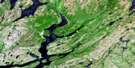
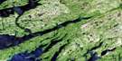
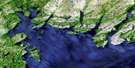
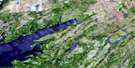
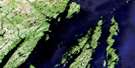
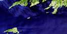
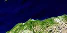
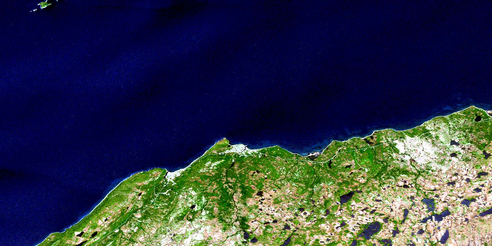
Grand Bank Satellite Image Map
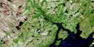
Download Free Aerial Photo 001M04 at 1:50,000 scale
Grand Bank Satellite Imagery
To view this satellite map, mouse over the air photo on the right.
You can also download this satellite image map for free:
001M04 Grand Bank high-resolution satellite image map.
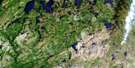
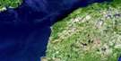
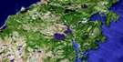
Maps for the Grand Bank aerial map sheet 001M04 at 1:50,000 scale are also available in these versions:
Grand Bank Surrounding Area Aerial Photo Maps
 |
 |
 |
 |
 |
 |
 |
 |
 |
 |
 |
 |
 |
 |
 |
 |
© Department of Natural Resources Canada. All rights reserved.
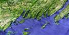
Grand Bank Gazetteer
The following places can be found on satellite image map 001M04 Grand Bank:
Grand Bank Satellite Image: Bays
Admiral CoveBeach Cove
Bouy Place
Caplin Cove
Famine Back Cove
Fortune Bay
Grand Bank Harbour
Kellys Cove
L'Anse à Paul
L'Anse au Loup
Lee Beach
Molliers Cove
Muddy Hole
Naked Mans Cove
Peter Cove
The Bight
Grand Bank Satellite Image: Beaches
Straight ShoreTrimms Beach
Grand Bank Satellite Image: Capes
Beach PointBlack Point
Bouilli Point
Burin Peninsula
Cross Point
Crouse Point
Evans Head
Famine Point
Fortune Head
Fox Hummocks
Grand Bank Head
Grand Beach Point
L'Anse au Loup Point
Lee Beach Point
Little Barasway Point
Long Point
Molliers Point
Schooner Point
The Cape
Grand Bank Satellite Image: Channels
First GulchFortune Gut
Grand Bank Gut
The Gut
Grand Bank Satellite Image: Forests
Connors WoodsSouthern Spot Woods
Grand Bank Satellite Image: Islands
Bird IslandPuffin Island
Grand Bank Satellite Image: Lakes
Admiral Cove PondAmerican Pond
Aunt Priscillas Ponds
Bar Pond
Bear Path Ponds
Big Gunville Pond
Black Duck Pond
Black Hill Woods Pond
Bulls Yard Pond
Burnt Hill Pond
Central Famine Ponds
Connors Woods Ponds
Country Pond
Cross Brook Pond
Crouse Barasway
Crouse Gull Pond
Crouse Pond
Dantzic Pond
Eastern Fork Famine Pond
Eastern Spell Pond
Famine Barasway
Famine Mowing Pond
Famine Pond
Famine Pond
Flahertys Pond
Forseys Pond
Fortune Barasway
Fresh Pond
Grand Bank Ponds
Grand Beach Barasway
Gull Pond
Gull Pond
Gunville Pond
Head Waters
Hill Of Birch Pond
Hunters Burnt Ground Pond
Inside Reservoir
Island Pond
L'Anse au Loup Barasway
L'Anse au Loup Country Pond
L'Anse au Loup Pond
L'anse au Loup Rocky Pond
Little Barasway
Little Barasway Pond
Long Pond
Long Pond
Martree Pond
Molliers Black Duck Pond
Moo Pond
Mud Pond
Northwest Pond
Northwest Pond
Old Hill Pond
Outside Reservoir
Piercey Brook Ponds
Round Pond
Spruce Pond
Stern Pond
Tolt Ponds
Western Angle Pond
Western Fork Famine Ponds
Wet Tilt Pond
Woody Island Pond
Woody Island Ponds
Grand Bank Satellite Image: Miscellaneous
Bulls YardPork Chop Pit
Grand Bank Satellite Image: Mountains
Baggers HillBennett Hill
Fortune Hill
Fortune Tolt
Jenkins Hill
Lebeach Hill
LeBeach Hill
Lee Beach Hill
Lewis Hill
Maloneys Hill
Middle Ridge
Middle Ridge
Mount Pleasant
Old Hill
Tumbling Hill
Wet Tilt Ridge
Grand Bank Satellite Image: Conservation areas
Fortune Head Ecological ReserveGrand Bank Satellite Image: Rivers
Burnells BrookCashmere Brook
Clawbonny Brook
Cross Brook
Crouse East Brook
Crouse West Brook
Darkhole Brook
Famine Brook
First Western Brook
Forseys Brook
Fortune Brook
Georges Brook
Grand Bank Brook
Gunville Brook
Hamilton Brook
Hawkins Brook
Horse Brook
L'Anse au Loup Brook
Little Barasway Brook
Loggerhead Brook
Muskrat Brook
Piercey Brook
Salmonier River
Second Western Brook
Stair Brook
Stern Pond Brook
Grand Bank Satellite Image: River features
Fortune ElbowGrand Bank Satellite Image: Undersea features
Banister ShoalGreen Island Shoal
Grand Bank Satellite Image: Shoals
Baldon RockL'Anse au Loup Rock
Old Rue Bank
Scott Rock
Yellow Rocks
Grand Bank Satellite Image: Towns
FortuneGrand Bank
Point May
Grand Bank Satellite Image: Unincorporated areas
Grand BeachL'Anse-au-Loup
Molliers
Grand Bank Satellite Image: Valleys
Second GulchGrand Bank Satellite Image: Low vegetation
Old Hill MarshTom Lees Marsh
© Department of Natural Resources Canada. All rights reserved.
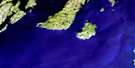
001M Related Maps:
001M Belleoram001M01 Ship Cove
001M02 Jude Island
001M03 Marystown
001M04 Grand Bank
001M05 Harbour Breton
001M06 Point Entragee
001M07 Baine Harbour
001M08 Merasheen
001M09 Harbour Buffett
001M10 Terrenceville
001M11 Belleoram
001M12 Gaultois
001M13 St Alban's
001M14 Hungry Grove Pond
001M15 Gisborne Lake
001M16 Sound Island
