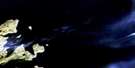
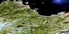
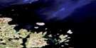
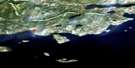
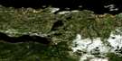
Pottles Bay Satellite Image Map
Download Free Aerial Photo 013I05 at 1:50,000 scale
Pottles Bay Satellite Imagery
To view this satellite map, mouse over the air photo on the right.
You can also download this satellite image map for free:
013I05 Pottles Bay high-resolution satellite image map.
Maps for the Pottles Bay aerial map sheet 013I05 at 1:50,000 scale are also available in these versions:
Pottles Bay Surrounding Area Aerial Photo Maps
 |
|||
 |
 |
||
 |
 |
 |
|
 |
 |
© Department of Natural Resources Canada. All rights reserved.
Pottles Bay Gazetteer
The following places can be found on satellite image map 013I05 Pottles Bay:
Pottles Bay Satellite Image: Bays
Black Island BightBlackDuck Cove
Bluff Head Cove
Flowers Cove
Groswater Bay
Hamilton Inlet
Pottles Bay
Queens Bight
Rattlers Bight
Rocky Cove
Tommys Deer Cove
Pottles Bay Satellite Image: Capes
Allies HeadBluff Head
Carocajou Point
Little Heads
Little Jules Head
Long Point
Point of Bar
Pompeys Leg
Westward Point
Pottles Bay Satellite Image: Channels
Black Island TicklePottles Bay Satellite Image: Islands
Black IslandBy Islands
Catos Island
Gull Island
Little Black Island
Saddle Island
Twin Islands
Watch and Chain
West Pompey Island
Pottles Bay Satellite Image: Lakes
Aerial PondBlack Island Pond
Bluff Head Big Pond
Pottles Bay Big Pond
Pottles Bay Satellite Image: Mountains
Big Jules HeadBig White Hill
Chancy Mountains
Round Hill
Sharp Hill
Stag Hill
Pottles Bay Satellite Image: Rivers
Black Island BrookBrook
Corner Brook
Little Brook
Little Brook
Northwest Brook
Sou'west Brook
Trouting Brook
Pottles Bay Satellite Image: Shoals
Sand BanksShag Rocks
Pottles Bay Satellite Image: Valleys
Cork Gulch
© Department of Natural Resources Canada. All rights reserved.
013I Related Maps:
013I Groswater Bay013I03E West Bay
013I03W West Bay
013I04E Tinker Harbour
013I04W Tinker Harbour
013I05E Pottles Bay
013I05W Pottles Bay
013I06E Indian Harbour
013I06W Indian Harbour
013I07W White Bear Island
013I11E Holton Harbour
013I11W Holton Harbour
013I12E Byron Bay
013I12W Byron Bay
013I13W Cape Harrison
