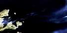
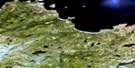
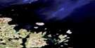
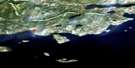
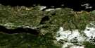
Indian Harbour Satellite Image Map
Download Free Aerial Photo 013I06 at 1:50,000 scale
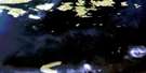
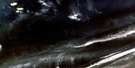
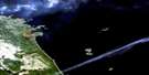
Indian Harbour Satellite Imagery
To view this satellite map, mouse over the air photo on the right.
You can also download this satellite image map for free:
013I06 Indian Harbour high-resolution satellite image map.
Maps for the Indian Harbour aerial map sheet 013I06 at 1:50,000 scale are also available in these versions:
Indian Harbour Surrounding Area Aerial Photo Maps
 |
|||
 |
 |
||
 |
 |
 |
|
 |
 |
© Department of Natural Resources Canada. All rights reserved.
Indian Harbour Gazetteer
The following places can be found on satellite image map 013I06 Indian Harbour:
Indian Harbour Satellite Image: Bays
Cut Throat HarbourEast Harbour
Edwards Harbour
George Island Cove
Groswater Bay
Hamilton Inlet
Indian Harbour
Little Harbour
Pottles Bay
Queens Bight
South Harbour
Winters Cove
Indian Harbour Satellite Image: Capes
Cut Throat PointEast Head
Indian Head
Lawrenceson Point
Leith Point
Long Point
Mann Point
Palmer Point
Pigeon Point
Round Head
Smokey Head
Indian Harbour Satellite Image: Channels
Cut Throat TickleIce Tickle
Run By Guess
Smokey Tickle
Indian Harbour Satellite Image: Islands
Bacalhao IslandBig Island
Boxer Island
Cut Throat Island
Double Islands
East Big Island
East Pompey Island
Entry Island
Five Islands
Foxy Islands
George Island
Green Island
Green Islet
Gull Islet
Herring Islands
Hullet Island
Ice Tickle Island
Indian Island
Little Entry Island
Marks Island
Mundy Island
North Duck Islands
North Green Island
Pigeon Island
Pinchgut Islet
Pompey Island
Ponsonby Island
Puffin Island
Round Head Island
Run By Guess Island
Southern Group
Tinker Island
Tinker Island
Winter Island
Indian Harbour Satellite Image: Mountains
Shakespeare HillIndian Harbour Satellite Image: Seas
Labrador SeaIndian Harbour Satellite Image: Shoals
Arthy ReefBlacks Rocks
Bulldog Rock
Jigger Rock
Leeming Rock
Lewis Rock
Tommy Rocks
Indian Harbour Satellite Image: Unincorporated areas
Indian HarbourSmokey

© Department of Natural Resources Canada. All rights reserved.
013I Related Maps:
013I Groswater Bay013I03E West Bay
013I03W West Bay
013I04E Tinker Harbour
013I04W Tinker Harbour
013I05E Pottles Bay
013I05W Pottles Bay
013I06E Indian Harbour
013I06W Indian Harbour
013I07W White Bear Island
013I11E Holton Harbour
013I11W Holton Harbour
013I12E Byron Bay
013I12W Byron Bay
013I13W Cape Harrison
