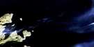
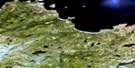
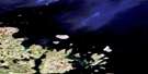
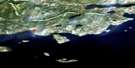
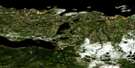
Holton Harbour Satellite Image Map
Download Free Aerial Photo 013I11 at 1:50,000 scale
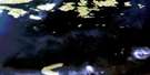
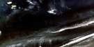
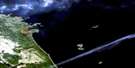
Holton Harbour Satellite Imagery
To view this satellite map, mouse over the air photo on the right.
You can also download this satellite image map for free:
013I11 Holton Harbour high-resolution satellite image map.
Maps for the Holton Harbour aerial map sheet 013I11 at 1:50,000 scale are also available in these versions:
Holton Harbour Surrounding Area Aerial Photo Maps
 |
|||
 |
 |
||
 |
 |
 |
|
 |
 |
© Department of Natural Resources Canada. All rights reserved.
Holton Harbour Gazetteer
The following places can be found on satellite image map 013I11 Holton Harbour:
Holton Harbour Satellite Image: Bays
Alliuk BightBrig Harbour
Dark Tickle Harbour
Emily Harbour
Holton Harbour
Horse Harbour
Little Holton
Sloop Harbour
Teapot Cove
Holton Harbour Satellite Image: Capes
Long PointMan of War Point
Rill Point
Sloop Harbour Point
Teapot Head
Holton Harbour Satellite Image: Islands
Boaz IslandBrig Harbour Island
Butt Island
Camel Island
Chance Island
Coffee Island
Cut Throat Island
Deadman Island
Double Island
Duck Island
Duck Islands
Fairy Island
Flat Island
Fox Island
Green Island
Green Island
Green Islet
Holton Island
Lark Island
Little Brig Island
Little Pigeon Island
Marks Island
Northern Group
Pigeon Island
Quaker Hat
Run By Guess Island
Teapot Island
Thomey Island
White Cockade Island
Holton Harbour Satellite Image: Shoals
Black RockBrig Harbour Rock
Brig Harbour Shoal
Harbour Rock
Harbour Rock
Isolated Rock
Quaker Reef
Taylor Rock
Holton Harbour Satellite Image: Unincorporated areas
Emily HarbourHolton

© Department of Natural Resources Canada. All rights reserved.
013I Related Maps:
013I Groswater Bay013I03E West Bay
013I03W West Bay
013I04E Tinker Harbour
013I04W Tinker Harbour
013I05E Pottles Bay
013I05W Pottles Bay
013I06E Indian Harbour
013I06W Indian Harbour
013I07W White Bear Island
013I11E Holton Harbour
013I11W Holton Harbour
013I12E Byron Bay
013I12W Byron Bay
013I13W Cape Harrison
