
Sturgeon Falls Satellite Image Map
Download Free Aerial Photo 031L05 at 1:50,000 scale
Sturgeon Falls Satellite Imagery
To view this satellite map, mouse over the air photo on the right.
You can also download this satellite image map for free:
031L05 Sturgeon Falls high-resolution satellite image map.
Maps for the Sturgeon Falls aerial map sheet 031L05 at 1:50,000 scale are also available in these versions:
Sturgeon Falls Surrounding Area Aerial Photo Maps
 |
 |
 |
 |
 |
 |
 |
 |
 |
 |
 |
 |
 |
 |
 |
 |
© Department of Natural Resources Canada. All rights reserved.
Sturgeon Falls Gazetteer
The following places can be found on satellite image map 031L05 Sturgeon Falls:
Sturgeon Falls Satellite Image: Bays
Cache BayDutrisac's Bay
Great North Bay
McLeod Bay
Minnehaha Bay
Moose Bay
Sturgeon Falls Satellite Image: Capes
Beaucage PointDokis Point
Dukis Point
Ferris Point
Goulais Island Point
Goulard's Point
Jocko Point
Mousseau Point
One Mile Point
Pointe à Beaucage
Pointe à Goulais
Yellek Point
Sturgeon Falls Satellite Image: City
Nipissing OuestSturgeon Falls Satellite Image: Cliffs
Côte à BellefeuilleSturgeon Falls Satellite Image: Falls
Chutes à SandyCrystal Falls
Duchesnay Falls
Sandy Falls
Sturgeon Falls
Sturgeon Falls Satellite Image: Geographical areas
BeaucageBertram
Blyth
Charlton
Commanda
Field
Grant
Merrick
Nipissing
Pedley
Springer
Widdifield
Sturgeon Falls Satellite Image: Indian Reserves
Nipissing 10Nipissing Indian Reserve 10
Réserve indienne Nipissing 10
Sturgeon Falls Satellite Image: Islands
Burritt IslandCalder Island
Cockburn Island
Dalaire's Island
Duck Island
Garden Island
Goose Islands
Great Manitou Island
Île de Fer
Île Pine
Îles Manitou
Iron Island
Jocko Point Islands
Little Iron Island
Little Manitou Island
Manitou Islands
Newman Island
Pine Island
Rankin Island
Toba's Little Islands
Sturgeon Falls Satellite Image: Lakes
Blyth LakeBooth Lake
Burnt Lake
Burt Lake
Cameron Lake
Chebogomog Lake
Coburn Lake
Cockburn Lake
Lac Brûlé
Lac Caché
Lac Cameron
Lac Chebogan
Lac Nipissing
Lake Nipissing
Lost Lake
McFarlane Lake
McInnis Lake
Moss Lake
Mudcat Lake
Springer Lake
Sturgeon Falls Satellite Image: Mountains
Bellefeuille HillSturgeon Falls Satellite Image: Other municipal/district area - miscellaneous
CaldwellField
Springer
Sturgeon Falls Satellite Image: Conservation areas
Manitou Islands Provincial Nature ReserveMudcat Lake Forest Conservation Reserve
Smoky River Headwaters Conservation Reserve
Sturgeon Falls Satellite Image: Rivers
Brule CreekBrûlé Creek
Duchesnay Creek
Duchesnay River
First Creek
Laronde Creek
Little Cache River
Little Sturgeon River
Moose Creek
Mosquito Creek
Mud Creek
Mudcat Creek
Rivière Tomiko
Smoke River
Smoky River
Sturgeon River
Tomiko River
Sturgeon Falls Satellite Image: Shoals
Delorme's RockSturgeon Falls Satellite Image: Towns
West NipissingSturgeon Falls Satellite Image: Unincorporated areas
BeaucageCache Bay
Crystal Falls
Duchesnay
Evansville
Garden Village
Harfred
Indian Reserve
Meadowside
Sturgeon Falls
Yellek
Sturgeon Falls Satellite Image: Low vegetation
Cranberry Marsh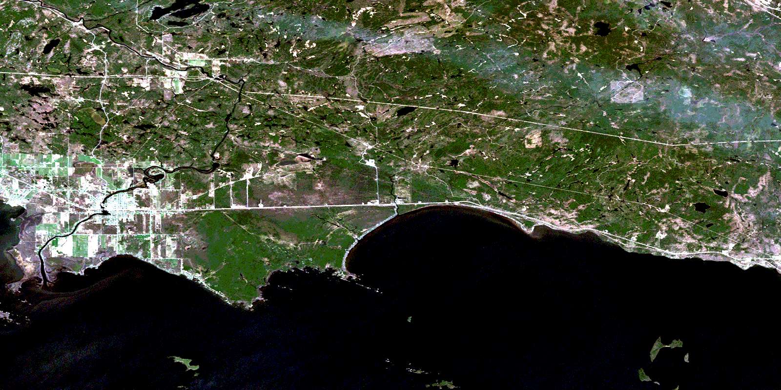
© Department of Natural Resources Canada. All rights reserved.
031L Related Maps:
031L North Bay031L01 Brent
031L02 Kiosk
031L03 Powassan
031L04 Nipissing
031L05 Sturgeon Falls
031L06 North Bay
031L07 Mattawa
031L08 Riviere Maganasipi
031L09 Lac Bleu
031L10 Lac Beauchene
031L11 Temiscaming
031L12 Marten Lake
031L13 Ingall Lake
031L14 Ottertail Creek
031L15 Lac Grindstone
031L16 Lac Sairs

 Newsletter Sign-up


