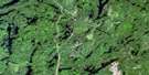
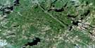
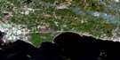
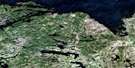
Brent Satellite Image Map
Download Free Aerial Photo 031L01 at 1:50,000 scale
Brent Satellite Imagery
To view this satellite map, mouse over the air photo on the right.
You can also download this satellite image map for free:
031L01 Brent high-resolution satellite image map.
Maps for the Brent aerial map sheet 031L01 at 1:50,000 scale are also available in these versions:
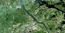
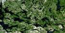
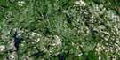
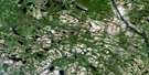
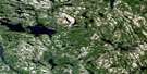
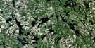
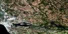
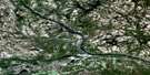
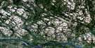
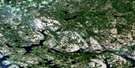
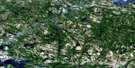
Brent Surrounding Area Aerial Photo Maps
 |
 |
 |
 |
 |
 |
 |
 |
 |
 |
 |
 |
 |
 |
 |
 |
© Department of Natural Resources Canada. All rights reserved.
Brent Gazetteer
The following places can be found on satellite image map 031L01 Brent:
Brent Satellite Image: Bays
Bissett BayLafortune Bay
Brent Satellite Image: Capes
Maraboo PointBrent Satellite Image: Craters
Brent CraterBrent Satellite Image: Falls
Devils ChuteBrent Satellite Image: Geographical areas
AberfordCameron
Clara
Deacon
Edgar
FitzGerald
Lister
Maria
Nipissing
Renfrew
White
Brent Satellite Image: Islands
Acanthus IslandRocher Capitaine Island
Brent Satellite Image: Lakes
Acanthus LakeAdelard Lake
Alco Lake
Allan Lake
Arrow Lake
Aumond Lake
Barbut Lake
Bernard Lake
Berwick Lake
Big Bissett Lake
Big George Lake
Big Poplar Lake
Big Shingle Lake
Billys Lake
Bissett Lake
Blackbass Lake
Blimkie Lake
Bluebill Lake
Bukadawin Lake
Campground Lake
Cap Lake
Carpenter Lake
Cedar Lake
Chateau Lake
Chela Lake
Christopher Robin Lake
Clamshell Lake
Clara Lake
Claradeer Lake
Cliff Lake
Collins Lake
Corbeau Lake
Cranberry Lake
Crystalline Lake
Decoy Lake
Deerhorn Lake
Deermeadow Lake
Deposit Lake
Dingley Lake
Dorami Lake
Ducknest Lake
Duhaime Lake
East Plover Lake
Esker Lake
First Twin Pond
Fitz Lake
Gardiner Lake
Genack Lake
Gerald Lake
Ghost Lake
Gibson Lake
Gilmour Lake
Grants Lake
Greenbough Lake
Gum Lake
Harveys Shanty Lake
Harvey's Shanty Lake
Holden Lake
Horseshoe Lake
Houghton Lake
Ignace Lake
Jackson Lake
Kabibonoka Lake
Kanga Lake
Kangas Lake
Lac Holden
Lafrenieres Lake
Lake Travers
Lake Traverse
Linear Lake
Little Lake
Little Marten Lake
Little North River Lake
Little Wabamimi Lake
Little Wabimimi Lake
Lost Coin Lake
Mag Lake
Maki Lake
Maraboo Lake
Mart Lake
Maskwa Lake
Max Lake
Menona Lake
Merganser Lake
Mishimagwa Lake
Mishimokwa Lake
Morin Lake
Mousseau Lake
Mud Lake
Mullin Lake
Mums Lake
Muskwa Lake
Nadon Lake
North Depot Lake
North River Lake
North Rouge Lake
Otterpaw Lake
Owlet Lake
Paddy Lake
Pan Lake
Peboan Lake
Piglet Lake
Plover Lake
Pooh Lake
Powell Lake
Puffball Lake
Quartz Lake
Rabbit Lake
Radiant Lake
Rana Lake
Rattail Lake
Redpine Lake
Reed Lake
Rinne Lake
Rit Lake
Rockery Lake
Roo Lake
Second Twin Pond
Shingeris Lake
Shingle Lake
Shoal Lake
Snipe Lake
Snow Lake
Southwind Lake
Span Lake
Stans Lake
Stoney Lake
Tallspruce Lake
Tecumseh Lake
Tigger Lake
Tower Lake
Township Line Lake
Twin Ponds
Twosound Lake
Valiant Lake
Wabamimi Lake
Wabimimi Lake
Waterloo Lake
Weasel Lake
Wee George Lake
Wendigo Lake
Whittla Lake
Windigo Lake
Wren Lake
Brent Satellite Image: Mountains
Battle HillBrent Satellite Image: Other municipal/district area - miscellaneous
CameronHead, Clara and Maria
Papineau
Papineau-Cameron
Brent Satellite Image: Conservation areas
Algonquin Provincial ParkBissett Creek Provincial Park
Greenbough Esker Conservation Reserve
Brent Satellite Image: Rapids
Rocher Capitaine RapidsBrent Satellite Image: Rivers
Alco CreekAumond Creek
Barbut Creek
Bissett Creek
Black Creek
Blackbass Creek
Cap Creek
Chela Creek
Clara Creek
Corbeau Creek
Corice Creek
Deerhorn Creek
Deermeadow Creek
Deux Rivières Creek
Dorami Creek
George Creek
Ghost Creek
Gibson Creek
Grant Creek
Grants Creek
Kabibonoka Creek
Lafortune Creek
Little Bissett Creek
Little Gilmour Creek
Maraboo Creek
Maskwa Creek
Menona Creek
Merganser Creek
Mishimagwa Creek
Mishimokwa Creek
Muskwa Creek
North Bissett Creek
North Corbeau Creek
North River
North Rouge Creek
Ottawa River
Otterpaw Creek
Peboan Creek
Petawawa River
Plover Creek
Powell Creek
Rivière des Outaouais
Rivière des Outaouais
Rivière Ottawa
Sheedys Creek
Shingeris Creek
Shingle Creek
Wabimimi Creek
Waterloo Creek
West Aumond Creek
Brent Satellite Image: Unincorporated areas
AcanthusAdelard
Aylen
Bissett
Bissett Creek
Brent
Deux Rivières
Deux-Rivières
Gratan
Brent Satellite Image: Low vegetation
Jims Marsh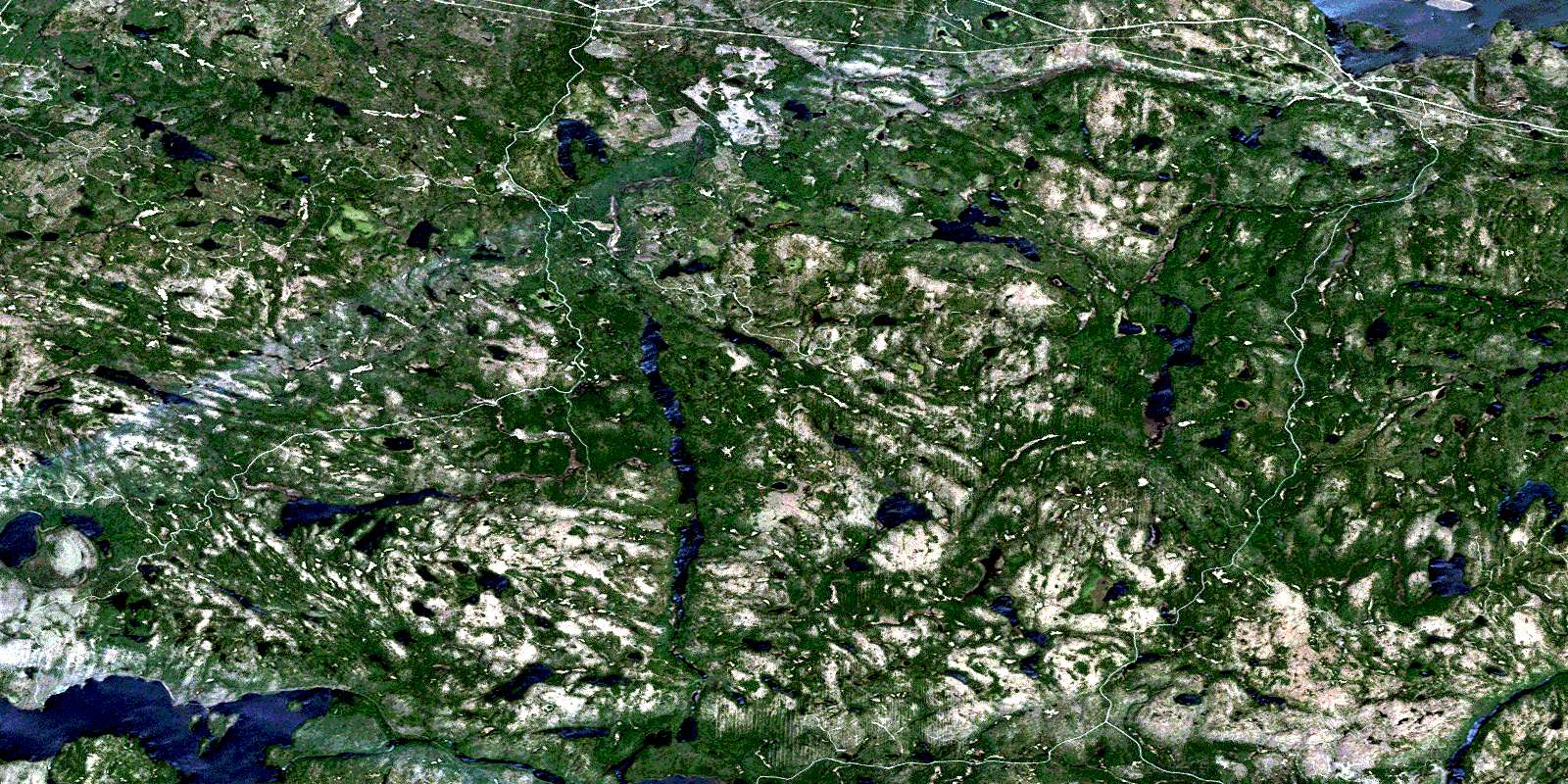
© Department of Natural Resources Canada. All rights reserved.
031L Related Maps:
031L North Bay031L01 Brent
031L02 Kiosk
031L03 Powassan
031L04 Nipissing
031L05 Sturgeon Falls
031L06 North Bay
031L07 Mattawa
031L08 Riviere Maganasipi
031L09 Lac Bleu
031L10 Lac Beauchene
031L11 Temiscaming
031L12 Marten Lake
031L13 Ingall Lake
031L14 Ottertail Creek
031L15 Lac Grindstone
031L16 Lac Sairs
