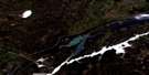
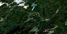
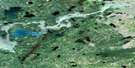
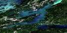
Cotton Lake Satellite Image Map
Download Free Aerial Photo 063P02 at 1:50,000 scale
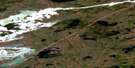
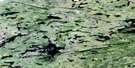
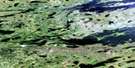
Cotton Lake Satellite Imagery
To view this satellite map, mouse over the air photo on the right.
You can also download this satellite image map for free:
063P02 Cotton Lake high-resolution satellite image map.
Maps for the Cotton Lake aerial map sheet 063P02 at 1:50,000 scale are also available in these versions:
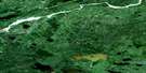
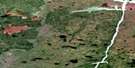
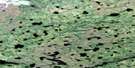
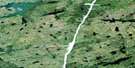
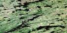
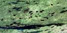
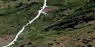
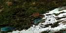
Cotton Lake Surrounding Area Aerial Photo Maps
 |
 |
 |
 |
 |
 |
 |
 |
 |
 |
 |
 |
 |
 |
 |
 |
© Department of Natural Resources Canada. All rights reserved.
Cotton Lake Gazetteer
The following places can be found on satellite image map 063P02 Cotton Lake:
Cotton Lake Satellite Image: Bays
Gosselin BayHenry Bay
Cotton Lake Satellite Image: Capes
Edwards PeninsulaCotton Lake Satellite Image: Islands
Benson IslandCarley Island
MacDougall Island
Peters Island
Robinson Island
Wells Island
Cotton Lake Satellite Image: Lakes
Alan McLeod LakeBlack Rabbit Lake
Boehmer Lake
Bulkley Lake
Coaffee Lake
Cotton Lake
David Smith Lake
Gerald Roberts Lake
Gittens Lake
Gittins Lake
Gladu Lake
Herman Lake
Hermon Lake
Hetherington Lake
John Allan Lake
McHaffie-Gow Lake
McHofflie Lake
Miskimmin Lake
Mutcheson Lake
Unwin Lake
Wetiko Lake
Wilkins Lake
Cotton Lake Satellite Image: Rivers
Atik RiverDevil Brook
Fleuve Nelson
Mahigan River
Mistasinni River
Nelson River
Utik River
Wetiko River
Cotton Lake Satellite Image: Road features
Pemechikamik Portage
© Department of Natural Resources Canada. All rights reserved.
063P Related Maps:
063P Sipiwesk063P01 Allbright Lake
063P02 Cotton Lake
063P03 Bulger Lake
063P04 Mustekapau Lake
063P05 Thicket Portage
063P06 Landing Lake
063P07 German Lake
063P08 Thom Lake
063P09 Bear Head Lake
063P10 Armstrong Lake
063P11 Pikwitonei
063P12 Thompson
063P13 Mystery Lake
063P14 Begg Lake
063P15 Arnot
063P16 Gunn Lake
