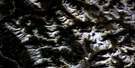
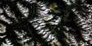
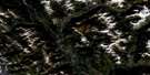
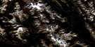
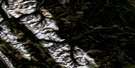
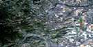
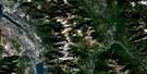
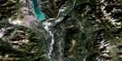
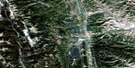
Fairmont Hot Springs Satellite Image Map
Download Free Aerial Photo 082J05 at 1:50,000 scale
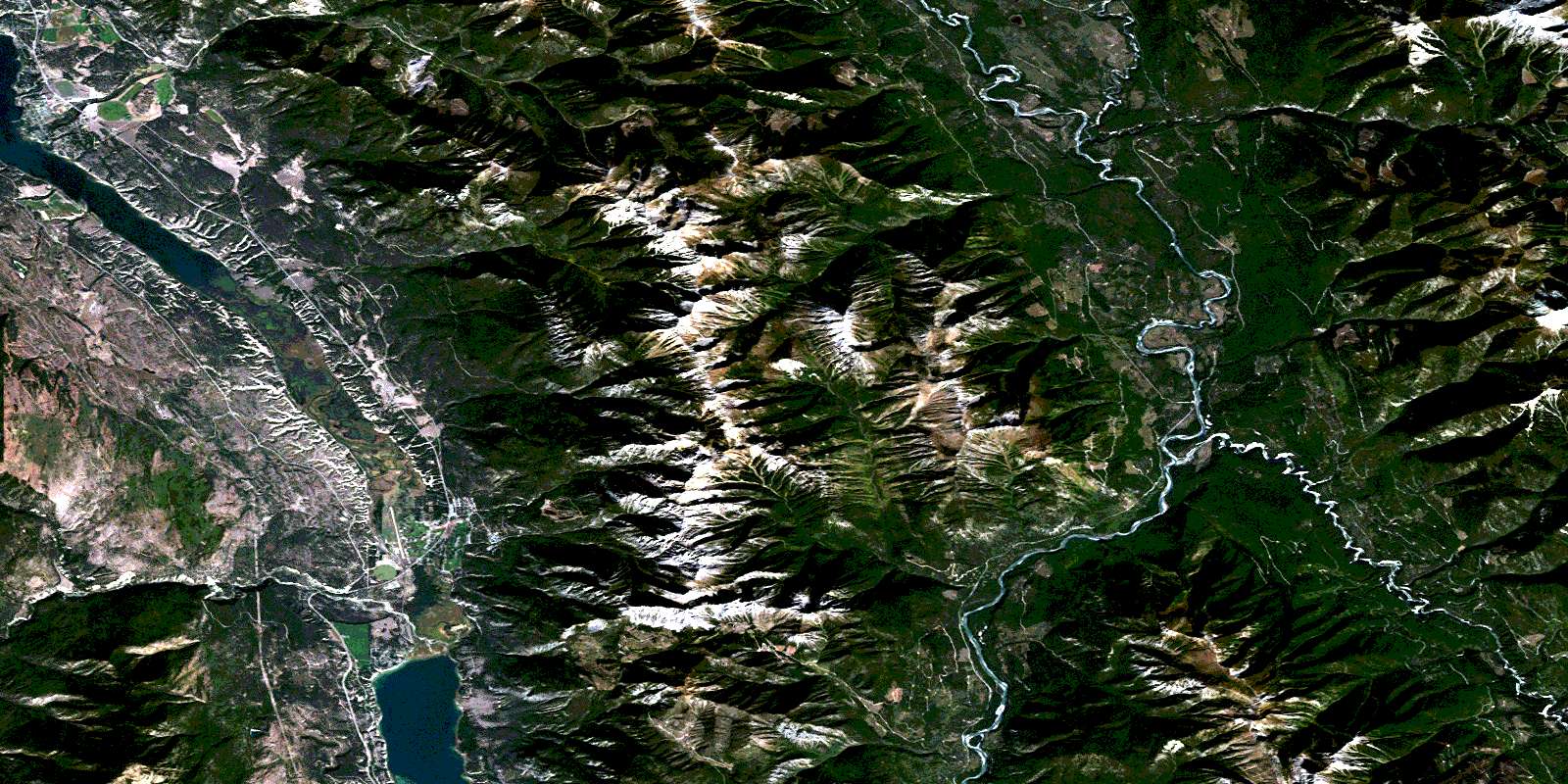
Fairmont Hot Springs Satellite Imagery
To view this satellite map, mouse over the air photo on the right.
You can also download this satellite image map for free:
082J05 Fairmont Hot Springs high-resolution satellite image map.
Maps for the Fairmont Hot Springs aerial map sheet 082J05 at 1:50,000 scale are also available in these versions:
Fairmont Hot Springs Surrounding Area Aerial Photo Maps
 |
 |
 |
 |
 |
 |
 |
 |
 |
 |
 |
 |
 |
 |
 |
 |
© Department of Natural Resources Canada. All rights reserved.
Fairmont Hot Springs Gazetteer
The following places can be found on satellite image map 082J05 Fairmont Hot Springs:
Fairmont Hot Springs Satellite Image: Bays
Armstrong BayFairmont Hot Springs Satellite Image: Cliffs
Gibraltar RockThe Hoodoos
Fairmont Hot Springs Satellite Image: Indian Reserves
Columbia Lake Indian Reserve 3Réserve indienne Columbia Lake 3
Fairmont Hot Springs Satellite Image: Lakes
Columbia LakeLyttle Lake
Lyttle Lake Reservoir
MacCarthy Lakes
MacCarthy Lakes Reservoir
Mud Lake
Tatley Slough
Windermere Lake
Fairmont Hot Springs Satellite Image: Mountains
Columbia MountainsFairmont Mountain
Fairmont Ridge
Four Points Mountain
Hughes Range
Indian Head Mountain
Kootenay Ranges
Montagnes Rocheuses
Mount Aeneas
Mount Bryan
Mount Pedley
Mount Stuart
Mount Tegart
Nappe Mountain
Park Ranges
Purcell Mountains
Rocky Mountains
Fairmont Hot Springs Satellite Image: Major municipal/district area - major agglomerations
Regional District of East KootenayFairmont Hot Springs Satellite Image: Conservation areas
Columbia Lake ParkWindermere Lake Park
Fairmont Hot Springs Satellite Image: Rivers
Brady CreekBrewer Creek
Cedrus Creek
Cold Spring Creek
Columbia River
Dry Creek
Dutch Creek
Ellenvale Creek
Fairmont Creek
Fenwick Creek
Fleuve Columbia
Geary Creek
Hardie Creek
Holland Creek
Jack Creek
Jane Creek
Johnston Creek
Kootenay River
Lansdowne Creek
Lemon Creek
Madias Creek
Major Creek
Mary Ann Creek
Meredith Creek
North Windermere Creek
Palliser River
Pedley Creek
Prust Creek
Tatley Creek
Tukats Creek
Warspite Creek
White River
Windermere Creek
Fairmont Hot Springs Satellite Image: Springs
Fairmont Hot SpringsFairmont Hot Springs Satellite Image: Unincorporated areas
FairmontFairmont Hot Springs
Rushmere
Windermere
Fairmont Hot Springs Satellite Image: Valleys
Pedley PassRocky Mountain Trench
Tegart Pass
© Department of Natural Resources Canada. All rights reserved.
082J Related Maps:
082J Kananaskis Lakes082J01 Langford Creek
082J02 Fording River
082J03 Mount Peck
082J04 Canal Flats
082J05 Fairmont Hot Springs
082J06 Mount Abruzzi
082J07 Mount Head
082J08 Stimson Creek
082J09 Turner Valley
082J10 Mount Rae
082J11 Kananaskis Lakes
082J12 Tangle Peak
082J13 Mount Assiniboine
082J14 Spray Lakes Reservoir
082J15 Bragg Creek
082J16 Priddis
