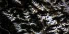
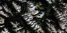
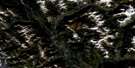
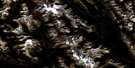
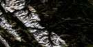
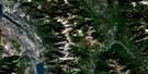
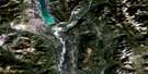
Mount Assiniboine Satellite Image Map
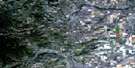
Download Free Aerial Photo 082J13 at 1:50,000 scale
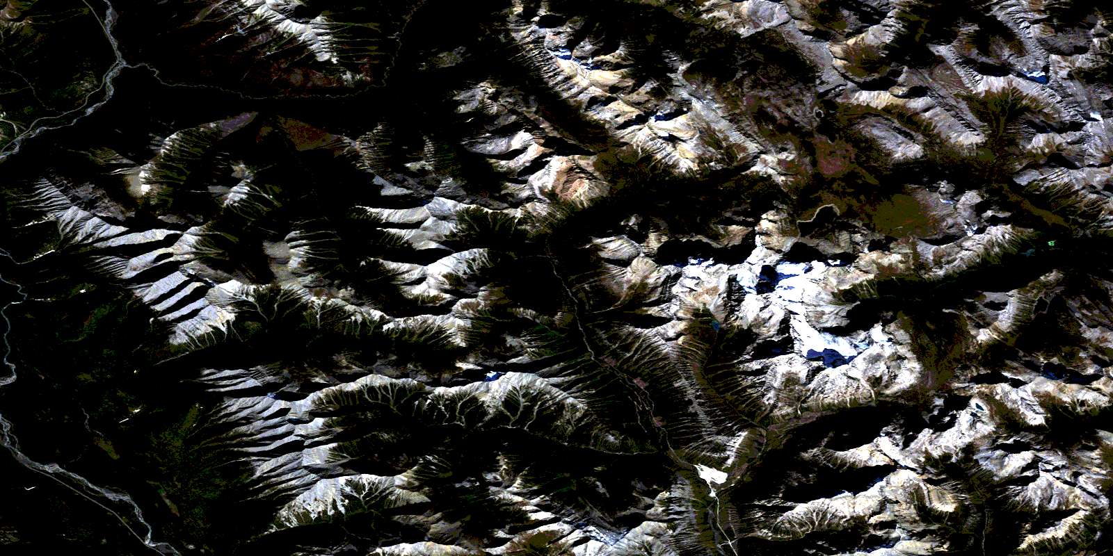
Mount Assiniboine Satellite Imagery
To view this satellite map, mouse over the air photo on the right.
You can also download this satellite image map for free:
082J13 Mount Assiniboine high-resolution satellite image map.
Maps for the Mount Assiniboine aerial map sheet 082J13 at 1:50,000 scale are also available in these versions:
Mount Assiniboine Surrounding Area Aerial Photo Maps
 |
 |
 |
 |
 |
 |
 |
 |
 |
 |
 |
 |
 |
 |
 |
 |
© Department of Natural Resources Canada. All rights reserved.
Mount Assiniboine Gazetteer
The following places can be found on satellite image map 082J13 Mount Assiniboine:
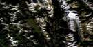
Mount Assiniboine Satellite Image: Glaciers
Brewster GlacierMount Assiniboine Satellite Image: Lakes
Assiniboine LakeCerulean Lake
Coney Lake
Dog Lake
Elizabeth Lake
Game Lake
Lake Gloria
Lake Magog
Lake Terrapin
Lunette Lake
Marvel Lake
Moose Bath Pond
Nestor Lake
Og Lake
Owl Lake
Rock Lake
Sunburst Lake
Wedgwood Lake
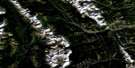
Mount Assiniboine Satellite Image: Mountains
Aurora MountainAurora Mountain
Aye Mountain
Aye Mountain
Blue Range
Blue Range
Brisco Range
Cascade Rock
Cave Mountain
Cave Mountain
Chucks Ridge
Eon Mountain
Eon Mountain
Gibraltar Rock
Gloria Mountain
Golden Mountain
Hawk Ridge
Indian Peak
Kootenay Ranges
Lachine Mountain
Lunette Peak
Lunette Peak
Marvel Peak
Mitchell Range
Montagnes Rocheuses
Montagnes Rocheuses
Mount Alcantara
Mount Allenby
Mount Assiniboine
Mount Assiniboine
Mount Aurora
Mount Aye
Mount Aye
Mount Brussilof
Mount Byng
Mount Cautley
Mount Cautley
Mount Daer
Mount Docking
Mount Eon
Mount Eon
Mount Gloria
Mount Gloria
Mount Harkin
Mount Magog
Mount Magog
Mount Mercer
Mount Red Man
Mount Red Man
Mount Sam
Mount Selkirk
Mount Strom
Mount Sturdee
Mount Terrapin
Mount Terrapin
Mount Watson
Mount Wedgwood
Naiset Point
Nasswald Peak
Nasswald Peak
Nestor Peak
Nub Peak
Nublet
Octopus Mountain
Og Mountain
Og Mountain
Park Ranges
Red Man Mountain
Red Man Mountain
Rocky Mountains
Rocky Mountains
Simpson Ridge
Spar Mountain
Split Peak
Sunburst Peak
Sunburst Peaks
Sundance Range
Terrapin Mountain
Terrapin Mountain
The Marshall
The Towers
The Towers
Wedgwood Peak
Windy Ridge
Windy Ridge
Wonder Peak
Wonder Peak
Mount Assiniboine Satellite Image: Major municipal/district area - major agglomerations
Regional District of East KootenayMount Assiniboine Satellite Image: Conservation areas
Banff National Park of CanadaKootenay National Park of Canada
Mount Assiniboine Park
Parc national du Canada Banff
Parc national du Canada Kootenay
Mount Assiniboine Satellite Image: Rivers
Alcantara CreekAllenby Creek
Assiniboine Creek
Aurora Creek
Brewster Creek
Brussilof Creek
Bryant Creek
Companion Creek
Cross River
Currie Creek
Daer Creek
Eon Creek
Extension Creek
Ferro Creek
Gog Lake
Indian Creek
Kootenay River
Lachine Creek
Lunette Creek
Magnesite Creek
Magog Creek
Marvel Creek
Meadow Creek
Mercer Creek
Mitchell River
Nestor Creek
Og Creek
Owl Creek
Pitts Creek
Sam Creek
Simpson River
Struna Creek
Surprise Creek
Turbulent Creek
Verdant Creek
Vermilion River
Wardle Creek
Wedgwood Creek
Mount Assiniboine Satellite Image: Valleys
Allenby PassAssiniboine Pass
Assiniboine Pass
Ferro Pass
Golden Valley
Hector Gorge
Marvel Pass
Marvel Pass
Og Pass
Og Pass
Sunburst Valley
Valley of the Rocks
Wonder Pass
Wonder Pass
Mount Assiniboine Satellite Image: Low vegetation
Lizzie MeadowsMcLeod Meadows
Mitchell Meadows
Police Meadows
© Department of Natural Resources Canada. All rights reserved.
082J Related Maps:
082J Kananaskis Lakes082J01 Langford Creek
082J02 Fording River
082J03 Mount Peck
082J04 Canal Flats
082J05 Fairmont Hot Springs
082J06 Mount Abruzzi
082J07 Mount Head
082J08 Stimson Creek
082J09 Turner Valley
082J10 Mount Rae
082J11 Kananaskis Lakes
082J12 Tangle Peak
082J13 Mount Assiniboine
082J14 Spray Lakes Reservoir
082J15 Bragg Creek
082J16 Priddis
