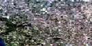
Astotin Lake Satellite Image Map
Download Free Aerial Photo 083H10 at 1:50,000 scale
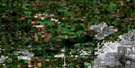
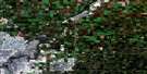
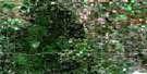
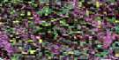
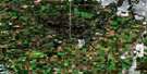
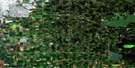
Astotin Lake Satellite Imagery
To view this satellite map, mouse over the air photo on the right.
You can also download this satellite image map for free:
083H10 Astotin Lake high-resolution satellite image map.
Maps for the Astotin Lake aerial map sheet 083H10 at 1:50,000 scale are also available in these versions:
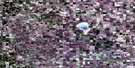
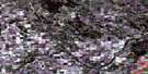
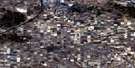
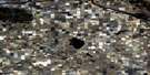
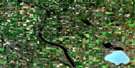
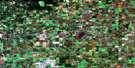
Astotin Lake Surrounding Area Aerial Photo Maps
 |
 |
 |
 |
 |
 |
 |
 |
 |
 |
 |
 |
 |
 |
 |
 |
© Department of Natural Resources Canada. All rights reserved.
Astotin Lake Gazetteer
The following places can be found on satellite image map 083H10 Astotin Lake:
Astotin Lake Satellite Image: Bays
Beaver BayCamp Bay
South Bay
Astotin Lake Satellite Image: Capes
Gull PointLong Island Point
Astotin Lake Satellite Image: Channels
The NarrowsAstotin Lake Satellite Image: Islands
Archer IslandCrane Island
Elk Island
Griesbach Island
Heron Island
High Island
Lamont Island
Line Island
Long Island
Mink Island
North Island
Pine Island
Raspberry Island
Spruce Island
Astotin Lake Satellite Image: Lakes
Adamson LakeAntler Lake
Astotin Lake
Bailey Lakes
Beaverhill Lake
Bennett Lake
Blackfoot Lake
Drygrass Lake
Eddy Lake
Emerald Lake
Flyingshot Lake
Goose Lake
Jordan Lake
Little Tawayik Lake
Moss Lake
Mud Lake
Oster Lake
Oxbow Lake
Paul Lake
Shirley Lake
Spruce Island Lake
Tawayik Lake
Trappers Lake
Walter Lake
Astotin Lake Satellite Image: Mountains
Tower HillAstotin Lake Satellite Image: Major municipal/district area - major agglomerations
Beaver CountyCounty of Beaver No. 9
County of Lamont No. 30
Lamont County
Strathcona County
Astotin Lake Satellite Image: Other municipal/district area - miscellaneous
Improvement District No. 13Astotin Lake Satellite Image: Conservation areas
Elk Island National Park of CanadaParc national du Canada Elk Island
Ukrainian Cultural Heritage Village Provincial Historic Site (Developed)
Astotin Lake Satellite Image: Rivers
Astotin CreekBeaverhill Creek
Lamont Creek
Norris Creek
Astotin Lake Satellite Image: Unincorporated areas
Good HopeSandy Beach
Astotin Lake Satellite Image: Villages
Chipman
© Department of Natural Resources Canada. All rights reserved.
