Larrys River Topo Map Online
Download Free Topo Map Sheet 011F03 at 1:50,000 scale
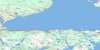
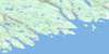
011F03 Larrys River Topo Map
To view this map, mouse over the map preview on the right.
You can also download this topo map for free:
011F03 Larrys River high-resolution topo map image.
Maps for the Larrys River topo map sheet 011F03 at 1:50,000 scale are also available in these versions:
Larrys River Surrounding Area Topo Maps
 |
 |
 |
 |
 |
 |
 |
 |
 |
 |
 |
|
 |
 |
© Department of Natural Resources Canada. All rights reserved.
Larrys River Gazetteer
The following places can be found on topographic map sheet 011F03 Larrys River:
Larrys River Topo Map: Bays
Back CoveBread Cove
Cabbage Garden Cove
Caseys Cove
Cashins Cove
Cashman Cove
Charlos Cove
Crane Cove
Crow Bunch Cove
Doliver Cove
Dover Bay
Factory Cove
Fair Weather Harbour
Farewell Harbour
Floating Island Cove
Flying Point Cove
Gammon Cove
Gammons Basin
Grovers Cove
Gull Island Cove
Heffernans Cove
John Wrights Cove
Langes Cove
Little Crane Cove
Little Harbour
Louse Harbour
Marshall Cove
Molasses Harbour
Mud Cove
New Harbour Cove
Northeast Arm
Pond Cove
Port Felix Harbour
Port Howe
Raspberry Cove East
Raspberry Cove West
Sand Cove
Sand Cove
Seine Berth Cove
Sugar Harbour
Summer Harbour
The Basin
Tor Bay
Uloths Cove
Webber Cove
Whale Cove
Whitehaven Harbour
Whitehead Harbour
Wine Cove
Witch Cove
Yankee Cove
Larrys River Topo Map: Beaches
Bones Ledge BeachCurrys Breaker
Eastern Breaker
Grovers Breaker
Long Beach
New Harbour Beach
Western Breaker
Larrys River Topo Map: Capes
Berry HeadBlack Point
Cole Harbour Head
Deming Point
Dogfish Point
Dogfish Point
Doliver Point
Dover Head
Durhams Point
Eastern Head
Eastern Point
Flat Point
Fluid Point
Flying Point
Goose Point
Green Point
Haulover Point
Howe Point
John Gammons Point
Larrys Point
Larry's Point
Leblanc Point
Mars Head
New Harbour Head
Pilot Point
Poule Point
Red Head
Rodmans Point
Shoal Point
Spry Point
The Cape
The Sand Spit
Verges Point
Well Point
Witch Cove Point
Larrys River Topo Map: Channels
Allies RunDover Passage
Eastern Passage
Mussel Run
Southern Passage
The Gap
The Passage
Western Passage
Western Run
Larrys River Topo Map: Cliffs
White CliffLarrys River Topo Map: Geographical areas
GuysboroughLarrys River Topo Map: Islands
Bakers IslandBig Island
Big Island
Black Duck Island
Bluff Island
Bonds Island
Boudreaus Island
Cahoon Island
Charlies Island
Cooks Island
Deming Island
Doliver Island
Dorts Island
Dover Island
Fisherman Island
Flag Island
Forster Island
Gammon Islands
Gooseberry Island
Gull Island
Harbour Island
Hog Island
John Wrights Islands
Larrys Island
Louse Harbour Island
Louse Island
Mattee Island
Millstone Island
Mink Island
Passage Island
Patate Island
Pearls Island
Port Island
Prices Island
Ram Island
Ram Island
Raspberry Island
Richards Island
Sand Cove Island
Sheep Island
Sheep Island
Sheep Island
Sugar Harbour Islands
Sugar Islands
Tanner Island
The Bull
Three Top Island
Webber Island
Western Island
Whale Island
White Head Island
White Islands
Winter Island
Witch Island
Woody Island
Yankee Island
Larrys River Topo Map: Lakes
Admiral LakeBasin Lake
Bears Big Lake
Bears Little Lake
Bellamys Lake
Black Ledge Pond
Bridge Lake
Camp Lake
Cranberry Lake
Crane Lake
Donovans Lake
Double Farm Lake
Double Lake
Duck Lake
Eastern Cove Lake
First Lake
Floating Island Lake
Fougère Lake
Gaspereaux Lake
Goose Lake
Grand Étang
Gull Lake
Hardwood Hill Lakes
Henry Brook First Lake
Henry Brook Second Lake
Henry Brook Third Lake
Henrys Lake
John Kirbys Lake
Johns Lake
La Trappe Lake
Lac des Sauts
Last Lake
Lily Lake
Little Crane Cove Lake
Little Harbour Lake
Little Lake
Little Lake
Little Lake
Long Lake
Lower Wood Lake
Mark Lake
Moosehorn Lakes
North Lake
Northeast Lake
Otter Lake
Pipe Lake
Red Head Pond
Rocky Lake
Rocky Lake
Rocky Lake
Second Lake
Second Lake
Simons Lake
Southeast Lake
Third Lake
Twin Lakes
Twin Lakes
Upper Wood Lake
Wood Lake
Larrys River Topo Map: Mountains
Bull HillIndian Peak
Larrys River Topo Map: Major municipal/district area - major agglomerations
GuysboroughLarrys River Topo Map: Rivers
Basin BrookCanters Lake Run
Eastern Brook
Henry Brook
Kyak Brook
Kyak Brook
Larrys River
Larry's River
Little River
New Harbour River
Patterson Brook
Larrys River Topo Map: River features
Bears PoolFirst Stillwater
Fourth Stillwater
Second Stillwater
Third Stillwater
Larrys River Topo Map: Undersea features
Big ShoalDead Cow Shoals
Flake Shoal
Haut-fond de Roche
Middle Ground
Net Rock
Outside Dry Rock
Pollock Ground
Larrys River Topo Map: Shoals
Avery ShoalBald Rock
Bald Rock
Bald Rock Reef
Bay Shoal
Bear Trap Ledge
Benoits Ledge
Big Shoal
Big Shoal
Black Ledge
Black Ledge
Black Ledge
Black Ledge
Black Rock
Black Rock
Black Rocks
Blackman Shoal
Bones Ledge
Brandy Ledge
Brig Rock
Bull Rock
Cape Shoal
Cedar Ledge
Charlos Reef
Charlos Shoal
Coote Rock
Country Island Shoal
Cow Rock
Crow Bunch Shoal
Dead Cow Shoals
Dogfish Rock
Dover Shoals
Dry Rocks
East Bull
East Bull
Fanning Shoal
Farewell HarbourLedges
Flake Shoal
Flat Ledge
Flying Point Shoals
French Rock
Georges Rock
Goose Point Shoal
Green Ledge
Gull Ledge
Gull Rock
Harbour Ledge
Harris Shoal
Haut-fond de Roche
Henrys Ledge
Indian Rocks
Inner Gull Ledge
Jacks Shoal
Jarvis Ledge
Joe Ground
John Davids Rock
Kelp Shoal
Kings Marsh Reef
Langley Shoal
Larrys Reef
Larry's Reef
Lisas Shoal
Little Ledge
Long Ledge
MacLeans Shoal
Michaud Ledge
Middle Ground
Middle Ground
Middle Rock
Monroe Rock
Moses Shoal
Mosses Shoal
Net Ledge
Net Ledge
Net Ledge
Net Rock
Net Rock
Net Rock
New Harbour Rock
Outer Gull Ledge
Outside Dry Rock
Paddy Ledge
Pellerins Ledge
Pollock Ground
Rock of the Bay
Rock of the Point
Rock Shoal
Rocket Shoals
Rocky Ledge
Round Rock
Sampson Rock
Sampsons Rock
Sculpin Rock
Seal Rocks
Seal Rocks
Seal Rocks
Shag Ledge
Shag Rock
Shot Ledge
Small Ledge
Snorting Rocks
Southeast Ledge
Southwest Bull
Split Rock
Split Rock
Sunken Rock
Sunken Rock Reef
The Bull
The Niblet
The Yankees
Three Fathom Shoal
Topstone Ledge
Tor Bay Ledges
Torbay Ledges
Tuffin Bank
Turtle Rock
Vache Ledge
Vache Shoals
Webber Shoal
West Bull
Western Ledge
Western Reef
Whale Rocks
Whale Shoal
Worm Shoal
Wry Widow Rock
Larrys River Topo Map: Unincorporated areas
CharloCharlo Cove
Charlos Cove
Fougere Farm Lake
Larrys River
Larry's River
Lower Whitehaven
Lower Whitehead
New Harbour
New Harbour East
New Harbour West
Port Felix
Tor Bay
Torbay
Upper West New Harbour
Whitehead
Yankee Harbour
Larrys River Topo Map: Low vegetation
Joes Marsh
© Department of Natural Resources Canada. All rights reserved.
