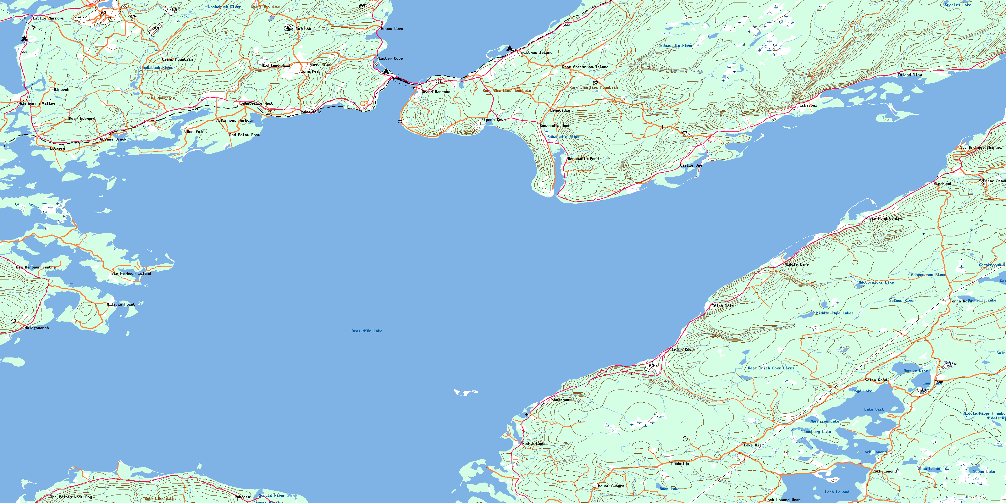
Grand Narrows Topo Map Online
Download Free Topo Map Sheet 011F15 at 1:50,000 scale
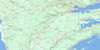
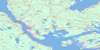
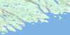
011F15 Grand Narrows Topo Map
To view this map, mouse over the map preview on the right.
You can also download this topo map for free:
011F15 Grand Narrows high-resolution topo map image.
Maps for the Grand Narrows topo map sheet 011F15 at 1:50,000 scale are also available in these versions:
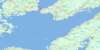
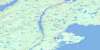
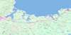
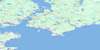
Grand Narrows Surrounding Area Topo Maps
 |
 |
 |
 |
 |
 |
 |
 |
 |
 |
 |
|
 |
 |
© Department of Natural Resources Canada. All rights reserved.
Grand Narrows Gazetteer
The following places can be found on topographic map sheet 011F15 Grand Narrows:
Grand Narrows Topo Map: Bays
Barachois HarbourCampbell Cove
Campbells Cove
Campbells Cove
Cassells Cove
Cranberry Cove
Crane Cove
Cribwork Cove
Crooked Cove
Denys Basin
East Bay
Frasers Cove
Grass Cove
Hay Cove
Irish Cove
John Alex Cove
Johnson Cove
Johnstown Harbour
Kennedys Cove
Little Harbour
Lochmore Harbour
MacIntosh Cove
MacKenzie Cove
MacKenzies Pond
MacKinnons Cove
MacKinnons Cove
MacLeod Cove
MacLeods Pond
Macrae Cove
MacRaes Cove
Malagawatch Harbour
Martin Cove
McKinnons Harbour
Morrison Harbour
Neilban Cove
Neilban Cove
North Pond
Pellier Harbour
Pipers Cove
Pipers Cove
Plaster Cove
Portage Creek
Pringle Harbour
River Cove
Ross Cove
Sand Cove
Small MacNabs Cove
The Pond
West Bay
West Eskasoni Harbour
Whycocomagh Bay
Wide Cove
Grand Narrows Topo Map: Beaches
Bens BeachGillis Beach
Indian Beach
Grand Narrows Topo Map: Capes
Benacadie PointBirch Point
Blacksmith Point
Campbell Point
Cape Rhumore
Derby Point
Dhu Point
Doucettes Point
Evans Point
Fiddle Head
Fox Point
Grammo Point
Hector Point
Hectors Point
Kelly Point
Kennedys Point
Lighthouse Point
Macdonald Point
MacDougall Point
MacIntosh Point
MacKenzies Point
MacKinnons Point
MacLeod Point
MacLeods Point
MacPherson Point
Macpherson Point
Macrae Point
MacRaes Point
MacVicar Point
Malagawatch Point
Marble Point
McKinnons Point
Middle Cape
Militia Point
Mill Cape
Morrison Head
Morrison Point
Murdocks Point
Neilys Point
Neilys Point
Nills Point
Noel Point
Pellier Point
Peters Point
Poor Point
Porphyry Point
Red Point East
Red Point West
Rudha Mor
Uniacke Point
Widows Point
Grand Narrows Topo Map: Channels
Barra StraitGreat Bras d'Or
Little Narrows
St. Patricks Channel
The Boom
The Passage
Grand Narrows Topo Map: Geographical areas
Cape BretonInverness
Juste au Corps
Richmond
Grand Narrows Topo Map: Indian Reserves
Eskasoni 3Eskasoni 3A
Malagawatch 4
Grand Narrows Topo Map: Islands
Bare IslandBethunes Island
Big Harbour Island
Boom Island
Campbell Island
Campbells Island
Campbells Island
Cape Breton Island
Christmas Island
Christmas Island
Cranberry Island
Evans Island
Fishermans Island
George Island
Gull Island
Île du Cap-Breton
Indian Island
Indian Islands
Little Island
MacPhails Island
Macrae Island
MacRaes Island
McPhee Island
Militia Island
Pellier Island
Pistol Island
Poor Island
Poor Islet
Pringle Island
Red Islands
Robert Island
Round Island
Sheep Island
Sheep Island
Wilson Island
Grand Narrows Topo Map: Lakes
Amaguadees PondBeaver Pond
Benacadie Pond
Bens Pond
Black Pond
Boot Lake
Boyd Lake
Bras d'Or Lake
Brians Pond
Campbells Pond
Cemetery Lake
Christmas Island Pond
Christmas Pond
Coopers Pond
Curries Pond
Denas Pond
Enon Lake
Enon Lake
Gaspereaux Lake
Gillis Pond
Gillis Pond
Goose Pond
Indian Pond
John Alex Pond
Kelly Pond
Lake Uist
Lieutenant Pond
Loch Lomond
Lochan Fad
MacCormicks Lake
Maccrutchie Pond
MacDougall Pond
MacInnis Pond
MacLeods Pond
MacNeils Lake
MacPhersons Pond
MacRaes Ponds
MacRitchies Pond
Middle Cape Lakes
Monroe Lake
Morrison Lake
Munroe Lake
Narrows Pond
Olson Pond
Pipers Cove Pond
Plaster Cove Ponds
Plaster Ponds
Powder Horn Lake
Powderhorn Lake
Rear Irish Cove Lakes
Shaw Lakes
Steeles Lake
Stone Lake
Urquhart Pond
Urquharts Pond
Wolfes Pond
Grand Narrows Topo Map: Mountains
Boisdale HillsCains Mountain
Campbells Hill
East Bay Hills
MacLeods Hill
Marble Hill
Mira Hills
North Mountain
Pringle Mountain
Rory Charlies Mountain
South Mountain
Sporting Mountain
Grand Narrows Topo Map: Major municipal/district area - major agglomerations
Cape BretonInverness
Richmond
Victoria
Grand Narrows Topo Map: Rivers
Archie MacKeigans BrookBenacadie Brook
Benacadie River
Big Brook
Breac Brook
Campbells Brook
Campbells Brook
Christmas Brook
Dugald Brook
Gaspereaux River
Gregwa Brook
Hare Brook
Indian Brook
Irish Brook
Irish Cove Brook
Jim MacDonalds Brook
Jims Brook
John MacKeigans Brook
Kates Brook
Little MacCuish Brook
Little MacLeod Brook
MacCuishs Brook
MacDonald Brook
MacDougalls Brook
Macintosh Brook
MacIntosh Brook
MacIntyres Brook
MacKinnons Brook
MacKinnons Little Brook
MacLeans Brook
MacLeans Little Brook
MacLeod Brook
MacLeods Brook
MacMullin Brook
MacMullins Brook
MacNeils Brook
MacVicar Brook
McCuish Brook
McGillivary Brook
McKinnons Brook
Middle River Framboise
Morrison Brook
Murdocks Brook
Nashs Brook
Ottawa Brook
Pringle Brook
River Tom
Ross Brook
Salmon River
Scott Brook
Scotts River
Snake Brook
South Branch Benacadie River
Toms Brook
Urquhart Brook
Urquharts Brook
Walkers Brook
Washabuck River
Grand Narrows Topo Map: Shoals
Barra ShoalCod Shoals
George Shoal
Gillis Shoal
Kelly Shoal
Kelly Shoals
MacLeod Shoals
MacLeods Shoal
McKinnons Shoal
Middle Shoal
Nameless Shoal
Outer Shoal
Paddle Shoal
Pellier Point Reef
Pringle Shoal
Grand Narrows Topo Map: Unincorporated areas
Barra GlenBenacadie
Benacadie Pond
Benacadie West
Big Brook
Big Harbour Centre
Big Harbour Island
Big Pond
Big Pond Centre
Breac Brook
Cains Mountain
Castle Bay
Christmas Island
Enon
Eskasoni
Estmere
Glengarry Valley
Grand Narrows
Grass Cove
Highland Hill
Iona
Iona Rear
Irish Cove
Irish Vale
Island View
Jamesville
Jamesville West
Johnstown
Jubilee
Lake Uist
Little Narrows
Loch Lomond
Loch Lomond West
Lochside
Malagawatch
Matheson
McKinnons Harbour
Middle Cape
Militia Point
Mount Auburn
Nineveh
Ottawa Brook
Pipers Cove
Plaster Cove
Rear Christmas Island
Rear Estmere
Red Islands
Red Point
Red Point East
Roberta
Salem Road
St. Andrews Channel
St. Andrew's Channel
St. Columba
Terra Nova
The Points West Bay
Whycocomagh Portage
Grand Narrows Topo Map: Low vegetation
Blueberry BarrenMacKinnons Marsh
© Department of Natural Resources Canada. All rights reserved.
